Hermiston, Oregon
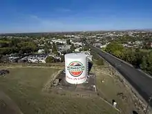
Hermiston (/ˈhɜːrməstən/) is a city in Umatilla County, Oregon, United States. Its population of 18,755[5] makes it the largest city in Eastern Oregon. Hermiston is the largest, and fastest-growing, city in the Hermiston-Pendleton Micropolitan Statistical Area, the eighth largest Core Based Statistical Area in Oregon with a combined population of 87,062 at the 2010 census.[2] Hermiston sits near the junction of I-82 and I-84, and is 7 miles south of the Columbia River, Lake Wallula, and the McNary Dam. The Hermiston area has become a hub for logistics and data center activity due to the proximity of the I-82 and I-84 interchange, Pacific Northwest fiber optic backbone, and low power costs.[6] The city is also known for its watermelons, which are part of its branding.[7]
Hermiston, Oregon | |
|---|---|
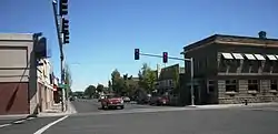 Historic business district of Hermiston | |
| Etymology: Hermiston, Edinburgh (district of capital of Scotland) | |
| Motto(s): "Where life is sweet." | |
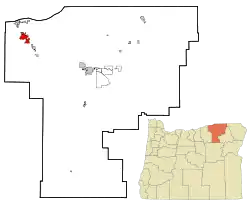 Location in Oregon | |
| Coordinates: 45°50′28″N 119°17′30″W | |
| Country | United States |
| State | Oregon |
| County | Umatilla |
| Incorporated | 1907 |
| Government | |
| • Type | Council-Manager |
| • Mayor | Dr. David A. Drotzmann |
| Area | |
| • City | 8.18 sq mi (21.19 km2) |
| • Land | 8.18 sq mi (21.19 km2) |
| • Water | 0.00 sq mi (0.00 km2) |
| Elevation | 643 ft (196 m) |
| Population | |
| • City | 16,745 |
| • Estimate (2019)[3] | 17,782 |
| • Density | 2,173.04/sq mi (839.06/km2) |
| • Metro | 87,062 |
| Demonym(s) | Hermistonian |
| Time zone | UTC-8 (Pacific) |
| • Summer (DST) | UTC-7 (Pacific) |
| ZIP code | 97838 |
| Area code(s) | 541 |
| FIPS code | 41-33700[2] |
| GNIS feature ID | 1167708[4] |
| Website | hermiston.or.us |
History
The historic inhabitants of the area were the indigenous Umatilla, Cayuse, Walla Walla, and Columbia Indians, descendants of peoples who lived in this area for thousands of years. The earliest European settlers established a mission near Pendleton in 1847. The territorial government organized Umatilla County in 1862 from the larger Wasco County. On July 10, 1907, the town of Hermiston was incorporated. Robert Louis Stevenson's novel Weir of Hermiston inspired the name.
Economy
Retail
Hermiston serves as the retail and services center for much of western Umatilla County,[8] as well as Morrow County and parts of Gilliam county. Hermiston's Local Trade Area, which describes the area where people will travel to purchase items on a weekly basis, stretches from Pendleton on the East, the Columbia River to the North, Heppner to the South, and Gilliam County to the West. There were 46,000 people living within Hermiston's Local Trade Area based on 2010 U.S. Census data.[9] Major national chain retailers in Hermiston include Wal-Mart, Home Depot, Big Lots, Sears, AutoZone, Big 5 Sporting Goods and Harbor Freight, among many others. The community also has Ford, Chevy, Dodge, Toyota, and Subaru dealerships. Despite a relatively robust local retail & services market, Hermiston experiences significant retail sales leakage to the Tri-Cities for items purchased on less than a weekly basis. The Tri-Cities, located approximately 30 minutes north of Hermiston in Washington, had a metro-area population of 275,740 as of April 1, 2014, making it the fourth largest metropolitan area in Washington.[10]
Workforce
Hermiston has the largest 30-mile-radius workforce in Eastern Oregon. According to 2014 U.S. Census estimates, there were 119,632 people actively employed within a 30-mile radius of Hermiston;[11] in comparison, there are 75,075 in the next-largest regional Labor Shed in Bend.[11] Hermiston-area employers benefit greatly from the proximity of the Tri-Cities in Washington which, based on light traffic, and easy freeway access, is approximately 30–35 minutes to the north of Hermiston.
Top employers
According to Hermiston's 2019 Comprehensive Annual Financial Report,[12] the top employers in the city are:
| # | Employer | # of Employees |
|---|---|---|
| 1 | Lamb Weston | 1,320 |
| 2 | Wal-Mart Distribution Center | 1,100 |
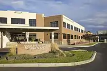
| 3 | Good Shepherd Healthcare System | 720 |
| 4 | River Point Farms | 650 |
| 5 | Hermiston School District | 519 |
| 6 | Shearer's Foods | 425 |
| 7 | Marlette Homes | 410 |
| 8 | Wal-Mart Supercenter | 400 |
| 9 | Union Pacific Railroad | 300 |
| 10 | Medelez Trucking | 200 |
Parks
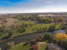
The City of Hermiston Parks Department maintains 10 parks, 13 landscape areas, and 100-plus acres for the enjoyment of the community. In addition to the developed parks, the Department also has 50 additional acres planned for future development. Recent major enhancements include the additions of Riverfront Park, the Oxbow Trail, and continual additions to the Hermiston Family Aquatic Center. Riverfront Park features 16 acres of open grassy areas alongside the Umatilla River, as well as nearly a mile of paved walking paths, with playground equipment, picnic shelters, restrooms, and fishing access. A 1.8-mile paved walking path, named the Oxbow Trail, was added in 2015 to connect Riverfront Park with the north side of town near Good Shepherd Medical Center. The Trail winds through protected wetland area for nearly the entirety of its length and also connects to Harrison Park.
Geography
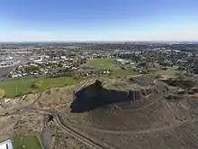
According to the United States Census Bureau, the city has a total area of 7.81 square miles (20.23 km2), all land.[14]
Distance to major cities:
- Tri-Cities, Washington - 30 to 45 miles (48 to 72 km)
- Portland, Oregon - 181 miles (291 km)
- Seattle, Washington - 259 miles (417 km)
- Spokane, Washington - 204 miles (328 km)
- Boise, Idaho - 259 miles (417 km)
- Salt Lake City, Utah - 587 miles (945 km)
- Missoula, Montana - 367 miles (591 km)
Hermiston's recent population growth is due to its proximity to large cities in the Pacific Northwest and its location along two major freeways.[15][16]
Climate
According to the Köppen climate classification system, Hermiston has a steppe climate (Köppen BSk).
| Climate data for Hermiston | |||||||||||||
|---|---|---|---|---|---|---|---|---|---|---|---|---|---|
| Month | Jan | Feb | Mar | Apr | May | Jun | Jul | Aug | Sep | Oct | Nov | Dec | Year |
| Record high °F (°C) | 77 (25) |
75 (24) |
84 (29) |
96 (36) |
102 (39) |
108 (42) |
112 (44) |
113 (45) |
102 (39) |
92 (33) |
79 (26) |
83 (28) |
113 (45) |
| Average high °F (°C) | 39.9 (4.4) |
47.6 (8.7) |
58.3 (14.6) |
66.9 (19.4) |
75.2 (24.0) |
82.5 (28.1) |
90.4 (32.4) |
88.7 (31.5) |
79.7 (26.5) |
66.8 (19.3) |
50.8 (10.4) |
41.8 (5.4) |
65.7 (18.7) |
| Average low °F (°C) | 23.6 (−4.7) |
27.8 (−2.3) |
32.9 (0.5) |
38.8 (3.8) |
45.6 (7.6) |
52.4 (11.3) |
57.1 (13.9) |
55.2 (12.9) |
47 (8) |
37.9 (3.3) |
31.1 (−0.5) |
26.5 (−3.1) |
39.7 (4.3) |
| Record low °F (°C) | −35 (−37) |
−29 (−34) |
6 (−14) |
14 (−10) |
22 (−6) |
32 (0) |
38 (3) |
35 (2) |
21 (−6) |
6 (−14) |
−12 (−24) |
−37 (−38) |
−37 (−38) |
| Average precipitation inches (mm) | 1.22 (31) |
0.9 (23) |
0.76 (19) |
0.67 (17) |
0.65 (17) |
0.59 (15) |
0.19 (4.8) |
0.28 (7.1) |
0.44 (11) |
0.72 (18) |
1.2 (30) |
1.22 (31) |
8.85 (225) |
| Average snowfall inches (cm) | 5 (13) |
2.4 (6.1) |
0.2 (0.51) |
0 (0) |
0 (0) |
0 (0) |
0 (0) |
0 (0) |
0 (0) |
0 (0) |
1.2 (3.0) |
2.4 (6.1) |
11.2 (28) |
| Average precipitation days | 10 | 9 | 7 | 6 | 5 | 5 | 2 | 2 | 4 | 6 | 10 | 11 | 77 |
| Source: [17] | |||||||||||||
Demographics
| Historical population | |||
|---|---|---|---|
| Census | Pop. | %± | |
| 1910 | 647 | — | |
| 1920 | 647 | 0.0% | |
| 1930 | 608 | −6.0% | |
| 1940 | 803 | 32.1% | |
| 1950 | 3,804 | 373.7% | |
| 1960 | 4,402 | 15.7% | |
| 1970 | 4,893 | 11.2% | |
| 1980 | 9,408 | 92.3% | |
| 1990 | 10,040 | 6.7% | |
| 2000 | 13,154 | 31.0% | |
| 2010 | 16,745 | 27.3% | |
| 2019 (est.) | 17,782 | [3] | 6.2% |
| Sources:[2][18][19][20][21][22] | |||
2020 Portland State University population estimates
The Population Research Center at Portland State University provides annual official population estimates to the State of Oregon. Hermiston's certified population estimate as of July 1, 2020 was 18,755[23] which is an increase of more than 2,000 residents since the 2010 Census. It has the largest population of any city in Oregon east of Bend, and the only one larger than 18,000.[24]
2010 census
As of the census of 2010, there were 16,745 people, 6,050 households, and 4,184 families residing in the city. The population density was 2,144.0 inhabitants per square mile (827.8/km2). There were 6,373 housing units at an average density of 816.0 per square mile (315.1/km2). The racial makeup of the city was 74.2% White, 0.8% African American, 1.3% Native American, 1.5% Asian, 0.2% Pacific Islander, 19.0% from other races, and 3.0% from two or more races. Hispanic or Latino of any race were 34.9% of the population.[2]
There were 6,050 households, of which 42.0% had children under the age of 18 living with them, 47.9% were married couples living together, 14.5% had a female householder with no husband present, 6.8% had a male householder with no wife present, and 30.8% were non-families. 25.8% of all households were made up of individuals, and 9.9% had someone living alone who was 65 years of age or older. The average household size was 2.74 and the average family size was 3.28.[2]
The median age in the city was 30.9 years. 31.7% of residents were under the age of 18; 9.2% were between the ages of 18 and 24; 27.3% were from 25 to 44; 20.8% were from 45 to 64; and 11% were 65 years of age or older. The gender makeup of the city was 49.4% male and 50.6% female.[2]
Education
K-12
Hermiston School District is the largest district in Eastern Oregon, with 5,297 students in the 2014–15 school year.[25] The district has one high school, Hermiston High School, which hosts 1,500 students.[25] Due to the school's size, it is able to offer comprehensive programming and courses for all students. The district also is composed of two middle schools, five elementary schools, and 1 alternative school. There are also two private schools in Hermiston.
Voters in the Hermiston School District have shown strong support for education as the district has experienced sustained robust enrollment growth. Voters approved a $69.9 million capital construction bond in November, 2008,[26] and another $82.7 million capital construction bond in November, 2019.[27] The 2019 bond will add a new elementary school near the intersection of NE 10th and Theater Lane, and will replace the 57-year old Rocky Heights Elementary School on-site with a larger facility. The 2019 bond will also add capacity for an additional 200 students at Hermiston High School.[27]
| School | Construction Year |
|---|---|
| Loma Vista Elementary | 2021-2023 |
| Rocky Heights Elementary (Rebuild) | 2021-2023 |
| Armand Larive Middle | 2011 |
| Sunset Elementary | 2011 |
| West Park Elementary | 2010 |
| Desert View Elementary | 2001 |
| Sandstone Middle | 1995 |
| Hermiston High | 1992/2001 |
| Highland Hills Elementary | 1980 |
Higher education
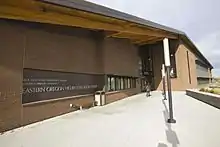
Blue Mountain Community College has a branch in Hermiston. Eastern Oregon University also hosts undergraduate and graduate-level courses at the Eastern Oregon Higher Education Center in Hermiston.
Transportation

Highways and roads
Hermiston benefits from being near the exact center of the Pacific Northwest, and at the crossroads of several major interstate highways. Drivers can easily access all four major Northwest metropolitan areas in just a half-day's drive. Portland is less than 3 hours to the West, and drivers can also reach Spokane in less than 3 hours to the east, while Seattle and Boise are both approximately 4 hours away to the northwest and southeast, respectively. Highways serving Hermiston include Interstate 84 and U.S. Route 30, both of which run east–west, U.S. Route 395, which runs north–south, and Interstate 82, which has its southern terminus near Hermiston and continues north to Ellensburg, Washington.
Major transportation-related businesses in Hermiston include Wal-Mart's Northwest Distribution Center, and both FedEx and United Parcel Service (UPS) have freight distribution facilities in Hermiston.
Rail
Hermiston is on the La Grande Subdivision of the Union Pacific Railroad, constructed originally through the area in the 1870s as the Oregon Railroad and Navigation Company. Railroad facilities include the Hinkle Locomotive Service and Repair Facility and "hump yard" located just outside the city.
Airports
Hermiston Municipal Airport is a city-owned airport serving General Aviation pilots, corporate jet traffic, agricultural operations, and cargo operations. There are currently no commercial flights out of Hermiston.
Tri-Cities Airport is located approximately 40 minutes north of Hermiston, and offers commercial flights to Seattle, Salt Lake City, Denver, Minneapolis, Las Vegas, Portland, San Francisco, and Phoenix. In 2014, due to strong growth in demand, the Port of Pasco approved a $42 million renovation and expansion, that will double the size of the current terminal.
Media
Radio
Newspapers
- The Hermiston Herald (published Wednesday)
- East Oregonian (Pendleton paper with coverage of Hermiston, published Tuesday through Saturday)
Notable people
- Tucker Bounds, public relations professional
- Bucky Jacobsen, baseball player
- Chuck Norris, politician
- Shoni Schimmel, basketball player
- Jim Stuart, football player
- Jared Zabransky, football player
Annual events
- Hermiston Raceway/Super Oval, 3⁄8-mile (0.6 km) paved oval stock car track, races almost every Saturday from late April through the end of September every year.[29]
- Farm City Pro Rodeo, annual rodeo held in August[30]
- Umatilla County Fair
Footnotes
- "2019 U.S. Gazetteer Files". United States Census Bureau. Retrieved July 28, 2020.
- "U.S. Census website". United States Census Bureau. Retrieved 2012-12-21.
- "Population and Housing Unit Estimates". United States Census Bureau. May 24, 2020. Retrieved May 27, 2020.
- "US Board on Geographic Names". United States Geological Survey. 2007-10-25. Retrieved 2008-01-31.
- https://www.pdx.edu/prc/population-reports-estimates
- "Big Data". East Oregonian.
- Carlton, Jim (February 7, 2015). "A Town Known for Watermelons Is Suddenly Ripe for Change". The Wall Street Journal. pp. A1, A8.
- "Hermiston Retail Market Analysis 2011" (PDF).
- "Hermiston Retail Market Analysis 2011" (PDF).
- "April 1, 2015 Population of Cities Towns and Counties Used for Allocation of Selected State Revenues State of Washington" (PDF).
- "Access Labor | City of Hermiston". www.hermiston.or.us. Retrieved 2016-03-08.
- "City of Hermiston, Oregon, Comprehensive Financial Report for the Fiscal Year Ended June 30, 2019" (PDF). City of Hermiston. Retrieved June 3, 2015.
- Lewis, Meriweather & William Clark. "October 19, 1805". The Journals of the Lewis and Clark Expedition Online. University of Nebraska Lincoln. Retrieved 2006-12-10.
- "US Gazetteer files 2010". United States Census Bureau. Archived from the original on 2012-01-25. Retrieved 2012-12-21.
- Hutchinson-Talaski, Karen (2006-11-24). "Hermiston growth leads the way". The Hermiston Herald. Western Communications. Retrieved 2006-12-10.
- "Population Trends". City of Hermiston. 2006. Archived from the original on 2006-09-25. Retrieved 2006-12-10.
- "HERMISTON 1 SE, OR (353847)". Western Regional Climate Center. Retrieved November 23, 2015.
- "Population-Oregon" (PDF). U.S. Census 1910. U.S. Census Bureau. Retrieved 22 November 2013.
- "Population-Oregon" (PDF). 15th Census of the United States. U.S. Census Bureau. Retrieved 27 November 2013.
- "Number of Inhabitants: Oregon" (PDF). 18th Census of the United States. U.S. Census Bureau. Retrieved 22 November 2013.
- "Oregon: Population and Housing Unit Counts" (PDF). U.S. Census Bureau. Retrieved 22 November 2013.
- "Incorporated Places and Minor Civil Divisions Datasets: Subcounty Population Estimates: April 1, 2010 to July 1, 2012". U.S. Census Bureau. Archived from the original on 11 June 2013. Retrieved 25 November 2013.
- "Portland State College of Urban & Public Affairs: Population Research Center | Population Estimates and Reports". www.pdx.edu. Retrieved 2016-12-23.
- McDowell, Jade (2020-11-24). "Hermiston Lengthens Lead as Largest City in Eastern Oregon". East Oregonian. Retrieved 2020-11-25.
- "DBI Reports". www.ode.state.or.us. Retrieved 2015-12-04.
- "2008 General Obligation bond". Hermiston School District.
- "$82.7 million Hermiston school bond passes". East Oregonian.
- "Hermiston School District Facility Master Plan 2018-2040" (PDF). Hermiston School District.
- "Columbia Motor Speedway Park homepage". Retrieved 2012-09-13.
- FarmCityEntry
Further reading
- Ronald E. Ingle, Oasis in the Desert: The Story of Hermiston from Sagebrush to City. Caldwell, ID: Caxton Printers, 2002.
External links
| Wikimedia Commons has media related to Hermiston, Oregon. |
Municipalities and communities of Umatilla County, Oregon, United States | ||
|---|---|---|
| Cities | 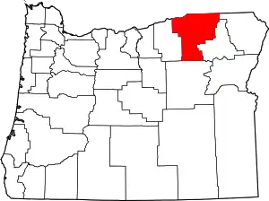 Umatilla County map | |
| CDPs | ||
| Other unincorporated communities | ||
| Indian reservation | ||
| Ghost towns | ||
| ||
| Authority control |
|---|