Friendly, Maryland
Friendly is an unincorporated area and census-designated place (CDP) in Prince George's County, Maryland, United States, with an African-American majority population, located a few miles south of Washington, D.C.[1] The population was 9,250 at the 2010 census.[2]
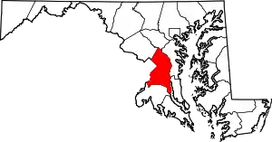
Friendly, Maryland | |
|---|---|
 Location of Friendly, Maryland | |
| Coordinates: 38°45′0″N 76°58′27″W | |
| Country | |
| State | |
| County | |
| Area | |
| • Total | 4.9 sq mi (12.6 km2) |
| • Land | 4.9 sq mi (12.6 km2) |
| • Water | 0.0 sq mi (0.0 km2) |
| Elevation | 236 ft (72 m) |
| Population (2010) | |
| • Total | 9,250 |
| • Density | 1,900/sq mi (730/km2) |
| Time zone | UTC−5 (Eastern (EST)) |
| • Summer (DST) | UTC−4 (EDT) |
| FIPS code | 24-30575 |
| GNIS feature ID | 0597435 |
Friendly had its own rural post office in the early 20th century, and is now under the mailing address Fort Washington. The name "Friendly" is most associated with Friendly High School, which serves most of the greater Fort Washington area. The Friendly area was largely rural until about 1960 and has steadily grown with single-family housing developments. At least five new residential neighborhoods are currently under construction in the area. Allentown Road connects Friendly with Andrews Air Force Base.
Geography
Friendly is located at 38°45′0″N 76°58′27″W (38.750064, −76.974267).[3]
According to the United States Census Bureau, the CDP has a total area of 4.9 square miles (12.6 km2), all land.[4]
Demographics
As of the census[5] of 2000, there were 10,938 people, 3,506 households, and 2,962 families residing in the CDP. The population density was 1,610.3 people per square mile (622.0/km2). There were 3,636 housing units at an average density of 535.3/sq mi (206.8/km2). The racial makeup of the CDP was 77.67% African American, 13.39% White, 0.36% Native American, 5.66% Asian, 0.07% Pacific Islander, 0.98% from other races, and 1.87% from two or more races. Hispanic or Latino of any race were 2.19% of the population.
There were 3,506 households, out of which 38.4% had children under the age of 18 living with them, 65.6% were married couples living together, 13.9% had a female householder with no husband present, and 15.5% were non-families. 12.2% of all households were made up of individuals, and 2.5% had someone living alone who was 65 years of age or older. The average household size was 3.12 and the average family size was 3.36.
In the CDP, the population was spread out, with 27.4% under the age of 18, 7.5% from 18 to 24, 27.8% from 25 to 44, 30.3% from 45 to 64, and 7.0% who were 65 years of age or older. The median age was 38 years. For every 100 females, there were 93.0 males. For every 100 females age 18 and over, there were 90.5 males.
The median income for a household in the CDP was $80,214, and the median income for a family was $82,827. Males had a median income of $43,281 versus $42,086 for females. The per capita income for the CDP was $28,545. About 0.2% of families and 0.4% of the population were below the poverty line, including 0.2% of those under age 18 and 0.5% of those age 65 or over. By the end of 2020, the CDP ranks # 8 among top 10 richest black communities in US, with an average family income of $82,827.[6]
Transportation
Potomac Airfield is in Friendly CDP, with a Fort Washington address.[7][8]
Education
Friendly is served by the Prince George's County School District.[7]
Zoned elementary schools serving the CDP are Rose Valley Elementary School and Tayac Elementary School.[9] Isaac J. Gourdine Middle School and Friendly High School serve all of the current CDP.[10][11]
Fort Washington Elementary School and Accokeek Middle School serve areas that were in the Friendly CDP (now in Fort Washington CDP) until 2010.[9][10][12]
References
- U.S. Geological Survey Geographic Names Information System: Friendly, Maryland
- "Profile of General Population and Housing Characteristics: 2010 Demographic Profile Data (DP-1): Friendly CDP, Maryland". United States Census Bureau. Retrieved December 19, 2011.
- "US Gazetteer files: 2010, 2000, and 1990". United States Census Bureau. 2011-02-12. Retrieved 2011-04-23.
- "Geographic Identifiers: 2010 Demographic Profile Data (G001): Friendly CDP, Maryland". United States Census Bureau. Retrieved December 19, 2011.
- "U.S. Census website". United States Census Bureau. Retrieved 2008-01-31.
- "10 Richest Black Communities in America". Retrieved November 12, 2020.
- "2010 CENSUS - CENSUS BLOCK MAP: Friendly CDP, MD." U.S. Census Bureau. Retrieved on September 2, 2018. Previously Friendly had a different shape: "CENSUS 2000 BLOCK MAP: FRIENDLY CDP." In the 1990 U.S. Census Bureau maps of Prince George's County, Maryland (index map) Friendly CDP is on pages 27, 28, and 33.
- "3rd%20class%20medical%20-%20final%20-%20PUBLIC.pdf." Potomac Airfield. Retrieved on September 2, 2018. "10300 Glen Way * Fort Washington * MD "
- "NEIGHBORHOOD ELEMENTARY SCHOOLS AND BOUNDARIES SCHOOL YEAR 2018-2019." Prince George's County Public Schools. Retrieved on September 2, 2018.
- "NEIGHBORHOOD MIDDLE SCHOOLS AND BOUNDARIES SCHOOL YEAR 2018-2019." Prince George's County Public Schools. Retrieved on September 2, 2018.
- "NEIGHBORHOOD HIGH SCHOOLS AND BOUNDARIES SCHOOL YEAR 2018-2019." Prince George's County Public Schools. Retrieved on September 2, 2018.
- "2010 CENSUS - CENSUS BLOCK MAP (INDEX): Fort Washington CDP, MD." U.S. Census Bureau. Retrieved on September 2, 2018. Note that the CDP previously covered a different set of territory: "CENSUS 2000 BLOCK MAP: FORT WASHINGTON CDP" with pages 1 and 2. In the 1990 U.S. Census Bureau maps of Prince George's County, Maryland (index map) Fort Washington CDP is on pages 26, 27, 32, and 33.