Peppermill Village, Maryland
Peppermill Village is an unincorporated community near Maryland Route 214 (Central Avenue) in Prince George's County, Maryland, United States.[1] FedExField, Metrorail's Blue Line, and Hampton Mall shopping center are all located nearby. Because it is not formally incorporated, it has no official boundaries, but the United States Census Bureau has defined a census-designated place (CDP) consisting of Peppermill Village and the adjacent community of Carmody Hills, for statistical purposes.
Peppermill Village, Maryland | |
|---|---|
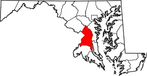
 Peppermill Village, Maryland Location within the U.S. state of Maryland  Peppermill Village, Maryland Peppermill Village, Maryland (the United States) | |
| Coordinates: 38°53′41″N 76°53′12″W | |
| Country | |
| State | |
| County | |
| Area | |
| • Total | 0.7 sq mi (1.9 km2) |
| • Land | 0.7 sq mi (1.9 km2) |
| • Water | 0 sq mi (0 km2) |
| Elevation | 266 ft (81 m) |
| Population (2010) | |
| • Total | 4,895 |
| • Density | 6,700/sq mi (2,600/km2) |
| Time zone | UTC−5 (Eastern (EST)) |
| • Summer (DST) | UTC−4 (EDT) |
| Area code | 301 |
| GNIS feature ID | 2391235 |
Geography
According to the U.S. Census Bureau, Peppermill Village had a total area of 0.73 square miles (1.9 km2), all land.[2] The CDP is bordered to the west and north by the city of Seat Pleasant, to the north and east by the Summerfield CDP, and to the south by the Walker Mill CDP. Peppermill Village is bounded to the south by Maryland Route 214, or Central Avenue, which to the west becomes East Capitol Street in the District of Columbia and to the east connects with the Capital Beltway and the town of Largo.
Demographics
The population of the CDP was 4,895 at the 2010 census.[3] For previous censuses, the CDP was named "Carmody Hills-Pepper Mill Village".
It has a majority African-American population.
Schools
The CDP is served by the Prince George's County Public Schools district.[4]
Almost all of the CDP is zoned to Carmbody Hills elementary while a small section is zoned to Cora L. Rice Elementary.[5] All residents are zoned to G. James Gholson Middle School.[6] Most CDP residents are zoned to Central High School while some are zoned to Fairmont Heights High School and .[7]
References
- U.S. Geological Survey Geographic Names Information System: Peppermill Village, Maryland
- "Geographic Identifiers: 2010 Demographic Profile Data (G001): Peppermill Village CDP, Maryland". United States Census Bureau. Retrieved December 16, 2011.
- "Profile of General Population and Housing Characteristics: 2010 Demographic Profile Data (DP-1): Peppermill Village CDP, Maryland". United States Census Bureau. Retrieved December 16, 2011.
- "2010 CENSUS - CENSUS BLOCK MAP: Peppermill Village CDP, MD." U.S. Census Bureau. Retrieved on August 31, 2018.
- "NEIGHBORHOOD ELEMENTARY SCHOOLS AND BOUNDARIES SCHOOL YEAR 2018-2019." Prince George's County Public Schools. Retrieved on August 31, 2018.
- "NEIGHBORHOOD MIDDLE SCHOOLS AND BOUNDARIES SCHOOL YEAR 2018-2019." Prince George's County Public Schools. Retrieved on August 31, 2018.
- "NEIGHBORHOOD HIGH SCHOOLS AND BOUNDARIES SCHOOL YEAR 2018-2019." Prince George's County Public Schools. Retrieved on August 31, 2018.