Konterra, Maryland
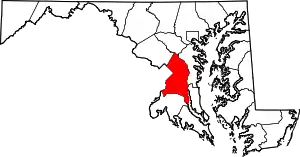
Konterra is an unincorporated area and census-designated place (CDP) in Prince George's County, Maryland, United States. The population was 2,527 at the 2010 census.[1]
Konterra, Maryland | |
|---|---|
 Konterra  Konterra | |
| Coordinates: 39°04′12″N 76°53′54″W | |
| Country | |
| State | |
| County | |
| Area | |
| • Total | 6.4 sq mi (16.5 km2) |
| • Land | 6.3 sq mi (16.4 km2) |
| • Water | 0.08 sq mi (0.2 km2) |
| Elevation | 138 ft (42 m) |
| Population (2010) | |
| • Total | 2,527 |
| • Density | 400/sq mi (150/km2) |
| Time zone | UTC−5 (Eastern (EST)) |
| • Summer (DST) | UTC−4 (EDT) |
| Area code(s) | 301 |
Parts of Konterra were previously defined by the U.S. Census Bureau as being in the West Laurel census-designated place.[2][3]
Geography
Konterra is located at 39°04′13″N 76°53′55″W.[4]
According to the United States Census Bureau, the CDP has a total area of 6.4 square miles (16.5 km2), of which 6.3 square miles (16.4 km2) is land and 0.04 square miles (0.1 km2), or 1.05%, is water.[5]
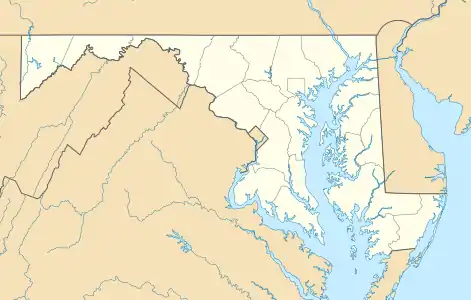
Konterra is located in northern Prince George's County, around the interchange of Interstate 95 and Maryland Route 200. The city of Laurel borders the CDP to the northeast. West Laurel lies to the north, and South Laurel is to the east. Beltsville is to the south, and Calverton is to the southwest. To the northwest, in Montgomery County, is Burtonsville.[6]
Education
The residents are zoned to schools of Prince George's County Public Schools. Zoned schools serving sections of the CDP include:[3]
Elementary schools:[7]
- Bond Mill Elementary School in West Laurel
- Vansville Elementary School in an unincorporated area
The sole zoned middle school serving the CDP is Martin Luther King Middle School in Beltsville.[8]
High schools:[9]
- Laurel High School in Laurel
- High Point High School in Beltsville
References
- "Profile of General Population and Housing Characteristics: 2010 Demographic Profile Data (DP-1): Konterra CDP, Maryland". United States Census Bureau. Retrieved December 20, 2011.
- "CENSUS 2000 BLOCK MAP: WEST LAUREL CDP." U.S. Census Bureau. Retrieved on August 26, 2018. The 1990 maps of Prince George's County (index map) show West Laurel on pages 1 and 4.
- "2010 CENSUS - CENSUS BLOCK MAP (INDEX): Konterra CDP, MD." U.S. Census Bureau. Retrieved on August 26, 2018. Pages: 1, 2, and 3.
- "US Gazetteer files: 2010, 2000, and 1990". United States Census Bureau. 2011-02-12. Retrieved 2011-04-23.
- "Geographic Identifiers: 2010 Demographic Profile Data (G001): Konterra CDP, Maryland". United States Census Bureau. Retrieved December 20, 2011.
- "P.L. 94-171 County Block Maps (2010 Census) - Prince George's County, Maryland". U.S. Census Bureau. Retrieved December 20, 2011.
- "NEIGHBORHOOD ELEMENTARY SCHOOLS AND BOUNDARIES SCHOOL YEAR 2018-2019." Prince George's County Public Schools. Retrieved on August 26, 2018.
- "NEIGHBORHOOD MIDDLE SCHOOLS AND BOUNDARIES SCHOOL YEAR 2018-2019." Prince George's County Public Schools. Retrieved on August 26, 2018.
- "NEIGHBORHOOD HIGH SCHOOLS AND BOUNDARIES SCHOOL YEAR 2018-2019." Prince George's County Public Schools. Retrieved on August 26, 2018.
| Wikimedia Commons has media related to Konterra, Maryland. |