Montpelier, Maryland
Montpelier, Prince George's County, Maryland, United States, (zip codes 20708, 20709) is a Levitt community outside the corporate boundaries of Laurel.[1] Located near the Baltimore–Washington Parkway, it was built in the late 1960s. There are four models of houses in the Levitt style, with mirror images giving eight different floor plans.
Montpelier | |
|---|---|
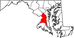
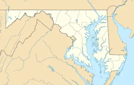 Montpelier Location in Maryland | |
| Coordinates: 39°03′41″N 76°51′03″W | |
| Country | |
| State | |
| County | |
| Built | late 1960s |
| Government | |
| • Type | Homeowners' association |
| • President | Bob Derrick |
| Elevation | 49 m (161 ft) |
| Time zone | UTC−05:00 (EST) |
| • Summer (DST) | UTC−04:00 (EDT) |
| GNIS feature ID | 597764 |
| Website | www |
The Montpelier area has a history dating back to 1685, when it was part of a land grant given to Richard Snowden, Sr. by Lord Baltimore. Richard Snowden arrived in Maryland as an indentured servant and eventually became one of the largest landowners. The Snowden family built and lived in the Montpelier Mansion which remains a symbol of their success, financially and socially.
The Montpelier community is a Planned Urban Development (PUD) and as such it has registered covenants and restrictions as set forth in Governing Documents dated January 1998. The purpose of these covenants is to provide a structured means of maintaining standards.
External links
| Wikimedia Commons has media related to Montpelier, Maryland. |
- Official website

- Gellerson, Justin T. (April 5, 2018). "Where We Live — Montpelier in Laurel, Md". Real Estate. The Washington Post (A photo gallery of Montpelier, published in The Washington Post online.). ISSN 0190-8286.
References
- "Montpelier". Geographic Names Information System. United States Geological Survey. Retrieved May 25, 2019.
| Authority control |
|---|