Marlton, Maryland
Marlton is an unincorporated area and census-designated place (CDP) in Prince George's County, Maryland, United States.[1] The population was 9,301 at the 2010 census.[2] The Marlton housing development, at first briefly called "Brandywine Country", grew up along U.S. Route 301 in the 1970s, and is part of the greater Upper Marlboro community. Originally made up of only single-family homes, more recently townhouses have been added.
Marlton, Maryland | |
|---|---|
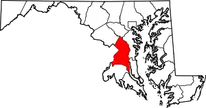
 Location of Marlton, Maryland | |
| Coordinates: 38°46′0″N 76°47′20″W | |
| Country | |
| State | |
| County | |
| Area | |
| • Total | 6.0 sq mi (15.6 km2) |
| • Land | 6.0 sq mi (15.6 km2) |
| • Water | 0.0 sq mi (0.0 km2) |
| Elevation | 197 ft (60 m) |
| Population (2010) | |
| • Total | 9,031 |
| • Density | 1,500/sq mi (580/km2) |
| Time zone | UTC−5 (Eastern (EST)) |
| • Summer (DST) | UTC−4 (EDT) |
| FIPS code | 24-50775 |
| GNIS feature ID | 1714754 |
Geography
Marlton is located at 38°46′00″N 76°47′20″W (38.766568, −76.788922).[3]
According to the United States Census Bureau, the CDP has a total area of 6.0 square miles (16 km2), all land.
Demographics
As of the census[4] of 2000, there were 7,798 people, 2,830 households, and 2,153 families residing in the CDP. The population density was 1,295.3 people per square mile (500.1/km2). There were 2,932 housing units at an average density of 487.0/sq mi (188.0/km2). The racial makeup of the CDP was 39.24% White, 55.49% African American, 0.28% Native American, 1.56% Asian, 0.01% Pacific Islander, 0.82% from other races, and 2.59% from two or more races. Hispanic or Latino of any race were 2.42% of the population.
There were 2,830 households, out of which 41.5% had children under the age of 18 living with them, 54.7% were married couples living together, 17.2% had a female householder with no husband present, and 23.9% were non-families. 18.3% of all households were made up of individuals, and 2.6% had someone living alone who was 65 years of age or older. The average household size was 2.75 and the average family size was 3.12.
In the CDP, the population was spread out, with 28.6% under the age of 18, 6.9% from 18 to 24, 35.8% from 25 to 44, 22.8% from 45 to 64, and 5.9% who were 65 years of age or older. The median age was 34 years. For every 100 females, there were 92.2 males. For every 100 females age 18 and over, there were 84.8 males.
The median income for a household in the CDP was $73,844, and the median income for a family was $82,936. Males had a median income of $43,659 versus $39,928 for females. The per capita income for the CDP was $28,558. About 1.2% of families and 2.3% of the population were below the poverty line, including 2.3% of those under age 18 and 2.8% of those age 65 or over.
Government
Prince George's County Police Department District 5 Station in Clinton CDP serves the community.[5]
Education
Marlton residents are assigned to schools in Prince George's County Public Schools.[6]
Marlton and Mattaponi elementary schools serve sections of the CDP.[7] James Madison Middle School and Gwynn Park Middle School serve sections of the CDP.[8] Frederick Douglass High School serves all of the CDP.[9]
References
- U.S. Geological Survey Geographic Names Information System: Marlton, Maryland
- "Profile of General Population and Housing Characteristics: 2010 Demographic Profile Data (DP-1): Marlton CDP, Maryland". United States Census Bureau. Retrieved December 22, 2011.
- "US Gazetteer files: 2010, 2000, and 1990". United States Census Bureau. 2011-02-12. Retrieved 2011-04-23.
- "U.S. Census website". United States Census Bureau. Retrieved 2008-01-31.
- "District 5 Station - Clinton." Prince George's County Police Department. Retrieved on September 9, 2018. " 6707 Groveton Drive Clinton, MD 20735". Beat map. See 2010 U.S. Census index map of Clinton CDP: area with police station is on the edge of page 6 with surroundings on page 5.
- "2010 CENSUS - CENSUS BLOCK MAP (INDEX): Marlton CDP, MD." U.S. Census Bureau. Retrieved on September 2, 2018. Pages: 1, 2, and 3.
- "NEIGHBORHOOD ELEMENTARY SCHOOLS AND BOUNDARIES SCHOOL YEAR 2018-2019." Prince George's County Public Schools. Retrieved on September 2, 2018.
- "NEIGHBORHOOD MIDDLE SCHOOLS AND BOUNDARIES SCHOOL YEAR 2018-2019." Prince George's County Public Schools. Retrieved on September 2, 2018.
- "NEIGHBORHOOD HIGH SCHOOLS AND BOUNDARIES SCHOOL YEAR 2018-2019." Prince George's County Public Schools. Retrieved on September 2, 2018.