Gabal El Uweinat
Mount Uwaynat or Gabal El Uweinat (Arabic: جبل العوينات Gabal El ʿUwaināt or Jabal al-ʿUwaināt "mountain of sourcelets") is a mountain range in the area of the Egyptian-Libyan-Sudanese tripoint.
| Mount Uwaynat | |
|---|---|
| جبل العوينات Jabal al-ʿUwaināt or Gabal El ʿUwaināt | |
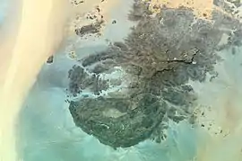 Mount Uwaynat on the border of Egypt, Libya and Sudan | |
| Highest point | |
| Elevation | 1,934 m (6,345 ft) |
| Coordinates | 21°55′N 24°59′E |
| Dimensions | |
| Length | 30 km (19 mi) |
| Width | 25 km (16 mi) |
| Geography | |
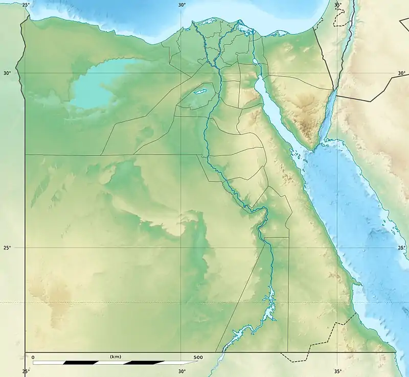 Location in Africa 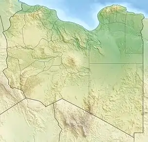 Mount Uwaynat (Libya) 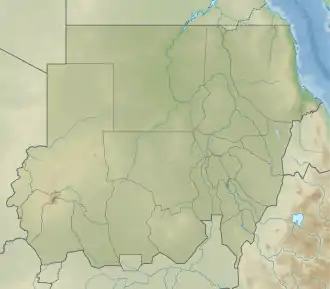 Mount Uwaynat (Sudan) 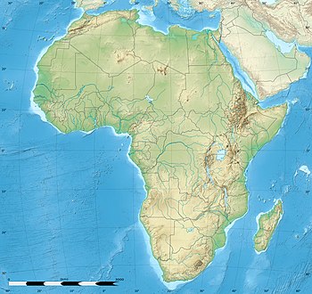 Mount Uwaynat (Africa) | |
| Country | Egypt, Libya, Sudan |
The area is notable for its prehistoric petroglyphs first reported by the Egyptian explorer Ahmed Pasha Hassanein—the discoverer of Uweinat, who in 1923 traversed the first 40 km of the mountain towards E, without reaching the end.[1] Engraved in sandstone, petroglyphs of Bushmen style are visible, representing lions, giraffes, ostriches, gazelles, cows and little human figures.[2]
Geography
Mount Uwaynat lies about 40 km S-SE of Jabal Arkanu.[1] The main spring called Ain Dua lies at the foot of the mountain, on the Libyan side. The W foot (located at 21°52′29″N 24°54′16″E according to Hassanein)[1] is 618 m high, and overcast with giant boulders fallen because of erosion.[1] In general, the W slope constitutes an oasis, with wells, bushes and grass.[1]
The western part of the massif consists of intrusive granite, arranged in a ring shape of some 25 km diameter, ending in three valleys (wadis) towards the west, named Karkur Hamid, Karkur Idriss and Karkur Ibrahim. Its eastern part consists of sandstone, ending in Karkur Talh. In Karkur Murr there is a permanent oasis (Guelta), Ain El Brins (Bir Murr). In the sandstone part four plateaus emerge from the level of the surrounding desert: the Hassanein plateau, connected to an unnamed plateau through a narrow neck, the Italia plateau and another unnamed plateau. The highest point of Uweinat is on top of the Italia plateau. There are two cairns on the top, the first was erected by R.A.Bagnold and the second by captain Marchesi, both in the 1930s.
Exploration
- Ahmed Pasha Hassanein—The discoverer who first published its existence on his 1923 map.
- Prince Kamal al-Dine Hussein (son of Hussein Kamel, Sultan of Egypt)
- Ralph Alger Bagnold—Founder of the Long Range Desert Group (LRDG) and desert explorer
- Pat Clayton—LRDG and Egyptian Government Survey
- László Almásy—Hungarian desert researcher
- Hubert W. G. J. Penderel
- Leo Frobenius
- Hans Rhotert
- Prinz Ferdinand von Lichtenstein
- Mahmoud Marai (who co-discovered the Yam Inscriptions near the southern end of the mountain in 2007)
Sources
- Bertarelli, L.V. (1929). Guida d'Italia, Vol. XVII (in Italian). Milano: Consociazione Turistica Italiana.
Notes
- Bertarelli (1929), p. 515.
- Bertarelli (1929), p. 516.
External links
- Story of the discovery of Oeunat as written by the Discoverer in National Geographic Magazine 1924
- UNESCO World Heritage, Jebel Ouenat Technical Report, 2004
- http://www.fjexpeditions.com/frameset/uweinat.htm
- http://www.gilf-kebir.de/set2/2_01.htm
- http://www.archaeoafrica.de/G_Auenat.html
- The 'Yam Inscriptions' of Pharaoh Montuhotep II
- http://www.uweinat.com/