Aurès Mountains
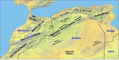
The Aures Mountains (Arabic: جبال الأوراس) are an eastern prolongation of the Atlas Mountain System that lies to the east of the Saharan Atlas in northeastern Algeria and northwestern Tunisia, North Africa. The mountain range gives its name to the mountainous natural and historical region of the Aures.
| Aures Mountains جبال الأوراس | |
|---|---|
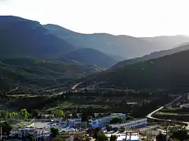 Mountain landscape at Hammam Essalihine | |
| Highest point | |
| Peak | Djebel Chélia, Algeria |
| Elevation | 2,328 m (7,638 ft) |
| Coordinates | 35°19′05″N 6°38′13″E |
| Geography | |
| |
| Countries | Algeria and Tunisia |
| Provinces | Batna, Tebessa, Khenchela, Oum El Bouaghi, Souk Ahras and Biskra |
| Parent range | Atlas Mountain System |
Geography
The Aures mountains are the eastern continuation of the Saharan Atlas. They are located at a lower elevation than the High Atlas mountains of Morocco. The highest peak in the Aurès mountain range is Djebel Chélia in Khenchela Province, which sits at 2,328 metres (7,638 ft).
The Belezma Range is a northwestern prolongation of the Aures Mountains located where the Tell Atlas and the Saharan Atlas come together. Its main summits are 2,178 m (7,146 ft) high Djebel Refaâ and 2,136 m (7,008 ft) high Djebel Tichaou.[1]
History
Historically, the Aures served as a refuge and bulwark for the Berber tribes, forming a base of resistance against the Romans, Vandals, Byzantine, and Arabs along the centuries.[2]
The mountain area was also a district of French Algeria that existed during and after the Algerian War of Independence from 1954 to 1962. It was in this region that the Algerian War of Independence was started by Berber freedom fighters. The rugged terrain of the Aures makes it still one of the least developed areas in the Maghreb.
Population
In eastern Algeria, the Aures is a large Berber-speaking region, home of the Chaoui people. The Chaoui eastern Berber population practices traditional transhumance, farming fixed stone terraces in the mountains where they grow sorghum, as well as other grains and vegetables. Seasonally they move their cattle to relatively warm areas in the lowland valleys where they pitch tents or live in other temporary structures and tend livestock through the winter.[3]
Features
 Location of the Aures region in Algeria
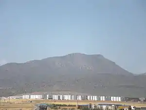 View of one of the mountains of the Belezma Range, a western subrange of the Aures
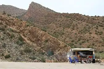 Landscape of southern area of the range
See also
References
- Belezma National Park - Travel to Algeria
- Conant, Jonathan (2012). Staying Roman : conquest and identity in Africa and the Mediterranean, 439–700. Cambridge New York: Cambridge University Press. pp. 280–281. ISBN 0521196973.
- La vie économique du Chaouia de l'Aures
External links
| Wikimedia Commons has media related to Aurès Mountains. |
- Les Aurès - Algérie (French). Includes many photos of the region.
| Tell Atlas |
|
|---|---|
| Saharan Atlas |
|
| Saharan massifs | |
| Peaks |
|
| Authority control |
|
|---|