Gilgit District
The Gilgit District (Urdu: ضلع گلگت) is one of the 14 districts of Pakistan-administered territory of Gilgit-Baltistan. The headquarters of the district is the town of Gilgit. According to the 1998 census, the Gilgit District had a population of 243,324. The district includes Gilgit (the capital city), the Bagrot Valley, Juglot, Danyore, Sultanabad, Naltar Peak, and the Nomal Valley. The highest peak in the district is Distaghil Sar 7,885 metres (25,869 ft), which is the seventh-highest peak in Pakistan and 19th highest in the world.
Gilgit District
ضلع گلگت | |
|---|---|
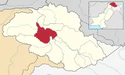 Map of Gilgit-Baltistan with the Gilgit District highlighted in red | |
| Sovereign state | |
| Administered territory | |
| Division | Gilgit Division |
| Headquarters | Gilgit |
| Area | |
| • Total | 38,000 km2 (15,000 sq mi) |
| Population (1998) | |
| • Total | 243,324 |
| • Density | 6.4/km2 (17/sq mi) |
| Number of tehsils | 3 |

Administration
THe Gilgit District is divided into three tehsils:
- Danyor Tehsil
- Gilgit Tehsil
- Juglot Tehsil
Education
According to the Alif Ailaan Pakistan District Education Rankings 2015, the Gilgit District was ranked 35th out of 148 districts in terms of education. In terms of facilities and infrastructure, the district was ranked 67th out of 148.[1]
Geography
The Gilgit District is bounded on the north by the Nagar District, on the east by the Shigar District and the Rondu District, on the south by the Tangir District, the Diamer District, and the Astore District, and on the west by the Ghizer District.
Rivers
The main rivers in the district are:
- Astore River
- Gilgit River - enters the Gilgit District from the west, south of the Bichhar Pass (Naltar Valley) and flows west through the town of Gilgit
- Hunza River - flows further south and joins the Gilgit River northeast of the town of Gilgit
- Indus River - enters the Gilgit District from the Shigar District about six kilometers north of Jaglot, where the Gilgit River joins the Indus River and flows south along the Karakoram Highway.
- Khunjerab River - flows south along the Karakoram Highway from the Khunjerab Valley and is known as the Hunza River south of Sost
There are many tributaries of the main rivers, some of which are the Ghujerab River, the Hispar River, the Naltar River, the Shimshal River, and the Yaheen River.
Lakes
- Borit Lake
- Naltar Lake
- Nomal Lake
- Pahote Lake
- Rush Lake
Demographics
In the 1941 census, the Gilgit District (then a tehsil) had a population of 22,495, distributed in 46 villages divided into 12 subdivisions. Roughly 50% of the population followed Shia Islam and 49% other forms of Islam (Sunni and Ismaili).[2] According to scholar Martin Sökefeld, the Sunni missionaries came from the south, Shia from the east and Ismaili from the north. [3]
References
| Wikimedia Commons has media related to Gilgit District. |
- "Individual district profile link, 2015". Alif Ailaan. Archived from the original on 2016-08-17. Retrieved 2015-05-07.
- Census of India, 1941, Volume XXII – Jammu and Kashmir, Part III (PDF), The Ranbir Government Press, 1943, pp. 522–525
- Sökefeld, Martin (2015), Spaces of Conflict in Everyday Life: Perspectives across Asia, transcript Verlag, pp. 14–15, ISBN 978-3-8394-3024-8
Capital: Gilgit | |
| Passes | |
| Valleys | |
| Cities and towns | |
| Rivers, glaciers and lakes | |
| Architecture | |
| See also | |