Khunjerab Pass
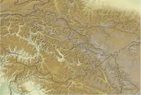
Khunjerab Pass (Chinese: 红其拉甫口岸; Urdu: درہ خنجراب, romanized: darra xunjarāb) is a 4,693-meter (15,397 ft)-high mountain pass in the Karakoram Mountains, in a strategic position on the northern border of Pakistan (Gilgit–Baltistan's Hunza and Nagar Districts) and on the southwest border of China (Xinjiang). Mutsjliga Pass is a 5,314-meter (17,434 ft)-high mountain pass at 36.97374°N 75.2973°E near Khunjerab Pass.
| Khunjerab Pass | |
|---|---|
 Khunjerab Pass | |
| Elevation | 4,693 m (15,397 ft) |
| Traversed by | |
| Location | Hunza Pakistan - administered Gilgit–Baltistan / Xinjiang, China |
| Range | Karakoram Range |
| Coordinates | 36°51′00″N 75°25′40″E |
 Location of Khunjerab Pass 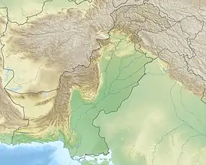 Khunjerab Pass (Pakistan) 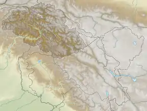 Khunjerab Pass (Gilgit Baltistan) 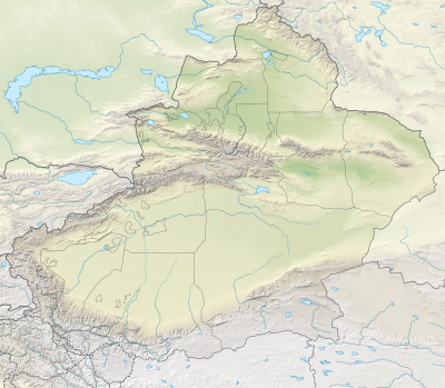 Khunjerab Pass (Xinjiang) | |
| Khunjerab Pass | |||||||
|---|---|---|---|---|---|---|---|
| Chinese name | |||||||
| Traditional Chinese | 紅其拉甫山口 | ||||||
| Simplified Chinese | 红其拉甫山口 | ||||||
| |||||||
Etymology
Its name is derived from two words of the local Wakhi language: "khun" means blood and "jerab" means a creek coming from a spring or waterfall.
Notability
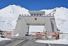
The Khunjerab Pass is the highest-paved international border crossing in the world and the highest point on the Karakoram Highway. The roadway across the pass was completed in 1982, and has superseded the unpaved Mintaka and Kilik Passes as the primary passage across the Karakoram Range. The choice of Khunjerab Pass for Karakoram Highway was decided in 1966: China citing the fact that Mintaka would be more susceptible to air strikes recommended the steeper Khunjerab Pass instead.[1]
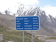
On the Pakistani-administered side, the pass is 42 km (26 mi) from the National Park station and checkpoint in Dih, 75 km (47 mi) from the customs and immigration post in Sost, 270 km (170 mi) from Gilgit, and 870 km (540 mi) from Islamabad.
On the Chinese side, the pass is the southwest terminus of China National Highway 314 (G314) and is 130 km (81 mi) from Tashkurgan, 420 km (260 mi) from Kashgar and some 1,890 km (1,170 mi) from Urumqi. The Chinese port of entry is located 3.5 km (2.2 mi) along the road from the pass in Tashkurgan County.
The long, relatively flat pass is often snow-covered[2] during the winter season and as a consequence is generally closed for heavy vehicles from November 30 to May 1 and for all vehicles from December 30 to April 1.[3]
The reconstructed Karakoram Highway passes through Khunjerab Pass.
Since June 1, 2006, there has been a daily bus service across the boundary from Gilgit to Kashgar, Xinjiang.[4]
This is one of the international borders where left-hand traffic (Pakistan-administered Gilgit-Baltistan) changes to right-hand traffic (China) and vice versa.
Highest ATM in the world
The Pakistani side features the highest ATM in the world, administered by the National Bank of Pakistan and 1LINK.[5]
Railway
In 2007, consultants[6] were hired to evaluate the construction of a railway through this pass to connect China with transport in Pakistani-administered Gilgit-Baltistan. A feasibility study started in November 2009 for a line connecting Havelian 750 km (466 mi) away in Pakistan and Kashgar 350 km (217 mi) in Xinjiang.[7] However, no progress has been made thereafter and this project is also not part of the current CPEC plan.
Gallery
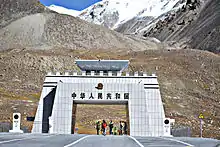
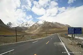
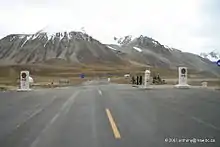
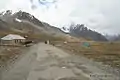
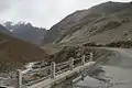
 Khunjerab Pass, border crossing between China and Pakistan
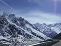
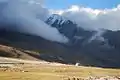
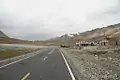
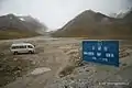
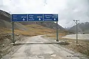
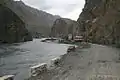
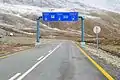 Khunjerab Pass Road
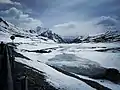
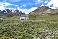
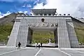
_near_Beautiful_Tunnels_at_atabad_lake_Hunza_Valley.jpg.webp) China–Pakistan friendship monument near the border
China–Pakistan friendship monument near the border
See also
References
Citations
- 刘欣 (2013-05-03). "重寻玄奘之路" [Rediscover the path taken by Xuanzang] (in Chinese). 东方早报. Retrieved 2017-02-02.
1966年,时任新疆军区副司令员的张希钦在主持修筑中巴公路时,为避敌国空袭,放弃了巴方主张的走宽阔的明铁盖达坂的方案,而取道地势高峻的红其拉甫山口。
- "Archived copy". Archived from the original on 2016-08-07. Retrieved 2016-06-11.CS1 maint: archived copy as title (link)
- "Khunjerab Pass". www.dangerousroads.org. Retrieved 2016-09-18.
- Road widening work has begun on 600 km (370 mi) of the highway.
- World's Highest ATM Atlas Obscura (www.atlasobscura.com). Retrieved on 2019-07-26.
- Online Asia Times South Asia Feb 24, 2007. "China-Pakistan rail link on horizon." Syed Fazl-e-Haider.
- http://www.fallingrain.com/world/CH/13/Kashi.html
Bibliography
| Wikimedia Commons has media related to Khunjerab Pass. |
- Curzon, George Nathaniel. 1896. The Pamirs and the Source of the Oxus. Royal Geographical Society, London. Reprint: Elibron Classics Series, Adamant Media Corporation. 2005. ISBN 1-4021-5983-8 (pbk); ISBN 1-4021-3090-2 (hbk).
- King, John 1989. Karakoram Highway : the high road to China. Hawthorn, Victoria, Lonely Planet Publications. ISBN 0-86442-065-X
- Episode 13/30 of the NHK television series The Silk Road, a series originally shown in Japan in the early 1980s.
Mountain passes of China | |||||||||||||||
|---|---|---|---|---|---|---|---|---|---|---|---|---|---|---|---|
| On the border | |||||||||||||||
| In the interior |
| ||||||||||||||
| |||||||||||||||
Mountain passes of Pakistan | |||||
|---|---|---|---|---|---|
| On the border | |||||
| In the interior | |||||
| |||||