Grimmer Parish, New Brunswick
Grimmer is a civil parish in Restigouche County, New Brunswick, Canada.[2]
Grimmer | |
|---|---|
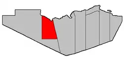 Location within Restigouche County. | |
| Coordinates: 47.67°N 67.45°W | |
| Country | |
| Province | |
| County | Restigouche |
| Erected | 1916 |
| Area | |
| • Land | 653.48 km2 (252.31 sq mi) |
| Population (2011)[1] | |
| • Total | 1,096 |
| • Density | 1.7/km2 (4/sq mi) |
| • Pop 2006-2011 | |
| • Dwellings | 469 |
| Time zone | UTC-4 (AST) |
| • Summer (DST) | UTC-3 (ADT) |
For governance purposes it is part of the incorporated rural community of Kedgwick[3] and the local service district of White's Brook,[4] both of which are members of the Restigouche Regional Service Commission (RRSC).[5]
Origin of name
The parish was named in honour of W.C.H. Grimmer, former Surveyor General and Attorney General of New Brunswick.[6]
History
Grimmer was erected in 1916 from Eldon Parish.[7] Grimmer included Saint-Quentin Parish.
In 1921 Saint-Quentin was erected as its own parish.[8]
Delineation
Grimmer Parish is defined in the Territorial Division Act[2] as being bounded:
- Southerly by the southern boundary line of lot number twenty-five, granted to Paul Berube, in Range 6, Rang-Double-Sud,[lower-alpha 1] and the prolongation of said boundary line easterly to the Parish of Eldon, and westerly to a point on the bank or shore of the Restigouche River. West by a straight line drawn due north astronomically from the said last-mentioned point to the southern boundary line of the Province of Quebec. Northerly by said Province and easterly by the Parish of Eldon.
Communities
Parish population total does not include incorporated municipalities (in bold).
|
|
Demographics
Population
| Canada census – Grimmer Parish, New Brunswick community profile | |||
|---|---|---|---|
| 2011 | 2006 | ||
| Population: | 1,096 (-0.8% from 2006) | 1,105 (-5.0% from 2001) | |
| Land area: | 653.48 km2 (252.31 sq mi) | 653.48 km2 (252.31 sq mi) | |
| Population density: | 1.7/km2 (4.4/sq mi) | 1.7/km2 (4.4/sq mi) | |
| Median age: | 41.8 (M: 42.5, F: 41.3) | 39.7 (M: 39.6, F: 39.8) | |
| Total private dwellings: | 469 | 531 | |
| Median household income: | $.N/A | $37,213 | |
| Notes: 2011 income data for this area has been suppressed for data quality or confidentiality reasons. – References: 2011[1] 2006[9] earlier[10] | |||
|
|
|
Language
| Canada Census Mother Tongue - Grimmer Parish, New Brunswick[11] | ||||||||||||||||||
|---|---|---|---|---|---|---|---|---|---|---|---|---|---|---|---|---|---|---|
| Census | Total | French |
English |
French & English |
Other | |||||||||||||
| Year | Responses | Count | Trend | Pop % | Count | Trend | Pop % | Count | Trend | Pop % | Count | Trend | Pop % | |||||
2011 |
1,090 |
1,060 | 97.25% | 25 | 2.29% | 0 | 0.00% | 5 | 0.46% | |||||||||
2006 |
1,095 |
1,080 | 98.63% | 15 | 1.37% | 0 | 0.00% | 0 | 0.00% | |||||||||
2001 |
1,165 |
1,120 | 96.14% | 25 | 2.14% | 20 | 1.72% | 0 | 0.00% | |||||||||
1996 |
1,100 |
1,065 | n/a | 96.82% | 25 | n/a | 2.27% | 10 | n/a | 0.91% | 0 | n/a | 0.00% | |||||
Access Routes
Highways and numbered routes that run through the parish, including external routes that start or finish at the parish limits:[12]
Notes
- Stewart Settlement.
References
- "2011 Community Profiles". 2011 Canadian Census. Statistics Canada. July 5, 2013. Retrieved 2014-03-21.
- "Chapter T-3 Territorial Division Act". Government of New Brunswick. Retrieved 13 November 2020.
- "New Brunswick Regulation 2012-18 under the Municipalities Act (O.C. 2012-75)". Government of New Brunswick. Retrieved 22 July 2020.
- "New Brunswick Regulation 84-168 under the Municipalities Act (O.C. 84-582)". Government of New Brunswick. Retrieved 22 July 2020.
- "Communities in each of the 12 Regional Service Commissions (RSC) / Les communautés dans chacune des 12 Commissions de services régionaux (CSR)" (PDF), Government of New Brunswick, July 2017, retrieved 2 February 2021
- "Grimmer Parish". Provincial Archives of New Brunswick. Retrieved 23 October 2020.
- "5 Geo. V c. 47 An Act to amend Chapter 2, Consolidated Statutes, 1903, so far as it relates to the Parish of Eldon, in the County of Restigouche.". Acts of the Legislative Assembly of New Brunswick Passed in the Months of April and May 1915. Fredericton: Government of New Brunswick. 1915. pp. 432–434.
- "11 Geo. V c. 18 An Act to Amend Chapter 2 of the Consolidated Statutes, 1903, respecting the division of the Province into Counties, Towns and Parishes.". Acts of the Legislative Assembly of New Brunswick Passed in the Month of April 1921. Fredericton: Government of New Brunswick. 1921. pp. 155–166.
- "2006 Community Profiles". 2006 Canadian Census. Statistics Canada. March 30, 2011. Retrieved 2014-03-21.
- "2001 Community Profiles". 2001 Canadian Census. Statistics Canada. February 17, 2012.
- Statistics Canada: 1996, 2001, 2006, 2011 census
- Atlantic Canada Back Road Atlas ISBN 978-1-55368-618-7 Pages 4, 12
Places adjacent to Grimmer Parish, New Brunswick | |
|---|---|
| Subdivisions | |
|---|---|
| Cities | |
| Counties | |
| |