Gumut, Bankura
Gumut is a village and gram panchayat in the Bishnupur CD block in the Bishnupur subdivision of the Bankura district in the state of West Bengal, India. It includes Muninagar.
Gumut | |
|---|---|
Village | |
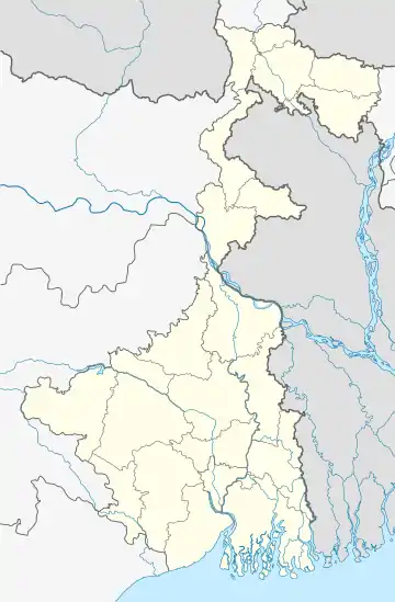
 Gumut Location in West Bengal, India  Gumut Gumut (India) | |
| Coordinates: 23.126883°N 87.383452°E | |
| Country | |
| State | West Bengal |
| District | Bankura |
| Population (2011) | |
| • Total | 1,723 |
| Languages | |
| • Official | Bengali, English |
| Time zone | UTC+5:30 (IST) |
| PIN | 722140 |
| Telephone/STD code | 03243 |
| Lok Sabha constituency | Bishnupur |
| Vidhan Sabha constituency | Bishnupur |
| Website | bankura |
Geography
| Places in Bishnupur subdivision in Bankura district M: Municipal town, CT: census town, R: rural/ urban centre, T: ancient/ temple centre Owing to space constraints in the small map, the actual locations in a larger map may vary slightly |
Location
Gumut is located at 23.126883°N 87.383452°E.
Note: The map alongside presents some of the notable locations in the subdivision. All places marked in the map are linked in the larger full screen map.
Demographics
According to the 2011 Census of India, Gumut had a total population of 1,723, of which 872 (51%) were males and 851 (49%) were females. There were 162 persons in the age range of 0–6 years. The total number of literate persons in Gumut was 1,136 (72.77% of the population over 6 years).[1]
Education
Gumut Vidyasagar Sisu Shiksha Niketan was established in 2010 and Gumut Girls Primary School was established in 1939.[2][3]
Muninagar Radhakanta Bidyapith is a Bengali-medium coeducational institution established in 1956. It has facilities for teaching from class V to class XII. The school has 10 computers, a library with 2,500 books and a playground.[4]
Culture
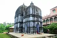
David J. McCutchion mentions the Muninagar Radha Kanta temple, located in Gumut, as a smooth twin deul plain laterite temple built in 1678.[5]
He further elaborates that in the tradition of Odisha, the porch or jagamohona (a kind of assembly hall) is under a separate roof. It is as large as or larger than the main shrine in base dimensions. It is attached to the main shrine by a passageway antarala). Similarly, a natmandapa or a bhogmandapa could be attached. The shrine or deul is in rekha style and the other buildings are in pirha style. This tradition had a strong influence on the medieval temples in Midnapore and Bankura. The pirha style is generally used for the tower of the jagamohana and rarely for the main shrine. Sometimes, the jagamohana is reduced to an entry porch. It can also be the other way around. At places such as Kharar and the 17th century Radha Kanta temple at Muninagar and earlier at Baidyapur, the porch is almost as high as the main shrine, giving the impression of twin deuls.[6]
The temple of Radha Kanta at Muninagar (at Sr No S-WB-10) is included in the List of State Protected Monuments in West Bengal by the Archaeological Survey of India. [7]
 Radhakanta Deul Muninagar
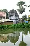
 View from across the pond
The pictures are a part of Wiki Explores Bankura programme, an initiative by West Bengal Wikimedians User Group
References
- "CD block Wise Primary Census Abstract Data(PCA)". West Bengal – District-wise CD blocks. Registrar General and Census Commissioner, India. Retrieved 14 April 2020.
- "Gumut Vidyasagar SS Niketan". Schools.org. Retrieved 4 May 2020.
- "Gumut Girls PS". Schools.org.in. Retrieved 4 May 2020.
- "Muninagar Radhakanta Bidyapith". Schools.org.in. Retrieved 4 May 2020.
- McCutchion, David J., Late Mediaeval Temples of Bengal, first published 1972, reprinted 2017, page 70. The Asiatic Society, Kolkata, ISBN 978-93-81574-65-2
- McCutchion, David J., Late Mediaeval Temples of Bengal, first published 1972, reprinted 2017, pages 67-68. The Asiatic Society, Kolkata, ISBN 978-93-81574-65-2
- "Protected Monuments in West Bengal". Archaeological Survey of India. Retrieved 17 April 2020.