Harlan, Indiana
Harlan is an unincorporated census-designated place (CDP) in Springfield Township, Allen County, in the U.S. state of Indiana.[3] As of the 2010 census, Harlan had a population of 1,634.[4]
Harlan, Indiana | |
|---|---|
 Harlan High School, built in 1908 and closed in 1965.[1] | |
 Location of Harlan in Allen County, Indiana. | |
| Coordinates: 41°11′46″N 84°55′11″W | |
| Country | United States |
| State | Indiana |
| County | Allen |
| Township | Springfield |
| Area | |
| • Total | 3.1 sq mi (8.0 km2) |
| • Land | 3.1 sq mi (8.0 km2) |
| • Water | 0 sq mi (0 km2) |
| Elevation | 784 ft (239 m) |
| Population (2010) | |
| • Total | 1,634 |
| • Density | 526/sq mi (203.2/km2) |
| Time zone | UTC-5 (Eastern (EST)) |
| • Summer (DST) | UTC-4 (EDT) |
| ZIP code | 46743 |
| Area code(s) | 260 |
| FIPS code | 18-31432 |
| GNIS feature ID | 435737 |
History
Harlan was laid out in 1853 by Lewis Reichelderfer.[5] It originally consisted of two communities, Harlan and Maysville. The border between the two towns was Georgetown Road (Indiana State Road 37), with Harlan being on the north side of the road.[6]
The post office at Harlan has been in operation since 1851.[7] Maysville faded from existence soon afterwards.
Geography
Harlan is located at 41°11′46″N 84°55′11″W. It is located on State Road 37, approximately 15 miles (24 km) northeast of Fort Wayne and 7 miles (11 km) west of the Ohio state line.
Education
Harlan is within East Allen County Schools (EACS) and is zoned to Woodlan Elementary School and Woodlan Junior/Senior High School.[8][9]
References
- Crawford, Christopher. "1908 Harlan High School in Harlan Indiana | Photograph by Christopher Crawford". Christopher Crawford: Documentary Photography. Retrieved 2 October 2018.
- "US Board on Geographic Names". United States Geological Survey. 2007-10-25. Retrieved 2008-01-31.
- "Harlan, Indiana". Geographic Names Information System. United States Geological Survey. Retrieved February 15, 2020.
- "Geographic Identifiers: 2010 Demographic Profile Data (G001): Harlan CDP, Indiana". U.S. Census Bureau, American Factfinder. Archived from the original on February 12, 2020. Retrieved March 26, 2013.
- Baker, Ronald L. (October 1995). From Needmore to Prosperity: Hoosier Place Names in Folklore and History. Indiana University Press. p. 157. ISBN 978-0-253-32866-3.
...was laid out in 1853 by Mr. and Mrs. Lewis Reichelderfer, who named the settlement Harlan.
- Andreas, Alfred Theodore (1876). "Allen County". Illustrated Historical Atlas of the State of Indiana. Chicago: Baskin, Forster & Company.
- "Allen County". Jim Forte Postal History. Retrieved February 15, 2020.
- "2010 CENSUS - CENSUS BLOCK MAP: Harlan CDP, IN" (PDF). U.S. Census Bureau. Retrieved 2020-04-04. - Compare it to the EACS map
- "District Boundary Map" (PDF). East Allen County Schools. Retrieved 2020-04-03. - Compare to the CDP limits.
- "Census of Population and Housing". Census.gov. Retrieved June 4, 2016.
External links
Municipalities and communities of Allen County, Indiana, United States | ||
|---|---|---|
| Cities | Map of Indiana highlighting Allen County | |
| Towns | ||
| Townships | ||
| CDPs | ||
| Other unincorporated communities |
| |
| Footnotes | ‡This populated place also has portions in an adjacent county or counties | |
| ||
| Counties | 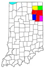 | |
|---|---|---|
| Municipalities with population over 10,000 in 2010 | ||
| Municipalities with population 1,000-10,000 in 2010 | ||
| Municipalities with population under 1,000 in 2010 | ||
| CDPs | ||