Whitley County, Indiana
Whitley County is a rural county in the U.S. state of Indiana. As of the 2010 United States Census, the population was 33,292.[1] Whitley County is the 49th largest county in Indiana. The county seat (and only incorporated city) is Columbia City.[2] The county has the highest county number (92) on Indiana license plates, as it is alphabetically the last in the state's list of counties.
Whitley County | |
|---|---|
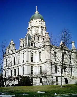 Whitley County courthouse in Columbia City | |
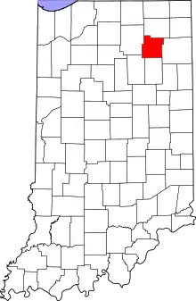 Location within the U.S. state of Indiana | |
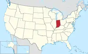 Indiana's location within the U.S. | |
| Coordinates: 41°08′N 85°30′W | |
| Country | |
| State | |
| Founded | 7 February 1835 (authorized) 1838 (organized) |
| Named for | William Whitley |
| Seat | Columbia City |
| Largest city | Columbia City |
| Area | |
| • Total | 337.91 sq mi (875.2 km2) |
| • Land | 335.57 sq mi (869.1 km2) |
| • Water | 2.34 sq mi (6.1 km2) 0.69%% |
| Population | |
| • Estimate (2018) | 34,074 |
| • Density | 101.6/sq mi (39.2/km2) |
| Time zone | UTC−5 (Eastern) |
| • Summer (DST) | UTC−4 (EDT) |
| Congressional district | 3rd |
| Website | whitleygov |
| Indiana county number 92 | |
It is part of the Fort Wayne Metropolitan Statistical Area and the Fort Wayne–Huntington–Auburn Combined Statistical Area.
History
Indiana was granted statehood near the end of 1816. On 7 February 1835, the state legislature approved an omnibus bill[3] that authorized the creation of thirteen counties,[4] including Whitley. It was named for Col. William Whitley, who was killed in the Battle of the Thames in the War of 1812.[5]
The first non-Native American settlers arrived in the area during that year, as a result of the end of the Black Hawk War and completion of the Erie Canal. They were from New England - "Yankee" settlers, descendents of the English Puritans who settled New England in the colonial era. They were primarily members of the Congregational Church though due to the Second Great Awakening many of them had converted to Methodism and some had become Baptists before coming to Indiana. Whitley County government was organized in 1838.
In the late 1870s immigrants began arriving from Germany and Ireland.[5]
Geography
Prior to white settlement, Whitley County's low rolling hills were densely forested, and dotted with lakes across its northern portion. At present, the available land is mostly deforested, and is entirely devoted to agriculture or to urban development.[6] Its highest point (approx. 1000'/305 meters ASL) is a small rise NE of Cedar Lake.[7] The Eel River flows southwestward through the lower part of the county, and the Blue River flows southwestward through the upper part.[6]
According to the 2010 United States Census, the county has a total area of 337.91 square miles (875.2 km2), of which 335.57 square miles (869.1 km2) (or 99.31%) is land and 2.34 square miles (6.1 km2) (or 0.69%) is water.[8]
Adjacent counties
- Noble County - north
- Allen County - east
- Huntington County - south
- Wabash County - southwest
- Kosciusko County - west
City and towns
- Columbia City (city/county seat)
- Churubusco
- Larwill
- South Whitley
Census-designated place
Unincorporated places
Lakes
- Blue Lake
- Brown Lake
- Cedar Lake
- Crooked Lake (part)
- Dollar Lake
- Goose Lake
- Indian Lake
- Little Cedar Lake
- Loon Lake (part)
- Mud Lake
- New Lake
- Old Lake
- Rine Lake
- Robinson Lake (part)
- Round Lake
- Scott Lake
- Shriner Lake
- Tadpole Lake
- Troy Cedar Lake
- Winters Lake[6]
Protected areas
- Deniston Resource Area
- Goose Lake Wetland Conservation Area
- Pisgah Marsh Nongame Area (part)[6]
Climate and weather
| Columbia City, Indiana | ||||||||||||||||||||||||||||||||||||||||||||||||||||||||||||
|---|---|---|---|---|---|---|---|---|---|---|---|---|---|---|---|---|---|---|---|---|---|---|---|---|---|---|---|---|---|---|---|---|---|---|---|---|---|---|---|---|---|---|---|---|---|---|---|---|---|---|---|---|---|---|---|---|---|---|---|---|
| Climate chart (explanation) | ||||||||||||||||||||||||||||||||||||||||||||||||||||||||||||
| ||||||||||||||||||||||||||||||||||||||||||||||||||||||||||||
| ||||||||||||||||||||||||||||||||||||||||||||||||||||||||||||
In recent years, average temperatures in Columbia City have ranged from a low of 14 °F (−10 °C) in January to a high of 83 °F (28 °C) in July, although a record low of −24 °F (−31 °C) was recorded in January 1994 and a record high of 103 °F (39 °C) was recorded in June 1988. Average monthly precipitation ranged from 1.80 inches (46 mm) in February to 4.44 inches (113 mm) in June.[9]
Government
The county government is a constitutional body, and is granted specific powers by the Constitution of Indiana, and by the Indiana Code.
County Council: The legislative branch of the county government; controls spending and revenue collection in the county. Representatives are elected to four-year terms from county districts. They set salaries, the annual budget, and special spending. The council has limited authority to impose local taxes, in the form of an income and property tax that is subject to state level approval, excise taxes, and service taxes.[10][11]
Board of Commissioners: The executive body of the county; commissioners are elected to four-year staggered terms in county-wide elections. One commissioner serves as president. The commissioners execute the acts legislated by the council, collect revenue, and manage the county government.[10][11]
Court: The county maintains a small claims court that handles civil cases. The judge on the court is elected to a term of four years and must be a member of the Indiana bar. The judge is assisted by a constable who is also elected to a four-year term. In some cases, court decisions can be appealed to the state level circuit court.[11]
County Officials: The county has other officers elected to four-year terms, including sheriff, coroner, auditor, treasurer, recorder, surveyor, and circuit court clerk. Members elected to county government positions are required to declare party affiliations and to be residents of the county.[11]
Whitely County is part of Indiana's 3rd congressional district and as of 2020 is represented by Republican James Edward Banks in the United States Congress.
| Year | Republican | Democratic | Third parties |
|---|---|---|---|
| 2016 | 72.1% 11,358 | 21.4% 3,379 | 6.5% 1,022 |
| 2012 | 68.2% 10,258 | 29.4% 4,420 | 2.4% 354 |
| 2008 | 60.0% 9,124 | 38.6% 5,862 | 1.5% 222 |
| 2004 | 70.6% 9,512 | 28.8% 3,880 | 0.7% 89 |
| 2000 | 65.0% 8,080 | 33.0% 4,107 | 2.0% 245 |
| 1996 | 51.3% 5,965 | 35.9% 4,176 | 12.8% 1,484 |
| 1992 | 43.3% 5,217 | 29.6% 3,569 | 27.1% 3,270 |
| 1988 | 67.4% 7,679 | 32.0% 3,642 | 0.6% 65 |
| 1984 | 67.2% 7,763 | 32.0% 3,690 | 0.9% 98 |
| 1980 | 55.7% 7,146 | 35.1% 4,497 | 9.2% 1,178 |
| 1976 | 54.3% 6,761 | 43.8% 5,445 | 1.9% 235 |
| 1972 | 65.7% 7,489 | 33.7% 3,838 | 0.7% 77 |
| 1968 | 53.3% 5,684 | 36.1% 3,848 | 10.7% 1,139 |
| 1964 | 45.6% 4,896 | 54.0% 5,798 | 0.5% 53 |
| 1960 | 60.5% 6,621 | 39.0% 4,266 | 0.5% 56 |
| 1956 | 63.2% 6,422 | 36.3% 3,688 | 0.5% 47 |
| 1952 | 60.3% 5,893 | 38.4% 3,755 | 1.3% 128 |
| 1948 | 51.9% 4,715 | 46.7% 4,240 | 1.5% 134 |
| 1944 | 55.9% 5,268 | 43.3% 4,079 | 0.9% 80 |
| 1940 | 53.3% 5,100 | 46.1% 4,404 | 0.6% 57 |
| 1936 | 43.3% 3,959 | 55.9% 5,115 | 0.8% 76 |
| 1932 | 39.2% 3,471 | 57.1% 5,058 | 3.7% 324 |
| 1928 | 57.4% 4,519 | 41.9% 3,294 | 0.7% 56 |
| 1924 | 54.8% 4,420 | 43.2% 3,484 | 1.9% 156 |
| 1920 | 52.5% 4,530 | 45.5% 3,929 | 2.0% 170 |
| 1916 | 44.7% 2,191 | 51.2% 2,510 | 4.1% 202 |
| 1912 | 24.0% 1,082 | 49.0% 2,206 | 27.0% 1,218 |
| 1908 | 46.6% 2,302 | 50.4% 2,493 | 3.0% 148 |
| 1904 | 49.0% 2,359 | 47.4% 2,281 | 3.6% 175 |
| 1900 | 47.8% 2,271 | 49.7% 2,361 | 2.6% 122 |
| 1896 | 46.9% 2,242 | 52.1% 2,494 | 1.0% 49 |
| 1892 | 44.6% 1,958 | 50.8% 2,234 | 4.6% 203 |
| 1888 | 46.2% 2,133 | 50.3% 2,325 | 3.5% 161 |
Demographics
| Historical population | |||
|---|---|---|---|
| Census | Pop. | %± | |
| 1840 | 1,237 | — | |
| 1850 | 5,190 | 319.6% | |
| 1860 | 10,730 | 106.7% | |
| 1870 | 14,399 | 34.2% | |
| 1880 | 16,941 | 17.7% | |
| 1890 | 17,768 | 4.9% | |
| 1900 | 17,328 | −2.5% | |
| 1910 | 16,892 | −2.5% | |
| 1920 | 15,660 | −7.3% | |
| 1930 | 15,931 | 1.7% | |
| 1940 | 17,001 | 6.7% | |
| 1950 | 18,828 | 10.7% | |
| 1960 | 20,954 | 11.3% | |
| 1970 | 23,395 | 11.6% | |
| 1980 | 26,215 | 12.1% | |
| 1990 | 27,651 | 5.5% | |
| 2000 | 30,707 | 11.1% | |
| 2010 | 33,292 | 8.4% | |
| 2018 (est.) | 34,074 | [13] | 2.3% |
| US Decennial Census[14] 1790-1960[15] 1900-1990[16] 1990-2000[17] 2010-2013[1] 2017[18] | |||
2010 Census
As of the 2010 United States Census, there were 33,292 people, 13,001 households, and 9,228 families in the county.[19] The population density was 99.2 inhabitants per square mile (38.3/km2). There were 14,281 housing units at an average density of 42.6 per square mile (16.4/km2).[8] The racial makeup of the county was 97.6% white, 0.3% Asian, 0.3% American Indian, 0.3% black or African American, 0.4% from other races, and 1.1% from two or more races. Those of Hispanic or Latino origin made up 1.5% of the population.[19] In terms of ancestry, 38.2% were German, 12.6% were Irish, 12.5% were American, and 9.3% were English.[20]
Of the 13,001 households, 32.5% had children under the age of 18 living with them, 57.4% were married couples living together, 9.2% had a female householder with no husband present, 29.0% were non-families, and 24.1% of all households were made up of individuals. The average household size was 2.53 and the average family size was 2.99. The median age was 40.1 years.[19]
The median income for a household in the county was $47,697 and the median income for a family was $63,487. Males had a median income of $44,883 versus $30,724 for females. The per capita income for the county was $24,644. About 5.1% of families and 6.8% of the population were below the poverty line, including 7.2% of those under age 18 and 7.6% of those age 65 or over.[21]
References
- "Whitley County QuickFacts". US Census Bureau. Retrieved 25 September 2011.
- "Find a County". National Association of Counties. Retrieved 7 June 2011.
- John W Tyndall & OE Lesh, Standard history of Adams and Wells Counties, Indiana. pp. 284-6 (accessed 9 August 2020)
- The counties are DeKalb, Fulton, Jasper, Jay, Kosciusko, Marshall, Newton, Porter, Pulaski, Stark, Steuben, Wells, and Whitley. Newton was dissolved in 1839 and its territory was attached to Jasper; it was re-created in 1859.
- De Witt Clinton Goodrich & Charles Richard Tuttle (1875). An Illustrated History of the State of Indiana. Indiana: R. S. Peale & co. p. 577.
- Whitley County IN (Google Maps, accessed 31 July 2020)
- Whitley County High Point, Indiana (PeakBagger.com, accessed 31 July 2020)
- "Population, Housing Units, Area, and Density: 2010 - County". US Census Bureau. Archived from the original on 12 February 2020. Retrieved 10 July 2015.
- "Monthly Averages for Columbia City IN". The Weather Channel. Retrieved 27 January 2011.
- Indiana Code. "Title 36, Article 2, Section 3". IN.gov. Retrieved 16 September 2008.
- Indiana Code. "Title 2, Article 10, Section 2" (PDF). IN.gov. Retrieved 16 September 2008.
- Leip, David. "Atlas of US Presidential Elections". uselectionatlas.org. Retrieved 21 May 2018.
- "Population and Housing Unit Estimates". Retrieved July 26, 2019.
- "US Decennial Census". US Census Bureau. Retrieved July 10, 2014.
- "Historical Census Browser". University of Virginia Library. Retrieved July 10, 2014.
- "Population of Counties by Decennial Census: 1900 to 1990". US Census Bureau. Retrieved July 10, 2014.
- "Census 2000 PHC-T-4. Ranking Tables for Counties: 1990 and 2000" (PDF). US Census Bureau. Retrieved July 10, 2014.
- "QuickFacts. Whitley County, Indiana". US Census Bureau. Retrieved November 6, 2018.
- "Profile of General Population and Housing Characteristics: 2010 Demographic Profile Data". US Census Bureau. Archived from the original on 13 February 2020. Retrieved 10 July 2015.
- "Selected Social Characteristics in the US – 2006-2010 American Community Survey 5-Year Estimates". US Census Bureau. Archived from the original on 14 February 2020. Retrieved 10 July 2015.
- "Selected Economic Characteristics – 2006-2010 American Community Survey 5-Year Estimates". US Census Bureau. Archived from the original on 14 February 2020. Retrieved 10 July 2015.
External links
| Wikimedia Commons has media related to Whitley County, Indiana. |
Places adjacent to Whitley County, Indiana | ||||||||||
|---|---|---|---|---|---|---|---|---|---|---|
| ||||||||||
Municipalities and communities of Whitley County, Indiana, United States | ||
|---|---|---|
| City | Map of Indiana highlighting Whitley County | |
| Towns | ||
| Townships | ||
| CDP | ||
| Other unincorporated communities | ||
| Footnotes | ‡This populated place also has portions in an adjacent county or counties | |
| ||
| Counties | 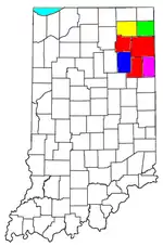 | |
|---|---|---|
| Municipalities with population over 10,000 in 2010 | ||
| Municipalities with population 1,000-10,000 in 2010 | ||
| Municipalities with population under 1,000 in 2010 | ||
| CDPs | ||

| Authority control |
|---|