Harvey Parish, New Brunswick
Harvey is a civil parish in southern Albert County, New Brunswick, Canada.[2] It comprises a single local service district, which is a member of the Southeast Regional Service Commission.[3]
Harvey | |
|---|---|
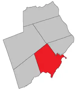 Location within Albert County. | |
| Coordinates: 45.72°N 64.78°W | |
| Country | |
| Province | |
| County | Albert |
| Erected | 1838 |
| Area | |
| • Land | 277.27 km2 (107.05 sq mi) |
| Population (2016)[1] | |
| • Total | 333 |
| • Density | 1.2/km2 (3/sq mi) |
| • Pop 2011-2016 | |
| • Dwellings | 248 |
| Time zone | UTC-4 (AST) |
| • Summer (DST) | UTC-3 (ADT) |
The Census subdivision of the same name shares the parish's borders.[1]
Origin of name
The parish was probably in honour of Sir John Harvey, Lieutenant Governor of New Brunswick 1837-1841.[4]
History
Harvey Parish was erected in 1838 from parts of Hopewell and Salisbury Parishes.[5] It included modern Alma Parish and most of Elgin.
The boundaries were adjusted in 1846,[6] taking in all of Salisbury Parish south of the prolongation of Harvey's northern line.
Elgin Parish was erected in 1847 from the northern part of Harvey.[7]
Alma Parish was erected from the western part of Harvey in 1855.[8]
In 1877 Grindstone Island was omitted from the boundary description of Harvey;[9] this was corrected in 1879.[10]
Harvey is sometimes erroneously stated to have included part of Saint John County but the county line was moved west in 1837.[11]
Boundaries
Harvey Parish is bounded on the south by Chignecto Bay, on the west by the prolongation of a grant line on Rocher Bay near Hebron, on the north by a line running from the northwestern corner of Hopewell Parish to south of Wolfe Lake, and on the east by the Shepody River, Crooked Brook, and a line running 20° north of west; it also includes Grindstone Island in Shepody Bay.[2]
Local service district
The local service district of the parish of Harvey includes the entire parish.[12] The LSD was established on 23 November 1966 to assess for fire protection[13] following the abolition of county councils in the new Municipalities Act. First aid & ambulance services were added on 21 January 1976.[14]
Today it assesses for community & recreation services in addition to the basic LSD services of fire protection, police services, land use planning, emergency measures, and dog control.[15] The taxing authority is 617.00 Harvey.
Communities
Parish population total does not include incorporated municipalities (in bold).
|
|
|
Bodies of water & Islands
This is a list of rivers, lakes, streams, creeks, marshes and Islands that are at least partially in this parish
- Petitcodiac River
- Shepody River
Demographics
Access Routes
Highways and numbered routes that run through the parish, including external routes that start or finish at the parish limits:[18]
See also
References
- "Census Profile, 2016 Census: Harvey, Parish [Census subdivision], New Brunswick". Statistics Canada. Retrieved September 4, 2019.
- "Chapter T-3 Territorial Division Act". Government of New Brunswick. Retrieved 13 November 2020.
- "Communities in each of the 12 Regional Service Commissions (RSC) / Les communautés dans chacune des 12 Commissions de services régionaux (CSR)" (PDF), Government of New Brunswick, July 2017, retrieved 1 February 2021
- Ganong, William F. (1896). A Monograph of the Place-Nomenclature of the Province of New Brunswick. Royal Society of Canada. p. 240.
- "1 Vic. c. 23 An Act for erecting parts of the Towns or Parishes of Hopewell and Salisbury, in the County of Westmorland, into a separate Town or Parish.". Acts of the General Assembly of Her Majesty's Province of New Brunswick, Passed in the Year 1838. Fredericton: Government of New Brunswick. 1838. pp. 72–73.
- "9 Vic. c. 7 An Act to alter the Division Line between the Counties of Westmorland and Albert, and also certain Parish Lines in the said County of Albert.". Acts of the General Assembly of Her Majesty's Province of New Brunswick, Passed in the Year 1846. Fredericton: Government of New Brunswick. 1846. pp. 20–21.
- "10 Vic. c. 46 An Act for erecting the Parish of Harvey, in the County of Albert, into two separate Parishes.". Acts of the General Assembly of Her Majesty's Province of New Brunswick, Passed in the Year 1847. Fredericton: Government of New Brunswick. 1847. pp. 43–44.
- "18 Vic. c. 48 An Act for the erection of a part of the Parish of Harvey, in the County of Albert, into a separate Parish.". Acts of the General Assembly of Her Majesty's Province of New Brunswick, Passed in the Month of November, 1854, and in the Months of February, March, and April, 1855. Fredericton: Government of New Brunswick. 1855. pp. 177–178.
- "Chapter 2 The Division of the Province into Counties, Towns, and Parishes.". The Consolidated Statutes of New Brunswick. Fredericton: Government of New Brunswick. 1877. pp. 56–85.
- "42 Vic. c. 58 An Act further to define the Boundary of the Parish of Harvey, in the County of Albert.". Acts of the General Assembly of Her Majesty's Province of New Brunswick. Passed in the Month of April 1879. Fredericton: Government of New Brunswick. 1879. pp. 115–116.
- "7 Wm. IV c. 35 An Act to establish a Boundary Line between the Counties of Westmorland and Saint John, and King's and Queen's Counties.". Acts of the General Assembly of His Majesty's Province of New Brunswick, Passed in the Year 1837. Fredericton: Government of New Brunswick. 1837. pp. 91–92.
- "New Brunswick Regulation 84-168 under the Municipalities Act (O.C. 84-582)". Government of New Brunswick. Retrieved 12 December 2020.
- "Regulation 66–41 under the Municipalities Act (O. C. 66–968)". The Royal Gazette. Fredericton. 124: 604–605. 21 December 1966.
- "Regulation 76–17 under the Municipalities Act (O. C. 76–71)". The Royal Gazette. Fredericton. 134: 91. 28 January 1976.
- "2020 Local Government Statistics for New Brunswick" (PDF). Department of Environment and Local Government. p. 55. Retrieved 12 December 2020.
- Statistics Canada: 2001, 2006 census
- 2011 Statistics Canada Census Profile: Harvey Parish, New Brunswick
- Atlantic Canada Back Road Atlas ISBN 978-1-55368-618-7
Places adjacent to Harvey Parish, New Brunswick | |
|---|---|
| Subdivisions | |
|---|---|
| Cities | |
| Counties | |
| |