Holley, Oregon
Holley is a census-designated place and unincorporated community in Linn County, Oregon, United States.[3] As of the 2010 census it had a population of 378.[2] It is about 4 miles (6 km) southwest of Sweet Home on Oregon Route 228 near the Calapooia River.[4]
Holley, Oregon | |
|---|---|
 Holley and the surrounding upper Calapooia River valley | |
 Holley  Holley | |
| Coordinates: 44°21′17″N 122°46′58″W | |
| Country | United States |
| State | Oregon |
| County | Linn |
| Area | |
| • Total | 2.82 sq mi (7.30 km2) |
| • Land | 2.82 sq mi (7.30 km2) |
| • Water | 0.0 sq mi (0.0 km2) |
| Elevation | 638 ft (194 m) |
| Population | |
| • Total | 378 |
| • Density | 130/sq mi (52/km2) |
| Time zone | UTC-8 (Pacific (PST)) |
| • Summer (DST) | UTC-7 (PDT) |
| FIPS code | 41-34650 |
| GNIS feature ID | 1121920 |
The Holley area was once the source of the semi-precious gemstone Holley blue agate.[5]

Holley Christian Church
References
- "2019 U.S. Gazetteer Files: Places: Oregon". United States Census Bureau. Retrieved August 25, 2020.
- "Total Population: 2010 Census DEC Summary File 1 (P1), Holley CDP, Oregon". data.census.gov. U.S. Census Bureau. Retrieved August 25, 2020.
- "Holley". Geographic Names Information System. United States Geological Survey. November 28, 1980. Retrieved January 14, 2011.
- Oregon Atlas & Gazetteer (7th ed.). Yarmouth, Maine: DeLorme. 2008. p. 40. ISBN 0-89933-347-8.
- "Socio-Cultural Impacts of Water Resource Development in the Santiam River Basin" (PDF). Oregon State University: Water Resources Research Institute. October 1970. p. 9. Retrieved February 19, 2012.
Municipalities and communities of Linn County, Oregon, United States | ||
|---|---|---|
| Cities | 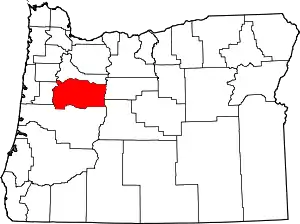 Linn County map | |
| CDPs | ||
| Other unincorporated communities | ||
| Ghost towns | ||
| Indian reservation | ||
| Footnotes | ‡This populated place also has portions in an adjacent county or counties | |
| ||
This article is issued from Wikipedia. The text is licensed under Creative Commons - Attribution - Sharealike. Additional terms may apply for the media files.