Crawfordsville, Oregon
Crawfordsville is a census-designated place and unincorporated community in Linn County, Oregon, United States.[3] As of the 2010 census it had a population of 332.[2] It is located about 7 miles (11 km) southeast of Brownsville and 8 miles (13 km) southwest of Sweet Home on Oregon Route 228, near the Calapooia River.[4] It has a post office with a ZIP code of 97336.[5]
Crawfordsville, Oregon | |
|---|---|
 | |
 Crawfordsville  Crawfordsville | |
| Coordinates: 44°21′25″N 122°51′28″W | |
| Country | United States |
| State | Oregon |
| County | Linn |
| Founded | 1870 |
| Area | |
| • Total | 1.92 sq mi (4.98 km2) |
| • Land | 1.92 sq mi (4.98 km2) |
| • Water | 0.0 sq mi (0.0 km2) |
| Elevation | 443 ft (135 m) |
| Population | |
| • Total | 332 |
| • Density | 170/sq mi (67/km2) |
| Time zone | UTC-8 (Pacific (PST)) |
| • Summer (DST) | UTC-7 (PDT) |
| ZIP code | 97336 |
| FIPS code | 41-16650 |
| GNIS feature ID | 1119522 |
History
Crawfordsville was founded on the land of Philemon Vawter Crawford in 1870 by Crawford and Robert Glass.[6] When the post office was established in 1870, it was named for Crawford.[6] Crawford was born in Madison, Indiana, in 1814 and he arrived in Oregon via the Oregon Trail in 1851.[6][7] His son, Jasper V. Crawford, was the first postmaster.[6] Philemon Crawford had previously helped establish the Boston Flour Mill near Shedd.[8]
In 1915 Crawfordsville had a population of 300, two sawmills, a flouring mill, a high school, an elementary school, and three churches.[9]
In the early 20th century, Crawfordsville had a population of Sikhs from Pakistan and India who worked for the Calapooya Lumber Company.[10]
Education
Crawfordsville Elementary School, part of the Sweet Home School District, closed in 2011, 158 years after its founding in 1853.[11] Area elementary students now attend Holley Elementary School in Holley.[12]
Points of interest
The Crawfordsville Bridge over the Calapooia River is listed on the National Register of Historic Places.
References
- "2019 U.S. Gazetteer Files: Places: Oregon". United States Census Bureau. Retrieved August 24, 2020.
- "Total Population: 2010 Census DEC Summary File 1 (P1), Crawfordsville CDP, Oregon". data.census.gov. U.S. Census Bureau. Retrieved August 24, 2020.
- "Crawfordsville". Geographic Names Information System. United States Geological Survey. November 28, 1980. Retrieved February 19, 2012.
- Oregon Atlas & Gazetteer (7th ed.). Yarmouth, Maine: DeLorme. 2008. ISBN 0-89933-347-8.
- "USPS ZIP Code Lookup". Archived from the original on November 23, 2010. Retrieved February 19, 2012.
- McArthur, Lewis A.; McArthur, Lewis L. (2003) [1928]. Oregon Geographic Names (7th ed.). Portland, Oregon: Oregon Historical Society Press. p. 248. ISBN 978-0875952772.
- Flora, Stephenie. "Emigrants to Oregon in 1851". oregonpioneers.com.
- "The Boston/Thompson Mill". Boston Mill Society. Retrieved February 19, 2012.
- Friedman, Ralph (1990). In Search of Western Oregon (2nd ed.). Caldwell, Idaho: The Caxton Printers, Ltd. pp. 509–510. ISBN 0-87004-332-3.
- Williamson, Stephen. "Sikhs and Hindus from India Working as Loggers & Millworkers for the Calapooya Lumber Company".
- "Celebration to mark school's closure". The Register-Guard. May 30, 2011. Archived from the original on July 29, 2012. Retrieved February 19, 2012.
- Moody, Jennifer (February 15, 2011). "Board to close Crawfordsville school". Albany Democrat-Herald. Retrieved February 19, 2012.
External links
- Historic images of Crawfordsville from Salem Public Library
- Images of Crawfordsville from Flickr
- History of Crawfordsville from Linn County Roots
- History of the Finley Mill in Crawfordsville from Linn Genealogical Society
Municipalities and communities of Linn County, Oregon, United States | ||
|---|---|---|
| Cities | 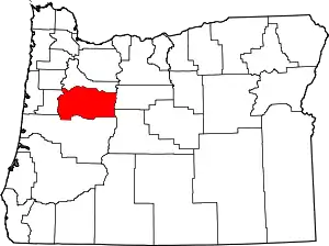 Linn County map | |
| CDPs | ||
| Other unincorporated communities | ||
| Ghost towns | ||
| Indian reservation | ||
| Footnotes | ‡This populated place also has portions in an adjacent county or counties | |
| ||