Huai'an District
Huai'an District (simplified Chinese: 淮安区; traditional Chinese: 淮安區; pinyin: Huái'ān Qū) is one of four districts of the prefecture-level city of Huai'an, Jiangsu Province, China. The southeast district was formerly named Shanyang County (山阳县; 山陽縣; Shānyáng Xiàn), Huai'an County (淮安县; 淮安縣; Huái'ān Xiàn) and Chuzhou District (楚州区; 楚州區; Chǔzhōu Qū).
Huai'an
淮安区 | |
|---|---|
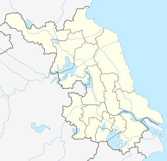 Huai'an District Location in Jiangsu | |
| Coordinates: 33°31′19″N 119°18′32″E[1] | |
| Country | People's Republic of China |
| Province | Jiangsu |
| Prefecture-level city | Huai'an |
| Subdivisions | Huai'an |
| Area | |
| • Total | 1,452 km2 (561 sq mi) |
| Population (2019) | |
| • Total | 1,143,700 |
| • Density | 790/km2 (2,000/sq mi) |
| Time zone | UTC+8 (China Standard) |
| Postal code | 223200 |
| Website | www |
The district is the home town of historical figures such as Zhou Enlai, Wu Cheng'en, Han Xin and Guan Tianpei
Administrative divisions
In the present, Huai'an District has 21 towns and 6 townships.[2]
- 21 towns
|
|
- 6 townships
|
|
References
- Google (2014-07-02). "Huai'an" (Map). Google Maps. Google. Retrieved 2014-07-02.
- "淮安市-行政区划网 www.xzqh.org" (in Chinese). XZQH. Retrieved 2012-05-24.
- www.xzqh.org (in Chinese)
External links
This article is issued from Wikipedia. The text is licensed under Creative Commons - Attribution - Sharealike. Additional terms may apply for the media files.