Ganyu District
Ganyu District (simplified Chinese: 赣榆区; traditional Chinese: 贛榆區; pinyin: Gànyú Qū) is under the administration of Lianyungang, Jiangsu province, China. It contains the province's northernmost point and is located along the Yellow Sea coast where the coastline takes a sharp turn toward the southeast, and borders the Shandong prefecture-level cities of Linyi and Rizhao to the north.
Ganyu
赣榆区 Kanyu | |
|---|---|
 Administrative boundaries in eastern China; provincial boundaries in blue | |
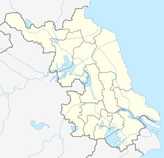 Ganyu Location in Jiangsu | |
| Coordinates: 34°54′00″N 119°02′10″E[1] | |
| Country | People's Republic of China |
| Province | Jiangsu |
| Prefecture-level city | Lianyungang |
| Township-level divisions | 18 towns |
| Seat | Qingkou (青口镇) |
| Area | |
| • Total | 1,363 km2 (526 sq mi) |
| Population (2010) | |
| • Total | 949,400 |
| • Density | 700/km2 (1,800/sq mi) |
| Time zone | UTC+8 (China Standard) |
| Postal code | 222100 |
| Area code(s) | 0518 |
Culture
Unlike the rest of Northern Jiangsu, the native locals of Ganyu speak Jiaoliao Mandarin which is also native to Eastern Shandong province and most of Liaodong peninsula, instead of Jianghuai Mandarin.
Demographics
According to the Fifth National Population Census of the People's Republic of China, there are 49 nations in Ganyu. Among all the people, the Han population accounts for 99.8% and the ethnic minority population account for 0.2%.
Geography and climate
Ganyu has a humid subtropical climate (Köppen Cwa) influenced by the East Asian Monsoon. The winters are cold and quite dry, while the summers are hot, rainy, and humid. The normal monthly mean temperature ranges from 0.0 °C (32.0 °F) in January to 26.5 °C (79.7 °F) in July, and the annual mean is 13.91 °C (57.0 °F). The annual precipitation of 914 mm (36.0 in) is heavily concentrated in the summer and other warmer months.
| Climate data for Ganyu District, Lianyungang (1981–2010 normals) | |||||||||||||
|---|---|---|---|---|---|---|---|---|---|---|---|---|---|
| Month | Jan | Feb | Mar | Apr | May | Jun | Jul | Aug | Sep | Oct | Nov | Dec | Year |
| Average high °C (°F) | 4.5 (40.1) |
7.0 (44.6) |
11.9 (53.4) |
18.9 (66.0) |
24.3 (75.7) |
27.4 (81.3) |
29.9 (85.8) |
29.5 (85.1) |
26.1 (79.0) |
21.1 (70.0) |
13.8 (56.8) |
7.0 (44.6) |
18.5 (65.2) |
| Daily mean °C (°F) | 0.0 (32.0) |
2.3 (36.1) |
7.0 (44.6) |
13.6 (56.5) |
19.2 (66.6) |
23.2 (73.8) |
26.5 (79.7) |
26.1 (79.0) |
21.9 (71.4) |
16.1 (61.0) |
8.8 (47.8) |
2.3 (36.1) |
13.9 (57.0) |
| Average low °C (°F) | −3.5 (25.7) |
−1.3 (29.7) |
2.9 (37.2) |
9.0 (48.2) |
14.7 (58.5) |
19.7 (67.5) |
23.6 (74.5) |
23.1 (73.6) |
18.3 (64.9) |
11.9 (53.4) |
4.7 (40.5) |
−1.4 (29.5) |
10.1 (50.3) |
| Average precipitation mm (inches) | 17.6 (0.69) |
21.8 (0.86) |
31.8 (1.25) |
41.2 (1.62) |
76.3 (3.00) |
108.2 (4.26) |
243.3 (9.58) |
199.7 (7.86) |
86.5 (3.41) |
42.7 (1.68) |
30.3 (1.19) |
14.4 (0.57) |
913.8 (35.97) |
| Average precipitation days (≥ 0.1 mm) | 4.0 | 5.2 | 6.4 | 6.6 | 8.3 | 8.6 | 14.0 | 11.0 | 7.6 | 6.6 | 5.4 | 3.6 | 87.3 |
| Average relative humidity (%) | 66 | 67 | 67 | 66 | 71 | 77 | 84 | 83 | 76 | 71 | 68 | 66 | 72 |
| Mean monthly sunshine hours | 175.5 | 172.9 | 204.9 | 227.5 | 254.8 | 226.9 | 208.1 | 234.0 | 219.0 | 211.8 | 181.2 | 178.8 | 2,495.4 |
| Percent possible sunshine | 56 | 56 | 56 | 58 | 59 | 53 | 47 | 56 | 59 | 60 | 58 | 59 | 56 |
| Source: China Meteorological Administration (precipitation days and sunshine 1971–2000)[2][3] | |||||||||||||
Famous food
Jianbing(煎饼)
Administrative divisions
There are 18 towns in the district:[4]
|
|
References
- Google (2014-07-02). "Ganyu" (Map). Google Maps. Google. Retrieved 2014-07-02.
- 中国气象数据网 - WeatherBk Data (in Chinese). China Meteorological Administration. Retrieved 2020-04-15.
- 中国地面国际交换站气候标准值月值数据集(1971-2000年). China Meteorological Administration. Archived from the original on 2013-09-21. Retrieved 2010-05-25.
- 2011年统计用区划代码和城乡划分代码:赣榆县 (in Chinese). National Bureau of Statistics of the People's Republic of China. Archived from the original on 2013-04-07. Retrieved 2013-02-21.
- www.xzqh.org (in Chinese)