Huttonsville, West Virginia
Huttonsville is a town in Randolph County, West Virginia, United States, along the Tygart Valley River. The population was 221 at the 2010 census.
Huttonsville, West Virginia | |
|---|---|
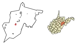 Location of Huttonsville in Randolph County, West Virginia. | |
| Coordinates: 38°42′48″N 79°58′38″W | |
| Country | United States |
| State | West Virginia |
| County | Randolph |
| Area | |
| • Total | 0.30 sq mi (0.78 km2) |
| • Land | 0.30 sq mi (0.78 km2) |
| • Water | 0.00 sq mi (0.00 km2) |
| Elevation | 2,037 ft (621 m) |
| Population | |
| • Total | 221 |
| • Estimate (2019)[3] | 210 |
| • Density | 693.07/sq mi (267.58/km2) |
| Time zone | UTC-5 (Eastern (EST)) |
| • Summer (DST) | UTC-4 (EDT) |
| ZIP code | 26273 |
| Area code(s) | 304 |
| FIPS code | 54-39628[4] |
| GNIS feature ID | 1551537[5] |
History
Huttonsville was named for Jonathan Hutton, a pioneer settler.[6][7]
Located at Huttonsville are the E. E. Hutton House and Tygarts Valley Church, listed on the National Register of Historic Places.[8] Located near Huttonsville are the site of Cheat Summit Fort and Fort Marrow, also listed on the Register.[8]
Geography
Huttonsville is located at 38°42′48″N 79°58′38″W (38.713266, -79.977329).[9]
According to the United States Census Bureau, the town has a total area of 0.30 square miles (0.78 km2), all of it land.[10]
Climate
The climate in this area has mild differences between highs and lows, and there is adequate rainfall year-round. According to the Köppen Climate Classification system, Huttonsville has a marine west coast climate, abbreviated "Cfb" on climate maps.[11]
Demographics
| Historical population | |||
|---|---|---|---|
| Census | Pop. | %± | |
| 1910 | 251 | — | |
| 1920 | 265 | 5.6% | |
| 1930 | 303 | 14.3% | |
| 1940 | 308 | 1.7% | |
| 1950 | 227 | −26.3% | |
| 1960 | 242 | 6.6% | |
| 1970 | 167 | −31.0% | |
| 1980 | 242 | 44.9% | |
| 1990 | 211 | −12.8% | |
| 2000 | 217 | 2.8% | |
| 2010 | 221 | 1.8% | |
| 2019 (est.) | 210 | [3] | −5.0% |
| U.S. Decennial Census[12] | |||
2010 census
At the 2010 census there were 221 people, 87 households, and 56 families living in the town. The population density was 736.7 inhabitants per square mile (284.4/km2). There were 105 housing units at an average density of 350.0 per square mile (135.1/km2). The racial makeup of the town was 99.5% White and 0.5% from two or more races. Hispanic or Latino of any race were 2.3%.[2]
Of the 87 households 33.3% had children under the age of 18 living with them, 40.2% were married couples living together, 13.8% had a female householder with no husband present, 10.3% had a male householder with no wife present, and 35.6% were non-families. 31.0% of households were one person and 18.3% were one person aged 65 or older. The average household size was 2.54 and the average family size was 3.11.
The median age in the town was 32.4 years. 28.1% of residents were under the age of 18; 12.6% were between the ages of 18 and 24; 21.7% were from 25 to 44; 23% were from 45 to 64; and 14.5% were 65 or older. The gender makeup of the town was 48.0% male and 52.0% female.
2000 census
At the 2000 census there were 217 people, 83 households, and 62 families living in the town. The population density was 707.3 inhabitants per square mile (270.3/km2). There were 96 housing units at an average density of 312.9 per square mile (119.6/km2). The racial makeup of the town was 99.08% White and 0.92% Asian.[4] Of the 83 households 36.1% had children under the age of 18 living with them, 63.9% were married couples living together, 8.4% had a female householder with no husband present, and 24.1% were non-families. 22.9% of households were one person and 13.3% were one person aged 65 or older. The average household size was 2.61 and the average family size was 3.06.
The age distribution was 25.8% under the age of 18, 10.1% from 18 to 24, 30.9% from 25 to 44, 21.7% from 45 to 64, and 11.5% 65 or older. The median age was 35 years. For every 100 females, there were 88.7 males. For every 100 females age 18 and over, there were 91.7 males.
The median household income was $22,321 and the median family income was $24,821. Males had a median income of $24,107 versus $12,321 for females. The per capita income for the town was $11,827. About 14.5% of families and 16.6% of the population were below the poverty line, including 28.4% of those under the age of eighteen and 7.1% of those sixty five or over.
References
- "2019 U.S. Gazetteer Files". United States Census Bureau. Retrieved August 7, 2020.
- "U.S. Census website". United States Census Bureau. Retrieved 2013-01-24.
- "Population and Housing Unit Estimates". United States Census Bureau. May 24, 2020. Retrieved May 27, 2020.
- "U.S. Census website". United States Census Bureau. Retrieved 2008-01-31.
- "US Board on Geographic Names". United States Geological Survey. 2007-10-25. Retrieved 2008-01-31.
- Gannett, Henry (1905). The Origin of Certain Place Names in the United States. Govt. Print. Off. pp. 164.
- Kenny, Hamill (1945). West Virginia Place Names: Their Origin and Meaning, Including the Nomenclature of the Streams and Mountains. Piedmont, WV: The Place Name Press. p. 320.
- "National Register Information System". National Register of Historic Places. National Park Service. July 9, 2010.
- "US Gazetteer files: 2010, 2000, and 1990". United States Census Bureau. 2011-02-12. Retrieved 2011-04-23.
- "US Gazetteer files 2010". United States Census Bureau. Archived from the original on 2012-01-25. Retrieved 2013-01-24.
- Climate Summary for Huttonsville, West Virginia
- "Census of Population and Housing". Census.gov. Retrieved June 4, 2015.
External links
Municipalities and communities of Randolph County, West Virginia, United States | ||
|---|---|---|
| City | 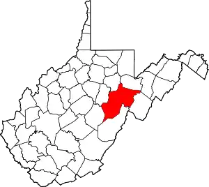 Map of West Virginia highlighting Randolph County | |
| Towns | ||
| CDPs | ||
| Unincorporated communities |
| |
| Ghost towns | ||
| Footnotes | ‡This populated place also has portions in an adjacent county or counties | |
| ||