Kimball, West Virginia
Kimball is a town in McDowell County, West Virginia, United States. The population was 194 at the 2010 census.
Kimball, West Virginia | |
|---|---|
 Kimball in 2014 | |
 Location of Kimball in McDowell County, West Virginia. | |
| Coordinates: 37°25′39″N 81°30′24″W | |
| Country | United States |
| State | West Virginia |
| County | McDowell |
| Area | |
| • Total | 0.25 sq mi (0.66 km2) |
| • Land | 0.25 sq mi (0.66 km2) |
| • Water | 0.00 sq mi (0.00 km2) |
| Elevation | 1,509 ft (460 m) |
| Population | |
| • Total | 194 |
| • Estimate (2019)[3] | 153 |
| • Density | 604.74/sq mi (233.47/km2) |
| Time zone | UTC-5 (Eastern (EST)) |
| • Summer (DST) | UTC-4 (EDT) |
| ZIP code | 24853 |
| Area code(s) | 304 |
| FIPS code | 54-43780[4] |
| GNIS feature ID | 1541195[5] |
Kimball was incorporated in 1911 and named for Frederick J. Kimball, a railroad official.[6] Kimball is the site of the first war memorial building erected in memory of the African-American veterans of World War I.[7]
History
The Kimball mining disaster happened on July 18, 1919, at the Carswell coal mine in Kimball, killing six miners.[8] Initial reports said that 221 men had been killed, but they were trapped by the explosion. A rescue party was able to dig through the wreckage allowing 215 to return alive to the surface.[9]
Geography
According to the United States Census Bureau, the town has a total area of 0.25 square miles (0.65 km2), all of it land.[10]
The town is on the Norfolk Southern Railway(former Norfolk and Western) network.
Economics
From 2005 when it opened until its closure in 2016, a Walmart superstore was the largest employer in the town.[11]
Kimball is home to the Five Loaves and Two Fishes foodbank, which features a hydropanel water production system which can produce 950 gallons of clean drinking water monthly.[12][13][14]
Media
The town is served by the thrice-weekly The Welch News out of the nearby county seat, Welch, West Virginia.[11]
Demographics
| Historical population | |||
|---|---|---|---|
| Census | Pop. | %± | |
| 1910 | 1,630 | — | |
| 1920 | 1,428 | −12.4% | |
| 1930 | 1,467 | 2.7% | |
| 1940 | 1,580 | 7.7% | |
| 1950 | 1,359 | −14.0% | |
| 1960 | 1,175 | −13.5% | |
| 1970 | 962 | −18.1% | |
| 1980 | 871 | −9.5% | |
| 1990 | 550 | −36.9% | |
| 2000 | 411 | −25.3% | |
| 2010 | 194 | −52.8% | |
| 2019 (est.) | 153 | [3] | −21.1% |
| U.S. Decennial Census[15] | |||
2010 census
As of the census[2] of 2010, there were 194 people, 78 households, and 52 families living in the town. The population density was 776.0 inhabitants per square mile (299.6/km2). There were 133 housing units at an average density of 532.0 per square mile (205.4/km2). The racial makeup of the town was 37.6% White, 57.2% African American, and 5.2% from two or more races.
There were 78 households, of which 33.3% had children under the age of 18 living with them, 32.1% were married couples living together, 26.9% had a female householder with no husband present, 7.7% had a male householder with no wife present, and 33.3% were non-families. 29.5% of all households were made up of individuals, and 12.8% had someone living alone who was 65 years of age or older. The average household size was 2.49 and the average family size was 3.08.
The median age in the town was 43 years. 23.7% of residents were under the age of 18; 10.3% were between the ages of 18 and 24; 18.6% were from 25 to 44; 28.9% were from 45 to 64; and 18.6% were 65 years of age or older. The gender makeup of the town was 45.4% male and 54.6% female.
2000 census
At the 2000 census,[4] there were 411 people, 166 households and 107 families living in the town. The population density was 1,578.6 inhabitants per square mile (609.5/km2). There were 233 housing units at an average density of 894.9 per square mile (345.5/km2). The racial makeup of the town was 34.06% White, 63.26% African American, 0.24% Pacific Islander, and 2.43% from two or more races.
There were 166 households, of which 22.3% had children under the age of 18 living with them, 33.1% were married couples living together, 27.1% had a female householder with no husband present, and 35.5% were non-families. 33.7% of all households were made up of individuals, and 20.5% had someone living alone who was 65 years of age or older. The average household size was 2.48 and the average family size was 3.12.
24.1% of the population were under the age of 18, 10.7% from 18 to 24, 18.2% from 25 to 44, 23.4% from 45 to 64, and 23.6% who were 65 years of age or older. The median age was 42 years. For every 100 females, there were 72.7 males. For every 100 females age 18 and over, there were 62.5 males.
The median household income was $17,333, and the median family income was $21,429. Males had a median income of $23,750 versus $21,250 for females. The per capita income for the town was $10,269. About 23.6% of families and 33.2% of the population were below the poverty line, including 48.1% of those under age 18 and 14.4% of those age 65 or over.
Notable people
- Tracy Gravely - former Canadian Football League linebacker
- Barney Brown - Negro league pitcher 1931-1949
- Jean Battlo - West Virginia playwright, born and raised in Kimball
References
- "2019 U.S. Gazetteer Files". United States Census Bureau. Retrieved August 7, 2020.
- "U.S. Census website". United States Census Bureau. Retrieved 2013-01-24.
- "Population and Housing Unit Estimates". United States Census Bureau. May 24, 2020. Retrieved May 27, 2020.
- "U.S. Census website". United States Census Bureau. Retrieved 2008-01-31.
- "US Board on Geographic Names". United States Geological Survey. 2007-10-25. Retrieved 2008-01-31.
- Kenny, Hamill (1945). West Virginia Place Names: Their Origin and Meaning, Including the Nomenclature of the Streams and Mountains. Piedmont, WV: The Place Name Press. pp. 350–351.
- West Virginia Blue Book. Published annually by the Clerk's Office of the West Virginia Senate.
- Greenberg, Michael I. (2006). Encyclopedia of Terrorist, Natural, and Man-made Disasters. Jones & Bartlett Learning. p. 192. ISBN 9780763737825.
- The Oklahoma City Times (July 18, 1919). "Rescuers Search For bodies of 14 men in Wreckage". The Oklahoma City Times. Oklahoma City. p. 1. ISSN 2333-0201. OCLC 13764083. Retrieved July 18, 2019.
- "US Gazetteer files 2010". United States Census Bureau. Archived from the original on 2012-07-02. Retrieved 2013-01-24.
- https://www.theguardian.com/us-news/2017/jul/09/what-happened-when-walmart-left?subid=2465317&CMP=EMCNEWEML6619I2
- Boothe, Charles (November 16, 2019). "Clean water for McDowell: Kimball food bank installs new SOURCE production system". Bluefield Daily Telegraph. Retrieved 2020-01-19.
- "Manchin Secures Forklift for Five Loaves & Two Fishes Food Bank in Kimball". U.S. Senator Joe Manchin of West Virginia. December 29, 2017. Retrieved 2020-01-19.
- Coyne, Caity (April 7, 2018). "In McDowell County 'food desert,' concerns about the future". Charleston Gazette-Mail. Retrieved 2020-01-19.
- "Census of Population and Housing". Census.gov. Retrieved June 4, 2015.
External links
Municipalities and communities of McDowell County, West Virginia, United States | ||
|---|---|---|
| Cities | 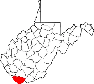 Map of West Virginia highlighting McDowell County | |
| Towns | ||
| CDPs | ||
| Unincorporated communities |
| |
| Ghost town | ||
| Footnotes | ‡This populated place also has portions in an adjacent county or counties | |
| ||