Winfield, West Virginia
Winfield is a town in Putnam County, West Virginia, United States. The population was 2,301 at the 2010 census.[6] It is the county seat of Putnam County.[7]
Winfield, West Virginia | |
|---|---|
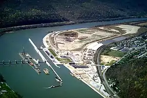
.jpg.webp) Sunrise over the Kanawha River in Winfield | |
 Location of Winfield in Putnam County, West Virginia. | |
| Coordinates: 38°32′4″N 81°53′32″W | |
| Country | United States |
| State | West Virginia |
| County | Putnam |
| Government | |
| • Type | Local Government |
| • Mayor | Randy L. Barrett |
| Area | |
| • Total | 2.43 sq mi (6.29 km2) |
| • Land | 2.41 sq mi (6.24 km2) |
| • Water | 0.02 sq mi (0.05 km2) |
| Elevation | 600 ft (183 m) |
| Population | |
| • Total | 2,301 |
| • Estimate (2019)[3] | 2,352 |
| • Density | 976.74/sq mi (377.15/km2) |
| Time zone | UTC-5 (Eastern (EST)) |
| • Summer (DST) | UTC-4 (EDT) |
| ZIP code | 25213 |
| Area code(s) | 304 |
| FIPS code | 54-87988[4] |
| GNIS feature ID | 1556008[5] |
| Website | www |
Winfield is a part of the Huntington-Ashland, WV-KY-OH, Metropolitan Statistical Area (MSA). As of the 2010 census, the MSA had a population of 287,702. New definitions from February 28, 2013 placed the population at 363,000.[8]
History
Winfield was established on a 400-acre (160 ha) tract of land owned by Charles Brown. He established a ferry across the river in 1818. The first meeting of the county court was held at the home of Talleyrand P. Brown, in Winfield, on May 22, 1848. The town was incorporated on February 21, 1868, and named in honor of Winfield Scott,[9] the commanding general of the U.S. Army during the Mexican–American War.
The James W. Hoge House, Putnam County Courthouse, and Winfield Toll Bridge are listed on the National Register of Historic Places in 2011.[10][11]
Geography
Winfield is located at 38°32′4″N 81°53′32″W (38.534455, -81.892206).[12]
According to the United States Census Bureau, the town has a total area of 2.43 square miles (6.29 km2), of which, 2.41 square miles (6.24 km2) is land and 0.02 square miles (0.05 km2) is water.[13]
Demographics
| Historical population | |||
|---|---|---|---|
| Census | Pop. | %± | |
| 1880 | 305 | — | |
| 1890 | 302 | −1.0% | |
| 1900 | 338 | 11.9% | |
| 1910 | 291 | −13.9% | |
| 1920 | 253 | −13.1% | |
| 1930 | 294 | 16.2% | |
| 1940 | 318 | 8.2% | |
| 1950 | 346 | 8.8% | |
| 1960 | 318 | −8.1% | |
| 1970 | 328 | 3.1% | |
| 1980 | 329 | 0.3% | |
| 1990 | 1,164 | 253.8% | |
| 2000 | 1,858 | 59.6% | |
| 2010 | 2,301 | 23.8% | |
| 2019 (est.) | 2,352 | [3] | 2.2% |
| U.S. Decennial Census[14] | |||
2010 census
As of the census[2] of 2010, there were 2,301 people, 920 households, and 660 families living in the town. The population density was 954.8 inhabitants per square mile (368.7/km2). There were 967 housing units at an average density of 401.2 per square mile (154.9/km2). The racial makeup of the town was 95.2% White, 1.2% African American, 0.3% Native American, 0.7% Asian, 0.7% from other races, and 1.8% from two or more races. Hispanic or Latino of any race were 1.1% of the population.
There were 920 households, of which 35.8% had children under the age of 18 living with them, 56.0% were married couples living together, 10.9% had a female householder with no husband present, 4.9% had a male householder with no wife present, and 28.3% were non-families. 24.1% of all households were made up of individuals, and 8.8% had someone living alone who was 65 years of age or older. The average household size was 2.50 and the average family size was 2.96.
The median age in the town was 40.2 years. 26% of residents were under the age of 18; 6.5% were between the ages of 18 and 24; 25.2% were from 25 to 44; 31% were from 45 to 64; and 11.3% were 65 years of age or older. The gender makeup of the town was 48.2% male and 51.8% female.
2000 census
As of the census[4] of 2000, there were 1,858 people, 736 households, and 563 families living in the town. The population density was 694.6 inhabitants per square mile (268.7/km2). There were 777 housing units at an average density of 290.5 per square mile (112.4/km2). The racial makeup of the town was 99.19% White, 0.22% African American, 0.27% Native American, 0.22% Asian, and 0.11% from two or more races. Hispanic or Latino of any race were 0.43% of the population.
There were 736 households, out of which 39.0% had children under the age of 18 living with them, 65.1% were married couples living together, 9.5% had a female householder with no husband present, and 23.5% were non-families. 20.8% of all households were made up of individuals, and 7.3% had someone living alone who was 65 years of age or older. The average household size was 2.52 and the average family size was 2.92.
In the town, the population was spread out, with 25.8% under the age of 18, 6.0% from 18 to 24, 32.2% from 25 to 44, 25.9% from 45 to 64, and 10.1% who were 65 years of age or older. The median age was 38 years. For every 100 females, there were 90.2 males. For every 100 females age 18 and over, there were 86.7 males.
The median income for a household in the town was $51,023, and the median income for a family was $59,196. Males had a median income of $43,885 versus $29,667 for females. The per capita income for the town was $23,564. About 4.5% of families and 4.9% of the population were below the poverty line, including 1.9% of those under age 18 and 5.2% of those age 65 or over.
Notable residents
- Jim Lett - Former Major League Baseball Player
- Michael Barber - Former NFL Player. College Football Hall of Famer
Education
Putnam County Schools serves the city. Winfield High School and Winfield Middle School are both located along Winfield Road and feature a General as their mascot. Winfield Elementary School is located just off of Winfield Road, on Wall Street.
References
- "2019 U.S. Gazetteer Files". United States Census Bureau. Retrieved August 7, 2020.
- "U.S. Census website". United States Census Bureau. Retrieved 2013-01-24.
- "Population and Housing Unit Estimates". United States Census Bureau. May 24, 2020. Retrieved May 27, 2020.
- "U.S. Census website". United States Census Bureau. Retrieved 2008-01-31.
- "US Board on Geographic Names". United States Geological Survey. 2007-10-25. Retrieved 2008-01-31.
- "Profile of General Population and Housing Characteristics: 2010 Demographic Profile Data (DP-1): Winfield town, West Virginia". United States Census Bureau. Retrieved November 28, 2011.
- "Find a County". National Association of Counties. Retrieved 2011-06-07.
- "Population statistics" (PDF).
- Kenny, Hamill (1945). West Virginia Place Names: Their Origin and Meaning, Including the Nomenclature of the Streams and Mountains. Piedmont, WV: The Place Name Press. p. 685.
- "National Register Information System". National Register of Historic Places. National Park Service. July 9, 2010.
- "National Register of Historic Places Listings". Weekly List of Actions Taken on Properties: 12/12/11 through 12/16/11. National Park Service. 2011-12-23.
- "US Gazetteer files: 2010, 2000, and 1990". United States Census Bureau. 2011-02-12. Retrieved 2011-04-23.
- "US Gazetteer files 2010". United States Census Bureau. Retrieved 2013-01-24.
- "Census of Population and Housing". Census.gov. Retrieved June 4, 2015.
External links
Municipalities and communities of Putnam County, West Virginia, United States | ||
|---|---|---|
| Cities | 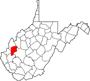 Putnam County map | |
| Towns | ||
| CDPs | ||
| Other localities |
| |
| Footnotes | ‡This populated place also has portions in an adjacent county or counties | |
| ||
| Principal cities | 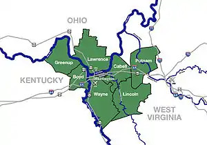 | |
|---|---|---|
| Municipalities with population over 5,000 | ||
| Municipalities with population 1,000–5,000 | ||
| Municipalities with population under 1,000 | ||
| West Virginia counties | ||
| Kentucky counties | ||
| Ohio counties | ||