Jebel Shams
Jebel Shams (Arabic: جَبَل شَمْس, romanized: Mountain of Sun) is a mountain located in northeastern Oman north of Al Hamra town. It is the highest mountain of the Hajar range and the country.[3] The mountain is a popular sightseeing area located 240 km (150 mi) from Muscat. In the summer, temperature is around 20 °C (68 °F) and in the winter it drops to less than 0 °C (32 °F). Nearby is Jabal Akhdar, another prominent peak in the region.
| Jabal Shams | |
|---|---|
 | |
| Highest point | |
| Elevation | 2,997 to 3,009 m (9,833 to 9,872 ft) |
| Prominence | 2,818 m (9,245 ft) [1] Ranked 110th |
| Isolation | 523 km (325 mi) |
| Listing | Country high point Ultra |
| Coordinates | 23°14′13″N 57°15′50″E |
| Naming | |
| Native name | جَبَل شَمْس (Arabic) |
| English translation | Mountain of Sun |
| Geography | |
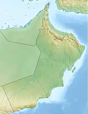 Jabal Shams Location of Jabal Shams in Oman | |
| Location | Oman |
| Parent range | Al Hajar Mountains |
| Climbing | |
| Easiest route | (to South Summit) W4 route published by Ministry or Tourism, Oman (Grade 2 / 3)[2] |
Summits
The highest point of the mountain is the North Summit, which is occupied by a military base and is a restricted area. The Ministry of Tourism, Sultanate of Oman, states the North Summit to be 3,009 m (9,872 ft)) high.[3]
The mountain also has second summit, the South Summit, which is publicly accessible for trekking via the W4 Trail,[4] marked by the Oman Ministry of Tourism.[2] The elevation of the second south summit is 2,997 m (9,833 ft).[4]
Gallery
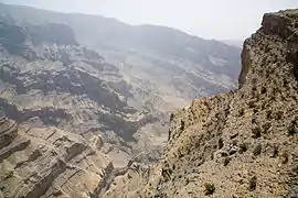
 A view from the top
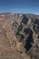
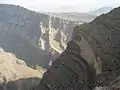
References
- "Jabal ash Sham, Oman". Peakbagger.com. This prominence value is based on an elevation of 3,018 m.
- Trekking Route 3
- "Mountains in Oman". Ministry of Tourism, Sultanate of Oman.
- "Trekking". website. Ministry of Tourism, Sultanate of Oman.
External links
- Travel Blog on Jebel Shams
- http://www.enhg.org/field/jshams04/jshams04.htm
- Flickr Images
- https://www.webcitation.org/query?url=http://www.geocities.com/evertinoman/shams.htm&date=2009-10-25+21:57:14
| Wikimedia Commons has media related to Jebel Shams. |
Hills and mountains on the Arabian Peninsula | ||
|---|---|---|
.jpg.webp)
 | ||
Note: Mountains are sorted in alphabetical order, unless where it concerns ranges. The highest confirmed mountains in each country are indicated with 'HP', and those with the highest peak are indicated with 'HP', bearing in mind that in the UAE, the highest mountain and the mountain with the highest peak are different. Outcrops are indicated with 'OC', and outliers with 'OL', and anticlines with 'AC'. Volcanoes are indicated with 'V', volcanic craters with 'VC', lava fields with 'LF', and volcanic fields with 'VF'.
Other notes:
| ||

