Jiménez (canton)
Jiménez is a canton in the Cartago province of Costa Rica.[2][3] The head city is in Juan Viñas district.
Jiménez | |
|---|---|
 Seal | |
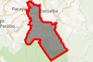
Jiménez canton | |
 Jiménez Jiménez canton location in Costa Rica | |
| Coordinates: 9.819549°N 83.6993734°W | |
| Country | |
| Province | Cartago |
| Creation | 19 August 1903[1] |
| Head city | Juan Viñas |
| Districts | Districts
|
| Government | |
| • Type | Municipality |
| • Body | Municipalidad de Jiménez |
| Area | |
| • Total | 286.43 km2 (110.59 sq mi) |
| Elevation | 862 m (2,828 ft) |
| Population (2011) | |
| • Total | 14,669 |
| • Density | 51/km2 (130/sq mi) |
| Time zone | UTC−06:00 |
| Canton code | 304 |
| Website | munijimenez |
History
Jiménez was created on 19 August 1903 by decree 84.[1]
Geography
Jiménez has an area of 286.43 km²[4] and a mean elevation of 862 metres.[2]
The Turrialba River forms the northern boundary of the canton of Jiménez, with the Reventazón River and Atirro River establishing the eastern border and the Pejibaye River delineating a major portion of the canton's border on the west.
Districts
The canton of Jiménez is subdivided into the following districts:
Demographics
| Historical population | |||
|---|---|---|---|
| Census | Pop. | %± | |
| 1927 | 5,892 | — | |
| 1950 | 7,731 | 31.2% | |
| 1963 | 10,439 | 35.0% | |
| 1973 | 11,523 | 10.4% | |
| 1984 | 11,861 | 2.9% | |
| 2000 | 14,046 | 18.4% | |
| 2011 | 14,669 | 4.4% | |
|
Instituto Nacional de Estadística y Censos[5] |
|||
For the 2011 census, Jiménez had a population of 14,669 inhabitants. [7]
Transportation
Road transportation
The canton is covered by the following road routes:
Economy
Its main economic activity is the sugar cane plantations operated by the Ingenio Juan Viñas, which factory produces more than 20,000 tons of sugar annually.[8]
References
- Hernández, Hermógenes (1985). Costa Rica: evolución territorial y principales censos de población 1502 - 1984 (in Spanish) (1 ed.). San José: Editorial Universidad Estatal a Distancia. pp. 164–173. ISBN 9977-64-243-5. Retrieved 5 October 2020.
- "Declara oficial para efectos administrativos, la aprobación de la División Territorial Administrativa de la República N°41548-MGP". Sistema Costarricense de Información Jurídica (in Spanish). 19 March 2019. Retrieved 26 September 2020.
- División Territorial Administrativa de la República de Costa Rica (PDF) (in Spanish). Editorial Digital de la Imprenta Nacional. 8 March 2017. ISBN 978-9977-58-477-5.
- "Área en kilómetros cuadrados, según provincia, cantón y distrito administrativo". Instituto Nacional de Estadística y Censos (in Spanish). Retrieved 26 September 2020.
- "Instituto Nacional de Estadística y Censos" (in Spanish).
- "Sistema de Consulta de a Bases de Datos Estadísticas". Centro Centroamericano de Población (in Spanish).
- "Censo. 2011. Población total por zona y sexo, según provincia, cantón y distrito". Instituto Nacional de Estadística y Censos (in Spanish). Retrieved 26 September 2020.
- https://www.juanvinas.com/ingenio.html