Kars Parish, New Brunswick
Kars is a civil parish in Kings County, New Brunswick, Canada.[2]
Kars | |
|---|---|
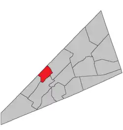 Location within Kings County, New Brunswick. | |
| Coordinates: 45.84°N 64.59°W | |
| Country | |
| Province | |
| County | Kings County |
| Erected | 1860 |
| Area | |
| • Land | 75.84 km2 (29.28 sq mi) |
| Population (2016)[1] | |
| • Total | 325 |
| • Density | 4.3/km2 (11/sq mi) |
| • Change 2011-2016 | |
| • Dwellings | 352 |
| Time zone | UTC-4 (AST) |
| • Summer (DST) | UTC-3 (ADT) |
For governance purposes it forms the local service district of the parish of Kars,[3] which is a member of Regional Service Commission 8 (RSC8).[4]
Origin of name
The parish was named for the Siege of Kars, last major operation of the Crimean War.[5]
History
Kars was erected in 1860 from Greenwich and Springfield Parishes.[6]
In 1877 the islands in Belleisle Bay were added to Kars.[7]
Delineation
Kars Parish is defined in the Territorial Division Act[2] as being bounded:
- West by the Saint John River; east by the eastern side lines of lots number ten, granted to Richard B. Squires, number one, granted to William McDonald, and number seven, granted to James Peters; and south by Belleisle Bay, including the islands at the mouth of Belleisle Bay.
Governance
The entire parish forms the local service district of the parish of Kars, established in 1968 to assess for fire protection. Recreational facilities were added in 2001 and non-fire related rescue in 2012. First aid and ambulance services (1972—2001) and community services (1986—2001) were formerly included.
Communities
Parish population total does not include incorporated municipalities (in bold):
|
|
Bodies of water & Islands
This is a list of rivers, lakes, streams, creeks, marshes and Islands that are at least partially in this parish
- Hog Island
Other Islands: Pig Island, Ghost Island
Main Water Sources: Belleisle Bay, Saint John River
Coves: Tennants Cove, Jenkins Cove, Urquharts Cove, Earle Cove
Demographics
Access Routes
Highways and numbered routes that run through the parish, including external routes that start or finish at the parish limits:[10]
See also
References
- "Census Profile, 2016 Census Kars, Parish [Census subdivision], New Brunswick". Statistics Canada. Retrieved September 20, 2019.
- "Chapter T-3 Territorial Division Act". Government of New Brunswick. Retrieved 13 November 2020.
- "New Brunswick Regulation 84-168 under the Municipalities Act (O.C. 84-582)". Government of New Brunswick. Retrieved 19 July 2020.
- "Communities in each of the 12 Regional Service Commissions (RSC) / Les communautés dans chacune des 12 Commissions de services régionaux (CSR)" (PDF), Government of New Brunswick, July 2017, retrieved 2 February 2021
- Ganong, William F. (1896). A Monograph of the Place-Nomenclature of the Province of New Brunswick. Royal Society of Canada. p. 242.
- "22 Vic. c. 51 An Act to erect parts of the Parishes of Greenwich and Springfield, in King's County, into a separate Town or Parish.". Acts of the General Assembly of Her Majesty's Province of New Brunswick, Passed in March and April 1859. Fredericton: Government of New Brunswick. 1859. pp. 129–130.
- "Chapter 2 The Division of the Province into Counties, Towns, and Parishes.". The Consolidated Statutes of New Brunswick. Fredericton: Government of New Brunswick. 1877. pp. 56–85.
- Statistics Canada: 2001, 2006 census
- 2011 Statistics Canada Census Profile: Kars Parish, New Brunswick
- Atlantic Canada Back Road Atlas ISBN 978-1-55368-618-7
Places adjacent to Kars Parish, New Brunswick | |
|---|---|
| Subdivisions | |
|---|---|
| Cities | |
| Counties | |
| |