Hampstead Parish, New Brunswick
Hampstead is a civil parish in Queens County, New Brunswick, Canada.[2]
Hampstead | |
|---|---|
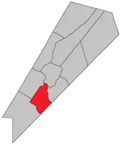 Location within Queens County, New Brunswick. | |
| Coordinates: 45.84°N 64.59°W | |
| Country | |
| Province | |
| County | Queens County |
| Erected | 1786 |
| Area | |
| • Land | 212.56 km2 (82.07 sq mi) |
| Population (2016)[1] | |
| • Total | 277 |
| • Density | 1.3/km2 (3/sq mi) |
| • Pop 2011-2016 | |
| • Dwellings | 185 |
| Time zone | UTC-4 (AST) |
| • Summer (DST) | UTC-3 (ADT) |
For governance purposes it is divided between CFB Gagetown and the local service district of Hampstead,[3] which is a member of Regional Service Commission 11 (RSC11).[4] The Saint John River islands are not part of the local service district.
Origin of name
The parish was probably named for Hempstead, New York,[5] source of some of the Loyalist settlers of the parish.
History
Hampstead was erected in 1786 as one of the county's original parishes.[6]
In 1838 the rear of the parish was included in the newly erected Petersville Parish.[7]
In 1895 the eastern half of Long Island was transferred to Wickham Parish.[8]
New Brunswick's last surviving African Canadian community, Elm Hill, was established here in 1806.
Delineation
Hampstead Parish is defined in the Territorial Division Act[2] as being bounded:
- Northwest by Gagetown Parish; southwest by Petersville Parish; southeast by the County line and by the Saint John River, including Upper Musquash Island and Spoon Island and the western half of Long Island to be determined by a line running lengthwise through the centre of the island from the head to the foot of the same.
Communities
Parish population total does not include incorporated municipalities (in bold):
Bodies of water & Islands
This is a list of rivers, lakes, streams, creeks, marshes and Islands that are at least partially in this parish
- Saint John River
Demographics
Population
|
LanguageMother tongue language (2016)[1]
|
Access Routes
Highways and numbered routes that run through the parish, including external routes that start or finish at the parish limits:[11]
|
|
|
|
See also
References
- "Census Profile, 2016 Census: Hampstead, Parish [Census subdivision], New Brunswick". Statistics Canada. Retrieved August 27, 2019.
- "Chapter T-3 Territorial Division Act". Government of New Brunswick. Retrieved 13 November 2020.
- "New Brunswick Regulation 84-168 under the Municipalities Act (O.C. 84-582)". Government of New Brunswick. Retrieved 19 July 2020.
- "Communities in each of the 12 Regional Service Commissions (RSC) / Les communautés dans chacune des 12 Commissions de services régionaux (CSR)" (PDF), Government of New Brunswick, July 2017, retrieved 2 February 2021
- Ganong, William F. (1896). A Monograph of the Place-Nomenclature of the Province of New Brunswick. Royal Society of Canada. p. 239.
- "26 Geo. III Chapter I. An Act for the better ascertaining and confirming the Boundaries of the several Counties within this Province, and for subdividing them into Towns or Parishes.". Acts of the General Assembly of His Majesty's Province of New-Brunswick, passed in the year 1786. Saint John, New Brunswick: Government of New Brunswick. 1786. pp. 3–12.
- "1 Vic. c. 35 An Act to erect a part of the Parishes of Gagetown and Hampstead, in Queen's County, into a separate and distinct Town or Parish.". Acts of the General Assembly of Her Majesty's Province of New Brunswick, Passed in the Year 1838. Fredericton: Government of New Brunswick. 1838. p. 78.
- "57 Vic. c. 35 An Act to change the boundaries of the Parishes of Wickham and Hampstead, in the County of Queen's.". Acts of the General Assembly of Her Majesty's Province of New Brunswick. Passed in the Month of April, 1894. Fredericton: Government of New Brunswick. 1894. pp. 160–161.
- Statistics Canada: 2001, 2006 census
- 2011 Statistics Canada Census Profile: Hampstead Parish, New Brunswick
- Atlantic Canada Back Road Atlas ISBN 978-1-55368-618-7
Places adjacent to Hampstead Parish, New Brunswick | |
|---|---|
| Subdivisions | |
|---|---|
| Cities | |
| Counties | |
| |