Springfield Parish, New Brunswick
Springfield is a civil parish in Kings County, New Brunswick, Canada.[2]
Springfield | |
|---|---|
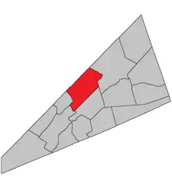 Location within Kings County, New Brunswick. | |
| Coordinates: 45.84°N 64.59°W | |
| Country | |
| Province | |
| County | Kings County |
| Erected | 1786 |
| Area | |
| • Land | 248.54 km2 (95.96 sq mi) |
| Population (2016)[1] | |
| • Total | 1,525 |
| • Density | 6.1/km2 (16/sq mi) |
| • Pop 2011-2016 | |
| • Dwellings | 885 |
| Time zone | UTC-4 (AST) |
| • Summer (DST) | UTC-3 (ADT) |
For governance purposes it is divided between the village of Norton[3] and the local service district of the parish of Norton,[4] both of which are members of Regional Service Commission 8 (RSC8).[5]
Origin of name
The name was common[6] in the Thirteen Colonies, now famously found at least once in every state of the United States.
History
Springfield was erected in 1786 as one of the original parishes of the county.[7]
In 1795 the boundaries were altered as part of the reorganisation of Kings County parishes.[8]
In 1860 part of the parish was included in the newly erected Kars Parish.[9]
In 1880 the boundary with Studholm was altered.[10]
In 1896 the southern boundary was altered.[11]
In 1899 the boundary was again altered.[12]
Delineation
Springfield Parish is defined in the Territorial Division Act[2] as being bounded:
- North by the County line and Kars Parish; west by Kars Parish and the line dividing lots number one and number eighteen, south of Belleisle Bay, and a part of the line dividing lots number fifteen and number sixteen, in the back settlement; south by a line running north sixty degrees east or parallel to the southern base line of the Belleisle Grant, and distant sixty-five chains therefrom, and extending to its intersection with a line running north from the mouth of Halfway Brook and east by a direct line from said intersection to the southeast angle of lot number eleven, granted to Henry A. Scovil in range two of Pascobac Brook lots, thence northeasterly, or in a direct line to the northeast angle of lot letter F, granted to Samuel Foster; thence northeasterly and northerly along the southeastern and eastern line of lot letter V, granted to William S. F. Wilson, to the northeastern angle thereof; thence northeasterly along the southeastern lines of the grant to John Coy and John Good, to a point intersected by the southeastern prolongation of the northeastern line of lot number one, granted to Samuel Kierstead; thence along said prolongation and line and its northwestern prolongation to Queens county line.
Communities
Parish population total does not include incorporated municipalities (in bold):
|
|
|
Bodies of water & Islands
This is a list of rivers, lakes, streams, creeks, marshes and Islands that are at least partially in this parish
- None
Demographics
Access Routes
Highways and numbered routes that run through the parish, including external routes that start or finish at the parish limits:[15]
See also
References
- "Census Profile, 2016 Census: Springfield, Parish [Census subdivision], New Brunswick". Statistics Canada. Retrieved August 28, 2019.
- "Chapter T-3 Territorial Division Act". Government of New Brunswick. Retrieved 13 November 2020.
- "New Brunswick Regulation 85-6 under the Municipalities Act (O.C. 85-45)". Government of New Brunswick. Retrieved 19 July 2020.
- "New Brunswick Regulation 84-168 under the Municipalities Act (O.C. 84-582)". Government of New Brunswick. Retrieved 19 July 2020.
- "Communities in each of the 12 Regional Service Commissions (RSC) / Les communautés dans chacune des 12 Commissions de services régionaux (CSR)" (PDF), Government of New Brunswick, July 2017, retrieved 2 February 2021
- Ganong, William F. (1896). A Monograph of the Place-Nomenclature of the Province of New Brunswick. Royal Society of Canada. p. 273.
- "26 Geo. III Chapter I. An Act for the better ascertaining and confirming the Boundaries of the several Counties within this Province, and for subdividing them into Towns or Parishes.". Acts of the General Assembly of His Majesty's Province of New-Brunswick, passed in the year 1786. Saint John, New Brunswick: Government of New Brunswick. 1786. pp. 3–12.
- "35 Geo. III c. 3 An Act in addition to an Act intitled, 'An Act for the better Ascertaining and Confirming the Boundaries of the several Counties within this Province, and for subdividing them into Towns or Parishes.'". Acts of the General Assembly of His Majesty's Province of New-Brunswick, Passed in the Year 1795. Fredericton: Government of New Brunswick. 1795. pp. 338–340.
- "22 Vic. c. 51 An Act to erect parts of the Parishes of Greenwich and Springfield, in King's County, into a separate Town or Parish.". Acts of the General Assembly of Her Majesty's Province of New Brunswick, Passed in March and April 1859. Fredericton: Government of New Brunswick. 1859. pp. 129–130.
- "43 Vic. c. 39 An Act to alter the Division Line between the Parishes of Springfield and Studholm, in King's County.". Acts of the General Assembly of Her Majesty's Province of New Brunswick. Passed in the Months of March & April 1880. Fredericton: Government of New Brunswick. 1880. pp. 79–80.
- "59 Vic. c. 8 An Act to Revise and Codify an Act to Provide for the Division of the Province into Counties, Towns and Parishes.". Acts of the General Assembly of Her Majesty's Province of New Brunswick. Passed in the Month of March, 1896. Fredericton: Government of New Brunswick. 1896. pp. 86–123.
- "62 Vic. c. 33 An Act to amend an Act intituled 'An Act to revise and codify an Act to provide for the Division of the Province into Counties, Towns and Parishes,' and to better define the bounds of the Parish of Springfield and the Parish of Saint Croix.". Acts of the General Assembly of Her Majesty's Province of New Brunswick. Passed in the Months of March and April, 1899. Fredericton: Government of New Brunswick. 1899. pp. 163–164.
- Statistics Canada: 2001, 2006 census
- 2011 Statistics Canada Census Profile: Springfield Parish, New Brunswick
- Atlantic Canada Back Road Atlas ISBN 978-1-55368-618-7
Places adjacent to Springfield Parish, New Brunswick | ||||||||||
|---|---|---|---|---|---|---|---|---|---|---|
| ||||||||||
| Subdivisions | |
|---|---|
| Cities | |
| Counties | |
| |