Wickham Parish, New Brunswick
Wickham is a civil parish in Queens County, New Brunswick, Canada.[2]
Wickham | |
|---|---|
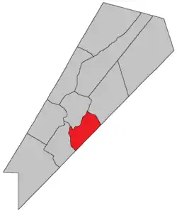 Location within Queens County, New Brunswick. | |
| Country | |
| Province | |
| ounty | Queens County |
| Erected | 1786 |
| Area | |
| • Land | 160.34 km2 (61.91 sq mi) |
| Population (2016)[1] | |
| • Total | 427 |
| • Density | 2.7/km2 (7/sq mi) |
| • Change 2011-2016 | |
| • Dwellings | 469 |
| Time zone | UTC-4 (AST) |
| • Summer (DST) | UTC-3 (ADT) |
For governance purposes it is divided between the village of Cambridge-Narrows and the local service district of the parish of Wickham,[3] both of which are members of Regional Service Commission 8 (RSC8).[4]
Origin of name
The source of the parish's name is not certain. William F. Ganong noted that the name was used in Hampshire, England and in Quebec.[5] The United States Geological Survey notes its use in Delaware, Georgia, Virginia, and West Virginia and the name was also used in several English counties at the time.
History
Wickham was erected in 1786 as one of the county's original parish.[6] The parish surrounded Washademoak Lake and extended past the county line.[7]
In 1839 the northeastern part of Wickham was erected as Johnston Parish.[8]
In 1852 part of Wickham was included in the newly erected Cambridge Parish.[9]
In 1895 the eastern half of Long Island was transferred from Hampstead Parish.[10]
Delineation
Wickham Parish is defined in the Territorial Division Act[2] as being bounded:
- Southeast by the County line; west by the Saint John River; northwest by Cambridge Parish; and northeast by the centre of the road[lower-alpha 1] leading from Washademoak Lake to Springfield, including the Lower Musquash and Hog Islands, and the eastern half of Long Island, to be determined by a line running lengthwise through the centre of the island, from the head to the foot of the same.
Communities
Parish population total does not include incorporated municipalities (in bold).
|
|
|
Bodies of water & Islands
This is a list of rivers, lakes, streams, creeks, marshes and Islands that are at least partially in this parish
- Hog Island
- Long Island
- Saint John River
- Hampstead Ferry
Demographics
Access Routes
Highways and numbered routes that run through the parish, including external routes that start or finish at the parish limits:[14]
See also
References
- "Census Profile, 2016 Census Wickham, Parish [Census subdivision], New Brunswick". Statistics Canada. Retrieved September 27, 2019.
- "Chapter T-3 Territorial Division Act". Government of New Brunswick. Retrieved 13 November 2020.
- "New Brunswick Regulation 84-168 under the Municipalities Act (O.C. 84-582)". Government of New Brunswick. Retrieved 19 July 2020.
- "Communities in each of the 12 Regional Service Commissions (RSC) / Les communautés dans chacune des 12 Commissions de services régionaux (CSR)" (PDF), Government of New Brunswick, July 2017, retrieved 2 February 2021
- Ganong, William F. (1896). A Monograph of the Place-Nomenclature of the Province of New Brunswick. Royal Society of Canada. p. 227.
- "26 Geo. III Chapter I. An Act for the better ascertaining and confirming the Boundaries of the several Counties within this Province, and for subdividing them into Towns or Parishes.". Acts of the General Assembly of His Majesty's Province of New-Brunswick, passed in the year 1786. Saint John, New Brunswick: Government of New Brunswick. 1786. pp. 3–12.
- Ganong, William F. (1901). A Monograph of the Evolution of the Boundaries of the Province of New Brunswick. Royal Society of Canada. p. Map No. 35.
- "2 Vic. c. 21 An Act to erect a part of the Parish of Wickham, in Queen's County into a separate and distinct Town or Parish.". Acts of the General Assembly of Her Majesty's Province of New Brunswick, Passed in the Year 1839. Fredericton: Government of New Brunswick. 1839. pp. 65–66.
- "15 Vic. c. 36 An Act for the erection of a new Parish in Queen's County.". Acts of the General Assembly of Her Majesty's Province of New Brunswick, Passed in the Year 1852. Fredericton: Government of New Brunswick. 1852. pp. 55–56.
- "57 Vic. c. 35 An Act to change the boundaries of the Parishes of Wickham and Hampstead, in the County of Queen's.". Acts of the General Assembly of Her Majesty's Province of New Brunswick. Passed in the Month of April, 1894. Fredericton: Government of New Brunswick. 1894. pp. 160–161.
- "No. 413" (PDF). 2015 Designated Highway Maps. Government of New Brunswick. Retrieved 30 August 2016.
- Statistics Canada: 2001, 2006 census
- 2011 Statistics Canada Census Profile: Wickham Parish, New Brunswick
- Atlantic Canada Back Road Atlas ISBN 978-1-55368-618-7
Places adjacent to Wickham Parish, New Brunswick | |
|---|---|
| Subdivisions | |
|---|---|
| Cities | |
| Counties | |
| |