L'Étrat
L'Étrat is a commune in the Loire department in central France.
L'Étrat | |
|---|---|
 Coat of arms | |
Location of L'Étrat 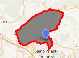
| |
 L'Étrat  L'Étrat | |
| Coordinates: 45°29′11″N 4°22′48″E | |
| Country | France |
| Region | Auvergne-Rhône-Alpes |
| Department | Loire |
| Arrondissement | Saint-Étienne |
| Canton | Sorbiers |
| Intercommunality | Saint-Étienne Métropole |
| Government | |
| • Mayor (2014–2020) | Yves Morand |
| Area 1 | 8.48 km2 (3.27 sq mi) |
| Population (2017-01-01)[1] | 2,531 |
| • Density | 300/km2 (770/sq mi) |
| Time zone | UTC+01:00 (CET) |
| • Summer (DST) | UTC+02:00 (CEST) |
| INSEE/Postal code | 42092 /42580 |
| Elevation | 430–686 m (1,411–2,251 ft) (avg. 453 m or 1,486 ft) |
| 1 French Land Register data, which excludes lakes, ponds, glaciers > 1 km2 (0.386 sq mi or 247 acres) and river estuaries. | |
Population
| Year | Pop. | ±% |
|---|---|---|
| 1886 | 1,008 | — |
| 1891 | 968 | −4.0% |
| 1901 | 1,079 | +11.5% |
| 1911 | 948 | −12.1% |
| 1921 | 991 | +4.5% |
| 1931 | 1,143 | +15.3% |
| 1946 | 1,279 | +11.9% |
| 1954 | 1,305 | +2.0% |
| 1962 | 1,322 | +1.3% |
| 1968 | 1,523 | +15.2% |
| 1975 | 2,147 | +41.0% |
| 1982 | 2,309 | +7.5% |
| 1990 | 2,524 | +9.3% |
| 1999 | 2,519 | −0.2% |
| 2005 | 2,640 | +4.8% |
| 2015 | 2,595 | −1.7% |
See also
References
- "Populations légales 2017". INSEE. Retrieved 6 January 2020.
| Wikimedia Commons has media related to L'Étrat. |
| Authority control |
|---|
This article is issued from Wikipedia. The text is licensed under Creative Commons - Attribution - Sharealike. Additional terms may apply for the media files.