La Sauvetat-de-Savères
La Sauvetat-de-Savères is a commune in the Lot-et-Garonne department in south-western France.
La Sauvetat-de-Savères | |
|---|---|
 The town hall in La Sauvetat-de-Savères | |
 Coat of arms | |
Location of La Sauvetat-de-Savères 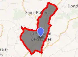
| |
 La Sauvetat-de-Savères  La Sauvetat-de-Savères | |
| Coordinates: 44°13′37″N 0°47′56″E | |
| Country | France |
| Region | Nouvelle-Aquitaine |
| Department | Lot-et-Garonne |
| Arrondissement | Agen |
| Canton | Le Pays de Serres |
| Intercommunality | Porte d'Aquitaine en Pays de Serres |
| Government | |
| • Mayor (2001–2008) | Jean-Jacques Lambrot |
| Area 1 | 6.86 km2 (2.65 sq mi) |
| Population (2017-01-01)[1] | 536 |
| • Density | 78/km2 (200/sq mi) |
| Time zone | UTC+01:00 (CET) |
| • Summer (DST) | UTC+02:00 (CEST) |
| INSEE/Postal code | 47289 /47270 |
| Elevation | 64–194 m (210–636 ft) (avg. 180 m or 590 ft) |
| 1 French Land Register data, which excludes lakes, ponds, glaciers > 1 km2 (0.386 sq mi or 247 acres) and river estuaries. | |
History
La Sauvetat-de-Savères was, in the 12th century, a bastide built up around a Benedictine priory. From the jurisdiction of Puymirol in the 13th century, La-Sauvetat-de-Savères became chief town of the bailiwick of the same name in the 14th. A garrison was placed there, in 1587, for keeping watch Puymirol. On August 16, 1589, Villars attacked four companies of Laugnac and Belzunce who had taken refuge there, and exerted reprisals on the city.[2]
References
- "Populations légales 2017". INSEE. Retrieved 6 January 2020.
- Cavaillé, J. (1900s). "La Sauvetat-de-Savères (Lot-et-Garonne) — La Grand'Rue". Laroque-Timbaut. Retrieved October 23, 2018.
| Wikimedia Commons has media related to La Sauvetat-de-Savères. |
| Authority control |
|---|
This article is issued from Wikipedia. The text is licensed under Creative Commons - Attribution - Sharealike. Additional terms may apply for the media files.