Lake Poinsett, South Dakota
Lake Poinsett is a census-designated place (CDP) in Hamlin and Brookings counties in South Dakota, United States. The population was 493 at the 2010 census.[3]
Lake Poinsett, South Dakota | |
|---|---|
 Lake Poinsett | |
| Coordinates: 44°33′56″N 97°4′55″W | |
| Country | United States |
| State | South Dakota |
| Counties | Hamlin, Brookings |
| Area | |
| • Total | 17.8 sq mi (46.0 km2) |
| • Land | 5.2 sq mi (13.5 km2) |
| • Water | 12.5 sq mi (32.5 km2) |
| Elevation | 1,649 ft (503 m) |
| Population (2010) | |
| • Total | 493 |
| • Density | 95/sq mi (36.5/km2) |
| Time zone | UTC-6 (Central (CST)) |
| • Summer (DST) | UTC-5 (CDT) |
| Area code(s) | 605 |
| FIPS code | 46-35480[1] |
| GNIS feature ID | 1257162[2] |
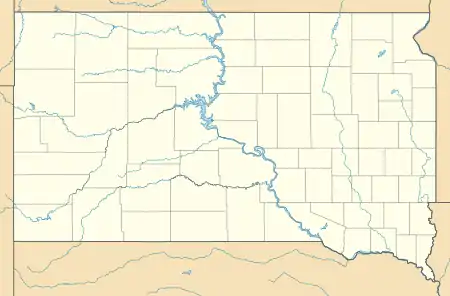
Geography
The Lake Poinsett CDP comprises the lake of the same name and its shoreside communities in Hamlin and Brookings counties. U.S. Route 81 passes through the CDP along the western shore of the lake and leads north 24 miles (39 km) to Watertown and south 13 miles (21 km) to Arlington.
According to the United States Census Bureau, the Lake Poinsett CDP has a total area of 17.8 square miles (46.0 km2), of which 5.2 square miles (13.5 km2) is land and 12.5 square miles (32.5 km2), or 70.67%, is water.[3]
References
- "U.S. Census website". United States Census Bureau. Retrieved 2008-01-31.
- "US Board on Geographic Names". United States Geological Survey. 2007-10-25. Retrieved 2008-01-31.
- "Geographic Identifiers: 2010 Demographic Profile Data (G001): Lake Poinsett CDP, South Dakota". U.S. Census Bureau, American Factfinder. Archived from the original on February 12, 2020. Retrieved April 7, 2014.
Municipalities and communities of Brookings County, South Dakota, United States | ||
|---|---|---|
| Cities | 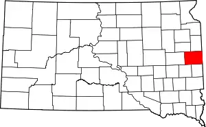 | |
| Towns | ||
| CDP | ||
| Other unincorporated communities | ||
| Townships |
| |
| Footnotes | ‡This populated place also has portions in an adjacent county or counties | |
| ||
Municipalities and communities of Hamlin County, South Dakota, United States | ||
|---|---|---|
| Cities | 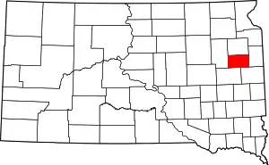 | |
| Towns | ||
| CDP | ||
| Unincorporated communities | ||
| Footnotes | ‡This populated place also has portions in an adjacent county or counties | |
| ||
This article is issued from Wikipedia. The text is licensed under Creative Commons - Attribution - Sharealike. Additional terms may apply for the media files.