Le Center, Minnesota
Le Center is a city in Le Sueur County, Minnesota, United States. The population was 2,499 at the 2010 census.[6] It is the county seat of Le Sueur County.[7] The Le Sueur County Courthouse and Jail are listed on the National Register of Historic Places.
Le Center, Minnesota | |
|---|---|
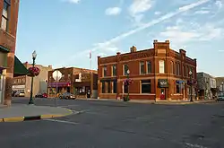 Downtown Le Center | |
| Nickname(s): Tree City USA | |
| Motto(s): "The Heart Of LeSueur County" | |
 | |
| Coordinates: 44°23′19″N 93°43′51″W | |
| Country | United States |
| State | Minnesota |
| County | Le Sueur |
| Government | |
| • Type | Mayor – Council |
| • Mayor | Josh Fredrickson |
| Area | |
| • Total | 1.68 sq mi (4.35 km2) |
| • Land | 1.68 sq mi (4.35 km2) |
| • Water | 0.00 sq mi (0.00 km2) |
| Elevation | 1,060 ft (323 m) |
| Population | |
| • Total | 2,499 |
| • Estimate (2019)[3] | 2,516 |
| • Density | 1,498.51/sq mi (578.59/km2) |
| Time zone | UTC-6 (Central (CST)) |
| • Summer (DST) | UTC-5 (CDT) |
| ZIP code | 56057 |
| Area code(s) | 507 |
| FIPS code | 27-36134[4] |
| GNIS feature ID | 0646552[5] |
| Website | cityoflecenter.com |
Geography
According to the United States Census Bureau, the city has a total area of 1.51 square miles (3.91 km2), all of it land.[8]
Le Center is located 26 miles from Mankato and 62 miles from Minneapolis.
Minnesota State Highways 99 and 112 are two of the main routes in the community.
Demographics
| Historical population | |||
|---|---|---|---|
| Census | Pop. | %± | |
| 1880 | 73 | — | |
| 1890 | 169 | 131.5% | |
| 1900 | 478 | 182.8% | |
| 1910 | 741 | 55.0% | |
| 1920 | 863 | 16.5% | |
| 1930 | 948 | 9.8% | |
| 1940 | 1,232 | 30.0% | |
| 1950 | 1,314 | 6.7% | |
| 1960 | 1,597 | 21.5% | |
| 1970 | 1,890 | 18.3% | |
| 1980 | 1,967 | 4.1% | |
| 1990 | 2,006 | 2.0% | |
| 2000 | 2,240 | 11.7% | |
| 2010 | 2,499 | 11.6% | |
| 2019 (est.) | 2,516 | [3] | 0.7% |
| U.S. Decennial Census[9] 2018 Estimate[10] | |||
As of 2000 the median income for a household in the city was $38,690, and the median income for a family was $47,143. Males had a median income of $30,901 versus $22,381 for females. The per capita income for the city was $17,225. About 6.6% of families and 7.6% of the population were below the poverty line, including 4.3% of those under age 18 and 17.3% of those age 65 or over.
2010 census
As of the census[2] of 2010, there were 2,499 people, 915 households, and 629 families residing in the city. The population density was 1,655.0 inhabitants per square mile (639.0/km2). There were 971 housing units at an average density of 643.0 per square mile (248.3/km2). The racial makeup of the city was 89.2% White, 0.2% African American, 0.2% Native American, 1.4% Asian, 8.4% from other races, and 0.5% from two or more races. Hispanic or Latino of any race were 21.0% of the population.
There were 915 households, of which 37.9% had children under the age of 18 living with them, 52.5% were married couples living together, 9.4% had a female householder with no husband present, 6.9% had a male householder with no wife present, and 31.3% were non-families. 27.1% of all households were made up of individuals, and 11.4% had someone living alone who was 65 years of age or older. The average household size was 2.67 and the average family size was 3.25.
The median age in the city was 32.8 years. 28.5% of residents were under the age of 18; 8.4% were between the ages of 18 and 24; 28.2% were from 25 to 44; 22.2% were from 45 to 64; and 12.6% were 65 years of age or older. The gender makeup of the city was 50.9% male and 49.1% female.
Climate
Le Center has a humid continental climate (Köppen Dfa). Summers are warm and humid, while winters are cold and snowy.
| Climate data for Le Center, Minnesota | |||||||||||||
|---|---|---|---|---|---|---|---|---|---|---|---|---|---|
| Month | Jan | Feb | Mar | Apr | May | Jun | Jul | Aug | Sep | Oct | Nov | Dec | Year |
| Record high °F (°C) | 60 (16) |
64 (18) |
84 (29) |
94 (34) |
99 (37) |
104 (40) |
105 (41) |
102 (39) |
98 (37) |
92 (33) |
81 (27) |
69 (21) |
105 (41) |
| Average high °F (°C) | 23 (−5) |
29 (−2) |
41 (5) |
58 (14) |
71 (22) |
80 (27) |
84 (29) |
81 (27) |
73 (23) |
61 (16) |
41 (5) |
27 (−3) |
56 (13) |
| Average low °F (°C) | 2 (−17) |
8 (−13) |
21 (−6) |
33 (1) |
47 (8) |
57 (14) |
61 (16) |
59 (15) |
48 (9) |
36 (2) |
23 (−5) |
9 (−13) |
34 (1) |
| Record low °F (°C) | −38 (−39) |
−34 (−37) |
−29 (−34) |
4 (−16) |
21 (−6) |
37 (3) |
40 (4) |
36 (2) |
25 (−4) |
9 (−13) |
−15 (−26) |
−32 (−36) |
−38 (−39) |
| Average snowfall inches (cm) | 7.5 (19) |
6.2 (16) |
7.9 (20) |
1.6 (4.1) |
0.2 (0.51) |
0 (0) |
0 (0) |
0 (0) |
0 (0) |
0.1 (0.25) |
4.5 (11) |
7.4 (19) |
35.4 (89.86) |
| Source: The Weather Channel[11] | |||||||||||||
References
- "2019 U.S. Gazetteer Files". United States Census Bureau. Retrieved July 26, 2020.
- "U.S. Census website". United States Census Bureau. Retrieved 2012-11-13.
- "Population and Housing Unit Estimates". United States Census Bureau. May 24, 2020. Retrieved May 27, 2020.
- "U.S. Census website". United States Census Bureau. Retrieved January 31, 2008.
- "US Board on Geographic Names". United States Geological Survey. October 25, 2007. Retrieved January 31, 2008.
- "2010 Census Redistricting Data (Public Law 94-171) Summary File". American FactFinder. United States Census Bureau. Retrieved April 27, 2011.
- "Find a County". National Association of Counties. Retrieved June 7, 2011.
- "US Gazetteer files 2010". United States Census Bureau. Archived from the original on July 2, 2012. Retrieved November 13, 2012.
- United States Census Bureau. "Census of Population and Housing". Retrieved September 12, 2013.
- "Population Estimates". United States Census Bureau. Retrieved July 5, 2019.
- "Seasonal Temperature and Precipitation Information". The Weather Channel. Retrieved July 28, 2008.
External links
| Wikimedia Commons has media related to Le Center, Minnesota. |
Places adjacent to Le Center, Minnesota | ||||||||||
|---|---|---|---|---|---|---|---|---|---|---|
| ||||||||||
Municipalities and communities of Le Sueur County, Minnesota, United States | ||
|---|---|---|
| Cities | 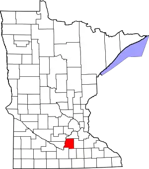 Map of Minnesota highlighting Le Sueur County | |
| Townships | ||
| Unincorporated communities | ||
| Footnotes | ‡This populated place also has portions in an adjacent county or counties | |
| ||
| Authority control |
|---|