Lembata Regency
Lembata Regency is a regency in East Nusa Tenggara province of Indonesia.[2] Established in 1999 (under administrative Law UU 52/1999), the regency covers the island of Lembata (formerly known as Lomblen), together with three small offshore islands together forming the eastern part of the Solor Archipelago, and has its administrative seat (capital) in Lewoleba. The population of the Regency was 117,829 at the 2010 decennial census;[3] at the 2015 Census this had risen to 131,955;[4] the latest official estimate (as at mid 2020) is 145,685.[5]
Lembata Regency
Kabupaten Lembata | |
|---|---|
 Coat of arms | |
 Location within East Nusa Tenggara | |
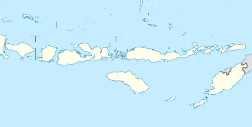 Lembata Regency Location in Lesser Sunda Islands and Indonesia  Lembata Regency Lembata Regency (Indonesia) | |
| Coordinates: 8.4330°S 123.4670°E | |
| Country | |
| Province | |
| Capital | Lewoleba |
| Government | |
| • Regent | Eliaser Yentji Sunur |
| • Vice Regent | Thomas Ola Langoday |
| Area | |
| • Total | 488.96 sq mi (1,266.39 km2) |
| Population (mid 2020 estimate)[1] | |
| • Total | 145,685 |
| • Density | 300/sq mi (120/km2) |
| Area code | (+62) 383 |
| Website | lembatakab |
Administrative Districts
The regency is divided into nine districts (kecamatan), tabulated below with their areas and their 2010 Census population[6] and the official estimates for mid-2019.[7] The table also includes the number of villages (rural desa and urban kelurahan) in each district, and its post code.
| District | Location | Area in km2 | Population Census 2010 | Population Estimate mid 2019 | Number of villages | Post codes |
|---|---|---|---|---|---|---|
| Nagawutung (a) | (Southwest Lembata) | 185.70 | 8,735 | 9,714 | 18 | 86684 |
| Wulandoni (b) | (South Lembata) | 121.44 | 8,375 | 8,439 | 15 | 86686 |
| Atadei | (Southeast Lembata) | 150.42 | 7,537 | 7,060 | 15 | 86685 |
| Ile Ape | (Northwest Lembata) | 96.86 | 11,499 | 12,460 | 17 | 86683 |
| Ile Ape Timur | (East Ile Ape) | 38.26 | 5,099 | 5,039 | 9 | 86687 |
| Lebatukan | (Central Lembata) | 241.91 | 8,550 | 9,013 | 17 | 86681 |
| Nubatukan (3) | (West Lembata) | 165.64 | 33,236 | 57,136 | 18 | (d) |
| Omesuri | (East Lembata) | 161.91 | 15,919 | 15,360 | 22 | 86691 |
| Buyasuri | (Far East Lembata) | 104.260 | 18,879 | 18,852 | 20 | 86692 |
| Total island | 1,266.39 | 117,829 | 143,073 | 151 |
Notes: (a) includes offshore island of Pulau Sewanggi. (b) includes offshore islands of Batutara and Watonubi.
(c) includes regency capital of Lewoleba town. (d) six villages have postcode of 86611-86616; twelve villages have postcode of 86682.
Geography
Mount Ile Lewotolok, an active volcano, is located in the north central part of Lembata Island. In November 2020, it erupted, leading to the evacuation of over 4,000 people from areas close to the volcano.[8]
References
- Badan Pusat Statistik, Jakarta, 2020.
- http://ntt.bps.go.id/index.php?option=com_content&view=article&id=46&Itemid=8
- Hasil Sensus Penduduk 2010
- Badan Pusat Statistik, Jakarta, 2018.
- Badan Pusat Statistik, Jakarta, 2020.
- Biro Pusat Statistik, Jakarta, 2011.
- Badan Pusat Statistik, Jakarta, 2020.
- Djemi Amnifu and Nina Loasana, 'Over 4,600 residents evacuated after Ili Lewotolok eruption', The Jakarta Post, 30 November 2020.
External links
Regencies and cities of East Nusa Tenggara | ||
|---|---|---|
Capital: Kupang | ||
| Regencies |  | |
| Cities | ||