East Sumba Regency
East Sumba Regency (Indonesian: Kabupaten Sumba Timur) is one of the four regencies which divide the island of Sumba, East Nusa Tenggara Province, Indonesia. Waingapu is the capital of East Sumba Regency. The population of East Sumba Regency was 227,732 at the 2010 Census;[2] the latest official estimate (as at mid 2020) is 261,503.[3]
East Sumba Regency
Kabupaten Sumba Timur | |
|---|---|
 Coat of arms | |
 Location within East Nusa Tenggara | |
 East Sumba Regency 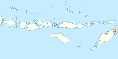 East Sumba Regency East Sumba Regency (Lesser Sunda Islands)  East Sumba Regency East Sumba Regency (Indonesia) | |
| Coordinates: 9.8833°S 120.2500°E | |
| Country | |
| Region | Lesser Sunda Islands |
| Province | |
| Capital | Waingapu |
| Government | |
| • Regent | Gidion Mbilijora |
| • Vice Regent | Umbu Lili Pekuwali |
| Area | |
| • Total | 7,000.5 km2 (2,702.9 sq mi) |
| Population (mid 2020) | |
| • Total | 261,503 |
| • Density | 37/km2 (97/sq mi) |
| [1] | |
| Time zone | UTC+8 (ICST) |
| Area code | (+62) 387 |
| Website | sumbatimurkab |
Administrative Districts
The East Sumba Regency is composed of twenty-two districts (kecamatan), whose areas (in km2) and 2010 Census populations are listed below,[4] together with the official estimates for 2017.[5] The table also includes the location of the district headquarters, the number of administrative villages (rural desa and urban kelurahan) in each district, and its postal code.
| Name | Area (in km2) | Population Census 2010 | Population Estimate mid 2017[6] | Admini- strative centre | Number of villages | Post code |
|---|---|---|---|---|---|---|
| Lewa | 281.1 | 15,423 | 17,144 | Pamati Karata | 8 | 87150 |
| Nggaha Oriangu | 286.4 | 8,614 | 9,755 | Karipidita | 8 | 87155 |
| Lewa Tidahu | 322.1 | 6,129 | 6,928 | Laikeri | 6 | 87151 |
| Katala Hamu Lingu | 453.1 | 3,699 | 4,101 | Kombapari | 5 | 87152 |
| Tabandung | 514.4 | 8,301 | 9,015 | Malahar | 10 | 87160 |
| Pinu Pahar | 246.6 | 6,410 | 7,426 | Tawui | 6 | 87161 |
| Paberiwai | 199.7 | 5,619 | 6,079 | Kananggar | 7 | 87175 |
| Karera | 334.6 | 7,365 | 8,325 | Nggongi | 7 | 87172 |
| Matawai Lapawu | 405.4 | 5,786 | 6,500 | Tanarara | 6 | 87174 |
| Kahaungu Eti | 475.1 | 8,214 | 8,909 | Kamanggih | 9 | 87171 |
| Mahu | 196.6 | 3,922 | 4,496 | Wairara | 6 | 87170 |
| Ngadu Ngala | 207.9 | 4,787 | 5,209 | Praiwitu | 5 | 87172 |
| Pahunga Lodu | 349.8 | 12,247 | 13,240 | Ngala | 8 | 87182 |
| Wula Waijelu | 221.3 | 6,902 | 7,680 | Wula | 7 | 87183 |
| Rindi | 366.5 | 9,070 | 10,034 | Tanaraing | 8 | 87181 |
| Umalulu | 307.9 | 16,251 | 17,946 | Melolo | 10 | 87180 |
| Pandawai | 412.6 | 14,776 | 16,256 | Kawangu | 7 | 87176 |
| Kambata Mapambuhang | 412.7 | 3,434 | 17,946 | Lukuwingir | 6 | 87171 (a) |
| Kota Waingapu | 73.8 | 35,142 | 39,239 | Waingapu | 7 | 87111-87116 |
| Kambera | 52.0 | 31,137 | 33,917 | Pakukinjara | 8 | 87113-87116 |
| Haharu | 601.5 | 5,586 | 6,353 | Rambangaru | 7 | 87153 |
| Kanatang | 279.4 | 8,918 | 10,311 | Temu | 5 | 87154 |
| Totals | 7000.5 | 227,732 | 252,704 | 156 |
Note: (a) except village of Lukuwingir (which has a postcode of 87116).
Airport
Currently, Umbu Mehang Kunda Airport has a 1,850-metres long runway with 30 metres width and can accommodate Boeing 737-300 aircraft. It will be extended by another 600 metres and was predicted to complete before Sail Komodo 2013 in October 2013.[7]
References
| Wikimedia Commons has media related to East Sumba Regency. |
- Badan Pusat Statistik, Jakarta, 2020.
- Biro Pusat Statistik, Jakarta, 2011.
- Badan Pusat Statistik, Jakarta, 2020.
- Biro Pusat Statistik, Jakarta, 2011.
- Badan Pusat Statistik, Jakarta, 2019.
- Badan Pusat Statistik, Jakarta, 2019.
- "NTT airports gear up ahead of Sail Komodo 2013". September 11, 2012.
Regencies and cities of East Nusa Tenggara | ||
|---|---|---|
Capital: Kupang | ||
| Regencies |  | |
| Cities | ||