Liberty, Allegheny County, Pennsylvania
Liberty is a borough in Allegheny County, Pennsylvania, United States. The population was 2,551 at the 2010 census.[3]
Liberty, Pennsylvania | |
|---|---|
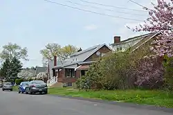 Bungalows on "E" Street | |
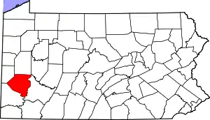
 Location in Allegheny County and the state of Pennsylvania. | |
| Coordinates: 40°19′35″N 79°51′22″W | |
| Country | United States |
| State | Pennsylvania |
| County | Allegheny |
| Area | |
| • Total | 1.49 sq mi (3.85 km2) |
| • Land | 1.43 sq mi (3.70 km2) |
| • Water | 0.06 sq mi (0.15 km2) |
| Population (2010) | |
| • Total | 2,551 |
| • Estimate (2019)[2] | 2,454 |
| • Density | 1,716.08/sq mi (662.38/km2) |
| Time zone | UTC-5 (Eastern (EST)) |
| • Summer (DST) | UTC-4 (EDT) |
| FIPS code | 42-43064 |
| GNIS feature ID | 1214805 |
| Website | www |
The mayor of Liberty is currently Jane Weigand.
Liberty does not have its own post office. The zip code is 15133, and mail is addressed to the city of McKeesport. Liberty is part of the South Allegheny School District, along with Glassport, Lincoln, and Port Vue, and is home to the district's high school and early childhood center. Liberty was at one time part of Port Vue but gained its "liberty" from Port Vue in 1912, thus the origin of the name of the town.
Locals tend to refer to the town as "Liberty Borough" or "Liberty Boro," rather than just as "Liberty."
Geography
Liberty is located at 40°19′35″N 79°51′22″W (40.326302, -79.856101).[4] It is bounded by Port Vue and McKeesport to the north, Versailles and the Youghiogheny River to the east, Lincoln to the south, and Glassport to the west.
According to the United States Census Bureau, the borough has a total area of 1.5 square miles (3.9 km2), of which 1.4 square miles (3.6 km2) is land and 0.1 square miles (0.26 km2), or 4.00%, is water.
Government and Politics
| Year | Republican | Democratic | Third Parties |
|---|---|---|---|
| 2016 | 62% 776 | 36% 450 | 2% 29 |
| 2012 | 52% 603 | 47% 547 | 1% 13 |
Education
Liberty Borough is served by the South Allegheny School District.
Taxes
School tax millage rate- The South Allegheny SD (shared with three other municipalities) in 2017 was 17.24. This ranked 41st highest/most expensive out of Allegheny County's 45 school districts, between McKeesport SD (40th highest) and Chartiers Valley SD (42nd highest).[7]
Demographics
| Historical population | |||
|---|---|---|---|
| Census | Pop. | %± | |
| 1920 | 601 | — | |
| 1930 | 906 | 50.7% | |
| 1940 | 1,084 | 19.6% | |
| 1950 | 1,900 | 75.3% | |
| 1960 | 3,624 | 90.7% | |
| 1970 | 3,594 | −0.8% | |
| 1980 | 3,112 | −13.4% | |
| 1990 | 2,744 | −11.8% | |
| 2000 | 2,670 | −2.7% | |
| 2010 | 2,551 | −4.5% | |
| 2019 (est.) | 2,454 | [2] | −3.8% |
| Sources:[8][9][10][11][12] | |||
As of the census[11] of 2000, there were 2,670 people, 1,125 households, and 768 families residing in the borough. The population density was 1,856.7 people per square mile (715.9/km2). There were 1,162 housing units at an average density of 808.1/sq mi (311.6/km2). The racial makeup of the borough was 97.98% White, 1.46% African American, 0.11% Native American, 0.11% Asian, 0.04% Pacific Islander, and 0.30% from two or more races. Hispanic or Latino of any race were 0.37% of the population.
There were 1,125 households, out of which 27.0% had children under the age of 18 living with them, 53.2% were married couples living together, 12.1% had a female householder with no husband present, and 31.7% were non-families. 28.5% of all households were made up of individuals, and 16.1% had someone living alone who was 65 years of age or older. The average household size was 2.35 and the average family size was 2.89.
In the borough the population was spread out, with 20.1% under the age of 18, 6.7% from 18 to 24, 26.6% from 25 to 44, 25.3% from 45 to 64, and 21.2% who were 65 years of age or older. The median age was 43 years. For every 100 females there were 88.7 males. For every 100 females age 18 and over, there were 84.3 males.
The median income for a household in the borough was $35,264, and the median income for a family was $42,857. Males had a median income of $35,685 versus $22,304 for females. The per capita income for the borough was $19,491. About 5.6% of families and 7.6% of the population were below the poverty line, including 11.8% of those under age 18 and 5.3% of those age 65 or over.
References
- "2019 U.S. Gazetteer Files". United States Census Bureau. Retrieved July 28, 2020.
- "Population and Housing Unit Estimates". United States Census Bureau. May 24, 2020. Retrieved May 27, 2020.
- "Race, Hispanic or Latino, Age, and Housing Occupancy: 2010 Census Redistricting Data (Public Law 94-171) Summary File (QT-PL), Liberty borough (Allegheny County), Pennsylvania". United States Census Bureau. Retrieved September 20, 2011.
- "US Gazetteer files: 2010, 2000, and 1990". United States Census Bureau. 2011-02-12. Retrieved 2011-04-23.
- EL. "2012 Allegheny County election". Pittsburgh Tribune-Review. Retrieved 15 October 2017.
- EL. "2016 Pennsylvani general election..." Pittsburgh Post-Gazette. Retrieved 15 October 2017.
- EL. "Allegheny County Treasurer". Retrieved 1 September 2017.
- "Number and Distribution of Inhabitants:Pennsylvania-Tennessee" (PDF). Fifteenth Census. U.S. Census Bureau.
- "Number of Inhabitants: Pennsylvania" (PDF). 18th Census of the United States. U.S. Census Bureau. Retrieved 22 November 2013.
- "Pennsylvania: Population and Housing Unit Counts" (PDF). U.S. Census Bureau. Retrieved 22 November 2013.
- "U.S. Census website". United States Census Bureau. Retrieved 2008-01-31.
- "Annual Estimates of the Resident Population". U.S. Census Bureau. Archived from the original on 19 October 2013. Retrieved 22 November 2013.
| Counties |  Map of the Pittsburgh Tri-State with green counties in the metropolitan area and yellow counties in the combined area | |
|---|---|---|
| Major cities | ||
| Cities and towns 15k–50k (in 2010) | ||
| Airports | ||
| Topics | ||
| ||