Lingeigh
Lingeigh or Lingay is an unpopulated islet in the Outer Hebrides. It lies towards the southern end of the archipelago, just north of Rosinish and 5 kilometres (3 miles) south of Vatersay. There is a cave on the south-east side of the island.
| Meaning of name | heather island |
|---|---|
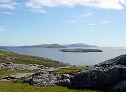 Lingeigh from Vatersay. It is the small island behind the first small one. | |
| Location | |
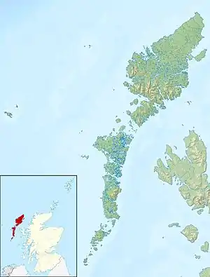 Lingeigh Lingeigh shown within the Outer Hebrides | |
| OS grid reference | NL602896 |
| Coordinates | 56.87°N 7.580°W |
| Physical geography | |
| Island group | Uists and Barra |
| Area | 27 ha (1⁄8 sq mi)[1] |
| Highest elevation | 83 m (272 ft) |
| Administration | |
| Sovereign state | United Kingdom |
| Country | Scotland |
| Council area | Na h-Eileanan Siar |
| Demographics | |
| Population | 0 |
| References | [2] |
Notes and references
- "Rick Livingstone's Tables of the Islands of Scotland" (pdf). Argyll Yacht Charters. Retrieved 12 Dec 2011.
- Ordnance Survey. OS Maps Online (Map). 1:25,000. Leisure.
| Wikimedia Commons has media related to Lingeigh. |
This article is issued from Wikipedia. The text is licensed under Creative Commons - Attribution - Sharealike. Additional terms may apply for the media files.