Longa Island
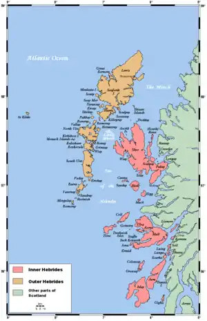
Longa Island (Gaelic: Longa) is a small uninhabited island at the mouth of Loch Gairloch, on the west coast of Scotland. Longa is nearly a mile in length with an area of 126 ha (310 acres) and a maximum height of 70 metres (230 ft) above sea level.
| Scottish Gaelic name | Longa |
|---|---|
| Old Norse name | Possibly Long-øy |
| Meaning of name | Gaelic, 'long' Old Norse 'ship Island' |
| Location | |
 Longa Island Longa Island shown within Highland Scotland | |
| OS grid reference | NG736776 |
| Coordinates | 57.72°N 5.8°W |
| Physical geography | |
| Island group | Highland |
| Area | 126 hectares (0.49 sq mi) |
| Area rank | 132 [1] |
| Highest elevation | Druim am Eilean 70 metres (230 ft) |
| Administration | |
| Sovereign state | United Kingdom |
| Country | Scotland |
| Council area | Highland Council |
| Demographics | |
| Population | 0[2] |
| References | [3][4][5] |
Economy
There was a small fishing community in early in the 19th century; the island had become deserted by the latter part. Today only sheep graze the island in the summer months.
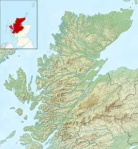
 Longa Island, across the Caolas Beag
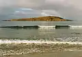
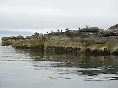 Shags on Sron na Caillich
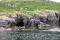 Unmapped Sea Cave Below An Raon
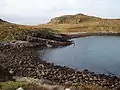 Camus na Rainich
Notes and references
- Area and population ranks: there are c. 300 islands over 20 ha in extent and 93 permanently inhabited islands were listed in the 2011 census.
- National Records of Scotland (15 August 2013). "Appendix 2: Population and households on Scotland's Inhabited Islands" (PDF). Statistical Bulletin: 2011 Census: First Results on Population and Household Estimates for Scotland Release 1C (Part Two) (PDF) (Report). SG/2013/126. Retrieved 14 August 2020.
- Ordnance Survey: Landranger map sheet 19 Gairloch & Ullapool (Loch Maree) (Map). Ordnance Survey. 2013. ISBN 9780319231074.
- Haswell-Smith, Hamish (2004). The Scottish Islands. Edinburgh: Canongate. ISBN 978-1-84195-454-7.
- Mac an Tàilleir, Iain (2003) Ainmean-àite/Placenames. (pdf) Pàrlamaid na h-Alba. Retrieved 26 August 2012.
| Wikimedia Commons has media related to Longa Island. |
This article is issued from Wikipedia. The text is licensed under Creative Commons - Attribution - Sharealike. Additional terms may apply for the media files.