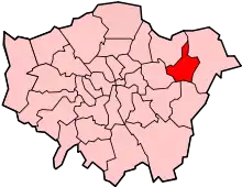
List of districts in the London Borough of Barking and Dagenham
There are various formal and informal subdivisions of London Borough of Barking and Dagenham
Postal Geography
17 Postcode sectors in (7 postcode areas) cover the borough: IG11 7, 8, 9 and 0; RM5 2; RM6 4, 5 and 6; RM7 0; RM8 1, 2 and 3; RM9 4, 5 and 6; RM10 7, 8, 9. All of RM8 and RM9 are wholly within B&D and for practical purposes so is all of RM10. The other areas extend into neighbouring boroughs (Newham, Redbridge and Havering)
The Post Towns Barking, Dagenham, and Romford each cover part of the borough (and beyond).
Neighbourhoods
This is a list of 13 'Neighbourhoods' without defined boundaries.
| Neighbourhood | Post town | Postcode Area/District/Sector | Coordinates | OS grid ref |
|---|---|---|---|---|
| Barking | BARKING | IG11 | 51.536°N 0.077°E | TQ440840 |
| Barking Riverside | BARKING | IG11 0 | 51.521°N 0.109°E | TQ464823 |
| Becontree | DAGENHAM | RM | 51.548°N 0.142°E | TQ485855 |
| Becontree Heath | DAGENHAM | RM | 51.563°N 0.152°E | TQ493871 |
| Castle Green | DAGENHAM | RM | 51.533°N 0.122°E | TQ472837 |
| Chadwell Heath | ROMFORD | RM6 | 51.575°N 0.144°E | TQ485885 |
| Creekmouth | BARKING | IG11 0 | 51.519°N 0.099°E | TQ457820 |
| Dagenham | DAGENHAM | RM | 51.539°N 0.142°E | TQ485845 |
| Dagenham Riverside | DAGENHAM | RM | 51.521°N 0.146°E | TQ489824 |
| Marks Gate | ROMFORD | RM6 | 51.593°N 0.144°E | TQ485905 |
| Rush Green | ROMFORD | RM7 | 51.562°N 0.171°E | TQ505870 |
| Thames View | BARKING | IG11 0 | 51.529°N 0.104°E | TQ460831 |
| Upney | BARKING | IG11 9 | 51.540469°N 0.098814°E | TQ456844 |
Note that 'Barking' and 'Dagenham' are the names both of post towns and of Neighbourhoods in this table.
Character areas
These 11 "character areas" were proposed in Barking & Dagenham Council's 'Issues and Options' report on page 50 (list) and 51 (map).[1] The character area names are unique within the list.
"We would appreciate your feedback on what you think the different places are in Barking and Dagenham. To help with this we’ve attempted to define what we think are the eleven places that make up the borough. Becontree; Becontree Heath; Barking Riverside/Thames View; Barking Town Centre; Chadwell Heath; Dagenham East; Dagenham Riverside; Faircross, Leftley and Eastbury; Goodmayes; Marks Gate; Rush Green."
The omission of Upney - an old place name and the name of a London Underground station - from this list is noteworthy.
Strategic sub-areas
These 7 'strategic sub-areas' are on a map published by Barking & Dagenham Council in September 2019:
Barking & The Roding; Becontree Heath & Rush Green; Becontree; Chadwell Heath & Marks Gate; Dagenham Dock & Beam Park; Dagenham East & The Village; Thames & Riverside
Similar (if not identical) areas were subsequently used, albeit with some names modified, in the council's Draft Local Plan 2019-2034:[2]
1: Barking Town Centre and the River Roding *
2: Thames Road, Barking Riverside and Castle Green
3: Dagenham Dock, Beam Park and the Ford Stamping Plant
4: Becontree
5: Chadwell Heath and Marks Gate
6: Becontree Heath and Rush Green
7: Dagenham East and Dagenham Village
- The September 2020 consultation version of the local plan[3] lists sub-area 1 above as: 'Barking, the River Roding'
Electoral wards
The borough is divided into wards - these 17 from 2010: Abbey, Alibon, Becontree, Chadwell Heath *, Eastbrook *, Eastbury, Gascoigne, Goresbrook, Heath *, Longbridge, Mayesbrook, Parsloes, River *, Thames, Valence, Village * and Whalebone * wards. Each ward is represented by three Councillors.
From the 2010 General election, the 6 wards indicated by * were in Dagenham & Rainham Constituency, with 3 wards from LB Havering, and the remaining 11 were in Barking constituency.
From 27 October 2020 until 31 May 2021 the Electoral Commission is consulting on ward boundary changes to take effect from the 2022 elections.[4] The council has proposed[5] to continue having 51 Councillors, but to increase the number of wards to 19. The 17 wards named above would be kept, though with changed boundaries, and two new wards - Roding and Creekmouth - each with 2 members - would be added. Eastbrook, Gascoigne, Heath, and Parsloes wards would become 2 member wards. The estimated borough-wide electorate at the time of the change will be 17,4322, equivalent to 3418 electors per Councillor. The proposed changes entail each ward boundary being drawn so that the electors per Councillor is within 10% of that borough average.[6] [7]
These boundary changes would mean, if implemented, that some wards straddled two parliamentary constituencies.
'Nextdoor' Neighbourhoods
Social networking site Nextdoor (formerly Streetlife) [8] lists these 20 neighbourhoods among others in B&D. This list covers the western area of the Borough, arguably Barking, though Nextdoor itself covers the whole borough (and a much wider area);
Barking Park & Faircross, Barking Riverside, Barking Town Centre, Becontree Station, East Castle Green, Gascoigne, Goresbrook Village, Great Fleete, Greatfields, Harts Lane, Leftley Estate-Mayesbrook Park, Longbridge Road, North Eastbury, South Eastbury, Thames View, The Triangle, Upney Lane, Waverley Gardens, West Castle Green, Westbury.
Controlled Car Parking Zones
As at November 2020 these do not cover the whole borough, but several of them are being expanded (depending on the outcome of consultations).[9] 26 zones are listed here in alphabetical order of their short code. The information is derived from Ringgo[10] and the location codes range from 27000 - 27061, non continuously. Not all of the zones are known to be in actual use.
Barking Town Centre AM, Barking Town Centre B, Becontree BEC, Barking Town Centre C, Chadwell Heath CH, Barking Town Centre D, Dagenham East DE, Barking Town Centre E, Barking Town Centre ES, Barking Town Centre F, Barking Town Centre FG, Barking Town Centre G, Gascoigne Estate GE, Barking Town Centre H, Barking Town Centre HR, Heathway HW, Barking Town Centre I, Barking Town Centre J, Barking Town Centre K, Barking Town Centre L, Lancaster Avenue LA, Longbridge Academy LB, Millard Terrace MT1, Barking RC, Barking Thames View TH, Barking Town Centre TV, Upney UP.
References
- https://www.lbbd.gov.uk/sites/default/files/attachments/Issues-and-Options-Report.pdf
- https://www.lbbd.gov.uk/sites/default/files/attachments/LBBD-Draft-Local-Plan-Reg-18-Consultation-version_121219.pdf
- http://lucmaps.com/HubComponents/10589/LBBD%20Local%20Plan%20Reg%2019%20Consultation%20Document%20Sep%202020%20(Redsize%20V1).pdf
- https://www.lgbce.org.uk/all-reviews/greater-london/greater-london/barking-and-dagenham
- https://modgov.lbbd.gov.uk/Internet/ieIssueDetails.aspx?IId=81195&PlanId=0&Opt=3
- https://modgov.lbbd.gov.uk/Internet/documents/s143027/App%201%20-%20Electoral%20numbers.pdf
- https://modgov.lbbd.gov.uk/Internet/documents/s143199/LGBCE%20ward%20boundary%20report.pdf
- https://nextdoor.co.uk/
- https://www.lbbd.gov.uk/where-you-can-park
- https://www.myringgo.co.uk/lbbd/parkinglocator
| Districts | | |
|---|---|---|
| Attractions | ||
| Places of worship | ||
| Parks and open spaces | ||
| Constituencies |
| |
| Tube and rail stations | ||
| Other topics | ||
| ||