List of historic places in Westman Region, Manitoba
This is a list of historic places in Westman Region, Manitoba entered on the Canadian Register of Historic Places, whether they are federal, provincial, or municipal.
List of historic places
| Name | Address | Coordinates | IDF | IDP | IDM | Image | |
|---|---|---|---|---|---|---|---|
| Alexander Post Office | 415 - 2nd Avenue West, Alexander, MB | 49°49′47″N 100°17′46″W | 2774 |  | |||
| Frelsis (Liberty) Lutheran Church | NW 12-6-14W, Argyle, MB | 49°28′01″N 99°14′35″W | 3855 | | |||
| Fowler Block | 225 Elizabeth Avenue East, Argyle, MB | 49°23′07″N 99°14′34″W | 4881 | | |||
| Thomas Poole Building | 215 Elizabeth Avenue East, Argyle, MB | 49°23′07″N 99°14′45″W | 4882 | | |||
| Baldur United Church | 202 Second Street South, Argyle, MB | 49°23′14″N 99°14′41″W | 5079 | | |||
| St. George's Anglican Church | Provincial Road 253, Argyle, MB | 49°15′08″N 99°09′15″W | 5483 | | |||
| Reeves Barn | , Whitehead, MB | 49°54′07″N 100°21′36″W | 8664 | | |||
| Napinka School | Souris Street, Brenda, MB | 49°19′17″N 100°50′35″W | 6617 | | |||
| Amos Blacksmith Shop | 101 Second Street, Waskada, MB | 49°05′50″N 100°48′07″W | 8052 | | |||
| Elton Heritage House | Justice Road, Elton, MB | 49°58′26″N 99°59′10″W | 2772 | | |||
| Ontario Gothic House | North of hamlet of Forrest, Elton, MB | 49°57′59″N 99°56′07″W | 20249 | | |||
| McGregor House | , Daly, MB | 49°53′47″N 100°06′47″W | 5011 | | |||
| Elgin Canadian Imperial Bank of Commerce Building | 131 Main Street, Whitewater, MB | 49°26′39″N 100°16′16″W | 5055 | | |||
| Anderson Barn | , Elton, MB | 49°56′23″N 99°54′13″W | 5084 | | |||
| St. George's Anglican Church | , Turtle Mountain, MB | 49°08′07″N 99°29′10″W | 5333 | | |||
| Holmfield Swimming Hole | Between Railway Avenue and the Long River in Holmfield, Turtle Mountain, MB | 49°08′16″N 99°29′19″W | 19379 | | |||
| Holmfield Centennial Hall | Gordon Avenue, Holmfield, Turtle Mountain, MB | 49°08′08″N 99°29′14″W | 19380 | | |||
| Hilton United Church | 2nd Street, Strathcona, MB | 49°30′21″N 99°31′26″W | 5479 | | |||
| Bank of Toronto Vault | , Turtle Mountain, MB | 49°08′23″N 99°29′04″W | 6755 | | |||
| Ninga Presbyterian Church | Glengarry Street and Glenco Avenue, Turtle Mountain, MB | 49°13′35″N 99°53′16″W | 6901 | | |||
| Riverside Park | , Whitewater, MB | 49°30′04″N 99°59′32″W | 8049 | 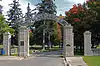 More images | |||
| St. Nicholas Ukrainian Catholic Church | , Harrison, MB | 50°28′04″N 100°05′42″W | 4830 | | |||
| Sts. Peter and Paul Ukrainian Orthodox Church | Provincial Route 566 east of Olha, Park (South), MB | 50°40′58″N 100°29′06″W | 4830 | | |||
| Bethlehem Lutheran Church Manse | Queen Elizabeth Road, Erickson, MB | 50°30′13″N 99°54′46″W | 6596 | | |||
| Chastko House | , Harrison, MB | 50°29′33″N 100°05′31″W | 8227 | | |||
| Graham Barn | , Whitewater, MB | 49°22′44″N 100°02′28″W | 3910 | | |||
| Riverside School | , Whitewater, MB | 49°28′13″N 99°59′24″W | 4831 | | |||
| Knox Bellafield Presbyterian Church | , Riverside, MB | 49°21′24″N 99°40′35″W | 5010 | | |||
| Old English Church | 602 River Avenue, Hartney, MB | 49°28′47″N 100°31′08″W | 16351 | | |||
| Yerex House | SE 1/4 21-15-16 WPM, Rosedale, MB | 50°17′25″N 99°36′23″W | 2765 | | |||
| Eunola School | SE 11-4-29 WPM, Edward, MB | 49°16′56″N 101°16′48″W | 5787 | | |||
| Coultervale School | , Arthur, MB | 49°01′47″N 101°01′34″W | 5991 | | |||
| Verona School | , Arthur, MB | 49°07′58″N 100°53′17″W | 5992 | | |||
| Strathclair Museum | 33 Main Street, Strathclair, MB | 50°24′05″N 100°23′35″W | 4108 | | |||
| St. John the Baptist Ukrainian Catholic Church | NW 2-19-22 WPM, Strathclair, MB | 50°36′09″N 100°25′59″W | 4603 | | |||
| Ukrainian Greek Orthodox Church of the Holy Transfiguration | , Strathclair, MB | 50°33′00″N 100°27′36″W | 6936 | | |||
| Strathclair Agricultural Society Bandstand | , Strathclair, MB | 50°24′05″N 100°23′35″W | 14522 | | |||
| Breadalbane Presbyterian Church | , Woodworth, MB | 49°54′59″N 100°46′54″W | 10366 | | |||
| Carpentier House | , Woodworth, MB | 49°48′22″N 100°32′56″W | 5122 | | |||
| Leander Lawlor House | Earl Street, Kenton, Woodworth, MB | 49°59′13″N 100°36′57″W | 20248 | | |||
| St. Alban's Anglican Church | 174 Assiniboine Street West, Oak Lake, MB | 49°46′02″N 100°37′19″W | 5080 | | |||
| Leitch House | 44 Fourth Avenue, Oak Lake, MB | 49°45′49″N 100°37′44″W | 5372 | | |||
| Kola Anglican Church of the Advent | , Wallace, MB | 49°50′23″N 101°16′52″W | 5361 | 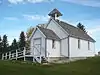 | |||
| Frame House | 390 King Street, Virden, MB | 49°50′43″N 100°55′55″W | 5396 | | |||
| Scarth Block | 408 7th Avenue South, Virden, MB | 49°51′01″N 100°55′52″W | 20252 | | |||
| Virden Canadian Pacific Railway Station | 425-6th Avenue South, Virden, MB | 49°50′53″N 100°55′37″W | 6499 | 5397 | | ||
| Virden Municipal Building and Auditorium | 228 Wellington Street, Virden, MB | 49°50′56″N 100°56′02″W | 5401 | 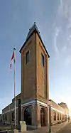 More images | |||
| Elkhorn United Church | 102 Foxford Avenue East, Elkhorn, MB | 49°58′42″N 101°14′17″W | 4899 | | |||
| Cromer United Church | 1st Street W and 1st Avenue, Pipestone, MB | 49°43′51″N 101°14′13″W | 4827 | | |||
| Forder Barn | Rural setting west of Pipestone, Pipestone, MB | 20247 | | ||||
| Pipestone Municipal Building | 401 - 3rd Avenue, Pipestone, MB | 49°33′33″N 101°05′38″W | 5112 | | |||
| Mutter House | 116 2nd Avenue, Pipestone, MB | 49°33′29″N 101°05′53″W | 2724 | | |||
| Reston Canadian Pacific Railway Engine House | , Pipestone, MB | 49°33′17″N 101°05′49″W | 5793 | | |||
| Berry House | 408 First Avenue, Pipestone, MB | 49°33′30″N 101°05′42″W | 8228 | | |||
| Stott Site | , Brandon, MB | 49°31′N 100°03′W | 7293 | | |||
| Millford Cemetery | , Glenboro, MB | 49°37′12″N 99°33′51″W | 7662 | | |||
| Camp Hughes Military Training Site | , Carberry, MB | 49°52′58″N 99°33′01″W | 18924 | 7745 | | ||
| Armoury | 1116 Victoria Avenue, Brandon, MB | 49°50′32″N 99°57′12″W | 9615 | | |||
| Canadian Pacific Railway Station | 1000 Pacific Avenue (at 10th St.), Brandon, MB | 49°50′59″N 99°57′05″W | 4558 | 19365 | | ||
| Commonwealth Air Training Plan Hangar | 300 Commonwealth Way, Brandon, MB | 49°54′09″N 99°56′30″W | 2578 | | |||
| Display Building Number II | North side of 1913 Dominion Fair grounds, Brandon, MB | 49°49′53″N 99°57′26″W | 21063 | | |||
| Federal Building | 1039 Princess Avenue, Brandon, MB | 49°50′49″N 99°57′09″W | 4793 | | |||
| First Baptist Church | 1037 Lorne Avenue, Brandon, MB | 49°50′43″N 99°57′08″W | 19932 | | |||
| Fraser Block | 1031 Rosser Avenue, Brandon, MB | 49°50′55″N 99°57′06″W | 2968 | 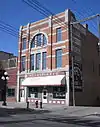 More images | |||
| Jackson House | 339 Victoria Avenue, Brandon, MB | 49°50′32″N 99°56′34″W | 19933 | | |||
| Maley House | 1605 Victoria Avenue, Brandon, MB | 49°50′35″N 99°57′16″W | 3220 |  More images | |||
| LaPlont Block | 924 Rosser Avenue, Brandon, MB | 49°50′55″N 99°57′17″W | 3329 | 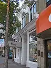 More images | |||
| Brandon Central Fire Station | 637 Princess Avenue, Brandon, MB | 49°51′N 99°57′W | 3336 | 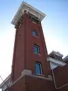 More images | |||
| Hangar #1 - CATP Museum | McGill Field, Brandon, MB | 49°53′59″N 99°56′30″W | 3351 |  | |||
| Zink's Grocery Store | 361 1st Street, Brandon, MB | 49°50′N 99°56′W | 3382 | | |||
| Stone Fence | 17th Street between Rosser and Princess Avenue, Princess Avenue between 17th and 18th Streets, Brandon, MB | 49°50′34″N 99°56′56″W | 3400 | 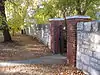 More images | |||
| Shillinglaw House | 302 Russell Street, Brandon, MB | 49°50′N 99°56′W | 3427 | | |||
| A.E. McKenzie Co. Building | 30-9th Street, Brandon, MB | 49°50′55″N 99°57′01″W | 3487 | 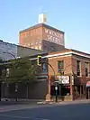 More images | |||
| Merchants Bank Building | 1043 Rosser Avenue, Brandon, MB | 49°51′N 99°57′W | 3495 | 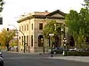 More images | |||
| Johnson House | 446 7th Street, Brandon, MB | 49°50′34″N 99°57′01″W | 3911 | 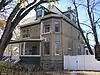 More images | |||
| St. Matthew's Anglican Cathedral | 403 13th Street, Brandon, MB | 49°50′38″N 99°57′16″W | 3918 | 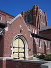 More images | |||
| Yates House | 431 16th Street, Brandon, MB | 49°50′35″N 99°57′32″W | 4872 | 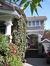 More images | |||
| Christie House | 404 13th Street, Brandon, Brandon, MB | 49°50′42″N 99°57′21″W | 4912 | 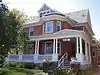 More images | |||
| Burchill and Howey Block | 908 Rosser Avenue, Brandon, MB | 49°50′51″N 99°57′27″W | 4925 | 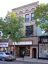 More images | |||
| Villa Louise | 707 Louise Avenue, Brandon, MB | 49°50′38″N 99°57′11″W | 5067 |  More images | |||
| Brandon Mental Health Centre Nurses' Residence | , Brandon, MB | 49°52′07″N 99°56′15″W | 5301 | 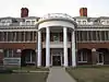 More images | |||
| Lorne Terrace | 1133-37 Lorne Avenue, Brandon, MB | 49°50′43″N 99°56′18″W | 5303 | 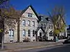 More images | |||
| Johnston Estate | 547 13th Street, Brandon, MB | 49°50′29″N 99°57′17″W | 5331 | | |||
| Brandon Normal School | 1129 Queens Avenue, Brandon, MB | 49°49′47″N 99°57′10″W | 5357 | | |||
| Commonwealth Air Training Plan Hangar | 300 Commonwealth Way, Brandon, MB | 49°54′09″N 99°56′30″W | 7333 | | |||
| Dominion Exhibition Display Building II National Historic Site of Canada | Provincial Exhibition Grounds, Brandon, MB | 49°49′53″N 99°57′31″W | 7411 | | |||
| BCATP Hangar No. 1 National Historic Site of Canada | Brandon Municipal Airport, Brandon, MB | 49°54′35″N 99°57′03″W | 7753 | More images | |||
| Brandon Court House and Jail | 525 Victoria Avenue East, Brandon, MB | 49°50′36″N 99°55′56″W | 8121 | | |||
| Paterson-Matheson House | 1039 Louise Avenue, Brandon, MB | 49°50′38″N 99°56′56″W | 8124 |  More images | |||
| B.J. Hales House | 1312 10th Street, Brandon, MB | 49°50′22″N 99°56′11″W | 8847 | | |||
| McKenzie House | 436 Victoria Avenue, Brandon, MB | 49°50′37″N 99°58′35″W | 3210 | | |||
| Daly House | 122 18th Street, Brandon, MB | 49°51′N 99°58′W | 3353 |  More images | |||
| Brandon College and Clark Hall Buildings | 270 - 18th Street, Brandon, MB | 49°50′49″N 99°57′43″W | 3881 |  More images | |||
| Brandon Citizens' Science Building | 270-18th Street, Brandon, MB | 49°50′35″N 99°57′47″W | 3882 |  More images | |||
| Carberry Agricultural Society Display Building | Carberry Fairgrounds, Carberry, MB | 49°52′05″N 99°21′34″W | 4873 | | |||
| A.E. Gardiner Building | 116 Main Street, Carberry, MB | 49°52′05″N 99°21′34″W | 5392 | | |||
| Nelson Butt Building | 31 Main Street, Carberry, MB | 49°44′34″N 99°21′05″W | 9859 | | |||
| Carberry News Express Building | 34 Main Street, Carberry, MB | 49°44′34″N 99°21′05″W | 9864 | | |||
| Old Bank of Montreal | 33 Main Street, Carberry, MB | 49°44′34″N 99°21′05″W | 9887 | | |||
| Historic Downtown Carberry | 316 Fourth Avenue; 9 - 145 Main Street, Carberry, MB | 49°52′11″N 99°21′39″W | 9891 | | |||
| Nelson Hotel | 9 Main Street, Carberry, MB | 49°52′11″N 99°21′19″W | 10330 | | |||
| Switzer's Red and White Store | 39 Main Street, Carberry, MB | 49°52′11″N 99°21′19″W | 10331 | | |||
| The Style Shop | 41 Main Street, Carberry, MB | 49°52′11″N 99°21′19″W | 10332 | | |||
| Ray's Diner | 43 Main Street, Carberry, MB | 49°52′11″N 99°21′19″W | 10333 | | |||
| Pharmacy Building | 44 Main Street, Carberry, MB | 49°52′02″N 99°21′33″W | 10447 | | |||
| Old Town Hall | 122 Main Street, Carberry, MB | 49°52′05″N 99°21′33″W | 9463 | | |||
| Calvary Pentecostal Church | 141 Main Street, Carberry, MB | 49°52′11″N 99°21′19″W | 10343 | | |||
| Former Rex Cafe Site | 50 Main Street, Carberry, MB | 49°52′11″N 99°21′19″W | 10346 | | |||
| Manitoba Telephone System Building | 121 Main Street, Carberry, MB | 49°52′11″N 99°21′19″W | 10348 | | |||
| White House | 510 Fourth Avenue, Carberry, MB | 49°51′58″N 99°21′40″W | 5784 | | |||
| Kowalchuk Building | 38 Main Street, Carberry, MB | 49°52′11″N 99°21′19″W | 10433 | | |||
| Forbes Building | 40 Main Street, Carberry, MB | 49°52′11″N 99°21′19″W | 10440 | | |||
| Moon Apartments | 30 Main Street, Carberry, MB | 49°52′11″N 99°21′19″W | 10442 | | |||
| McCullough Building | 48 Main Street, Carberry, MB | 49°52′11″N 99°21′19″W | 10443 | | |||
| Wright Building | 46 Main Street, Carberry, MB | 49°52′11″N 99°21′19″W | 10446 | | |||
| Modern Bakery | 42 Main Street, Carberry, MB | 49°52′11″N 99°21′19″W | 10448 | | |||
| Royal Canadian Legion | 25 Main Street, Carberry, MB | 49°52′11″N 99°21′19″W | 10567 | | |||
| Charlie Sear Building | 19-21 Main Street, Carberry, MB | 49°52′11″N 99°21′19″W | 10568 | | |||
| Murphy Block | 29 Main Street, Carberry, MB | 49°52′11″N 99°21′19″W | 10569 | | |||
| Carberry-North Cypress Library | 115 Main Street, Carberry, MB | 49°52′11″N 99°21′19″W | 10739 | | |||
| Waters Block | 125 Main Street, Carberry, MB | 49°52′11″N 99°21′19″W | 10779 | | |||
| Davidson Building | 109 Main Street, Carberry, MB | 49°52′11″N 99°21′19″W | 10780 | | |||
| Sid's Garage | 135 Main Street, Carberry, MB | 49°52′11″N 99°21′19″W | 17081 | | |||
| Flower Shop | 110 Main Street, Carberry, MB | 49°52′11″N 99°21′19″W | 15839 | | |||
| C.V.M. Café | 24 Main Street, Carberry, MB | 49°52′11″N 99°21′19″W | 15849 | | |||
| Carberry Public Washroom | 113 Main Street, Carberry, MB | 49°52′11″N 99°21′19″W | 17082 | | |||
| Birtle Union Bank Building | 738 Main Street, Birtle, MB | 50°25′21″N 101°02′35″W | 3884 | | |||
| Old Deloraine Bank Vault | , Deloraine, MB | 49°09′33″N 100°24′29″W | 4829 | | |||
| Deloraine Presbyterian Church | 220 South Railway Avenue West, Deloraine, MB | 49°11′33″N 100°29′46″W | 5377 | | |||
| Boundary Commission Trail - Turtlehead Creek Crossing | , Deloraine, MB | 49°08′04″N 100°24′04″W | 8149 | | |||
| St. Paul's United Church | 590 Johnson Street, Boissevain, MB | 49°13′50″N 100°03′11″W | 3489 |  More images | |||
| Boissevain Town Hall | 578 Cook Street, Boissevain, MB | 49°13′23″N 100°03′25″W | 3685 | | |||
| Welch Block | 410-412 South Railway Street, Boissevain, MB | 49°13′50″N 100°03′14″W | 4876 | | |||
| Cottingham House | , Boissevain, MB | 49°13′12″N 100°02′10″W | 5304 | | |||
| Dow House | 721 Mill Road, Boissevain, MB | 49°14′03″N 100°03′32″W | 5375 | | |||
| Armstrong Homestead | , Boissevain, MB | 49°11′47″N 100°03′00″W | 5096 | | |||
| McKinney House | 10 km southwest of Boissevain, Boissevain, MB | 49°10′23″N 100°08′05″W | 5083 | | |||
| Arrow River Standing Stone Site | , Hamiota, MB | 50°55′48″N 100°31′26″W | 7329 | | |||
| Union Bank Building | 39 Maple Avenue East, Hamiota, MB | 50°10′47″N 100°35′46″W | 4072 | | |||
| Kaye House | 17 Government Allowance Road, Melita, MB | 49°16′55″N 100°59′38″W | 2781 | | |||
| Belfry School | SW 5-4-27 WPM, Melita, MB | 49°16′00″N 101°05′53″W | 3359 | | |||
| Brockinton National Historic Site of Canada | East bank of Souris River, Melita, MB | 19003 | | ||||
| Melita United Church Manse | 79 Ash Street, Melita, MB | 49°16′20″N 100°59′24″W | 4898 | | |||
| Sourisford Park | , Melita, MB | 49°08′08″N 101°00′29″W | 8152 | More images | |||
| Linear Mounds National Historic Site of Canada | , Melita, MB | 49°07′00″N 101°01′16″W | 10475 | | |||
| McDonald Drug Store and Bakery | 237 Nelson Street West, Virden, MB | 49°50′52″N 100°55′48″W | 10982 | | |||
| Wright House | 114 Sowden Street, Souris, MB | 49°37′04″N 100°15′22″W | 2770 | | |||
| F. Sowden House | 26 Crescent Avenue, Souris, MB | 49°36′58″N 100°15′22″W | 3196 | | |||
| Souris Dominion Post Office | 21 Crescent Avenue, Souris, MB | 49°36′58″N 100°15′32″W | 3201 | | |||
| St. Luke's Anglican Church | 140 First Street South, Souris, MB | 49°36′58″N 100°15′18″W | 8609 | | |||
| Dolmage House | 44-4th Avenue, Souris, MB | 49°37′08″N 100°15′47″W | 13546 | | |||
| Demonstration Farm House | 44 Water Street, Killarney, MB | 49°10′23″N 99°40′17″W | 4233 | | |||
| Canadian National Railways Station | , Rivers, MB | 50°01′44″N 100°14′10″W | 4324 | | |||
| Shaver House | , Killarney, MB | 49°13′26″N 99°37′46″W | 5065 | | |||
| Hay House | 402 Clark Avenue, Killarney, MB | 49°10′53″N 99°40′02″W | 5772 | | |||
| Canadian Pacific Railway Station | Railway Ave. (at Hway 16A and 2nd Ave.), Minnedosa, MB | 50°15′02″N 99°50′24″W | 4557 | | |||
| Myers House | 149-2nd Avenue SW, Minnedosa, MB | 50°14′49″N 99°50′36″W | 2712 | | |||
| Manitoba Power Commission Building | 100 Heritage Park Crescent, Minnedosa, MB | 50°15′15″N 99°49′46″W | 3319 | | |||
| Beautiful Plains County Court Building | 282 Hamilton Street, Neepawa, MB | 50°13′42″N 99°27′52″W | 12302 | 3544 | 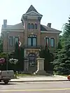 More images | ||
| McKay House | 110 4th Street SE, Minnedosa, MB | 50°14′49″N 99°49′56″W | 3556 | | |||
| Minnedosa Agricultural Society Display Building | Agricultural Society Fairgrounds, Minnedosa, MB | 50°15′26″N 99°50′42″W | 5092 | | |||
| Minnedosa Dominion Post Office | 103 Main Street South, Minnedosa, MB | 50°14′50″N 99°50′21″W | 5362 | 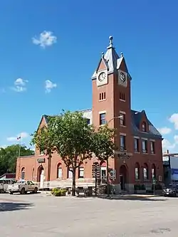 | |||
| Sprague House | 100 Heritage Park Crescent, Minnedosa, MB | 50°15′14″N 99°49′48″W | 5373 | | |||
| Tanner's Crossing | , Minnedosa, MB | 50°14′54″N 99°49′53″W | 6551 | | |||
| Drysdale House | SW 35-14-14 WPM - Highway 16, Neepawa, MB | 50°13′28″N 99°28′07″W | 6644 | | |||
| Minnedosa Canadian Pacific Railway Station | Railway Avenue, Minnedosa, MB | 50°15′02″N 99°50′24″W | 7330 | | |||
| Thompson Family Rest Site | 101 Elizabeth Street, Shoal Lake, MB | 50°26′13″N 100°35′56″W | 8048 | | |||
| Canadian National Railway Station | 91 Hamilton Street, Neepawa, MB | 50°13′43″N 99°28′26″W | 7886 | | |||
| Davidson House | 344 Main Street East, Neepawa, MB | 50°13′25″N 99°27′47″W | 3172 | | |||
| Independent Order of Odd Fellows Building | 376 Mountain Avenue, Neepawa, MB | 50°13′45″N 99°27′57″W | 3966 | | |||
| Knox Presbyterian Church | 396 First Street, Neepawa, MB | 50°13′48″N 99°28′03″W | 3391 | | |||
| Margaret Laurence House | 312 First Avenue, Neepawa, MB | 50°13′43″N 99°27′51″W | 4235 | 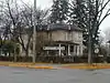 More images | |||
| Roxy Theatre | 291 Hamilton Street, Neepawa, MB | 50°13′43″N 99°27′54″W | 6169 | 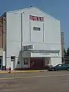 More images | |||
| McKenzie House | Near Jct MB 10 and MB 24, Rapid City, MB | 50°07′30″N 99°56′29″W | 5054 | | |||
| Rapid City Museum and Cultural Centre | 4th Avenue at 4th Street, Rapid City, MB | 50°07′08″N 100°02′10″W | 19367 | | |||
| Northfield School | , South Cypress, MB | 5078 | | ||||
| St. John the Divine Anglican Church | 102 4th Street (SE corner of Cliff Street), Wawanesa, MB | 49°35′36″N 99°41′02″W | 4266 | | |||
| Wawanesa Mutual Insurance Company Building | 102 4th Street (SW corner of Cliff Street), Wawanesa, MB | 49°35′38″N 99°41′02″W | 15282 | 4234 | |
See also
| Wikimedia Commons has media related to Cultural heritage monuments in Manitoba. |
This article is issued from Wikipedia. The text is licensed under Creative Commons - Attribution - Sharealike. Additional terms may apply for the media files.