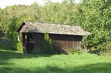
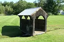
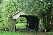
List of non-authentic covered bridges in Vermont
The State of Vermont has the highest number of covered bridges per square mile in the United States. Not surprisingly, replica covered bridges have also been built throughout the state to capture the essence of the historic bridges. Non-authentic covered bridges are those that do not use traditional truss construction. Usually they are built with stringer construction. This list is bound to be incomplete as "backyard bridges", as most of these can be, are not publicized.
Bridge access by the public
The "access" column indicates whether the bridge is publicly accessible or not.
- Public bridges: There are some bridges in this list that are truly public... bridges at parks, etc. Other bridges that are technically privately owned, but on property generally open to the public (condominium projects, hotels, stores, etc.) are also listed as "public". It can be assumed that easy access to these bridges without trespassing is possible.
- Private bridges: Bridges that are definitely privately owned and not open to the public are marked as "private", despite whether or not visitors are welcomed. In the case of these bridges, it is noted (when known) whether they can be seen or accessed from public land (a road) without trespassing.
GPS coordinates
Longitude and latitude coordinates are given when confirmed either by personal observation or satellite imagery.
The list
| Name | County | Location | Built | Length (ft) | Crosses | Access | Coordinates | Photo | Notes |
|---|---|---|---|---|---|---|---|---|---|
| Hemingway | Addison | Granville | 1973 | 20' | unknown stream | Private | |||
| Casey | Addison | Starksboro | 1991 | 16' | Baldwin Brook | Private | |||
| Gilley | Addison | Starksboro | 1991 | 12' | unknown brook | Private | |||
| Little Otter Creek | Addison | Ferrisburgh | 1973 | 16' | Little Otter Creek | Private | 44°10′46.2″N 73°11′43.8″W | ||
| Heath | Addison | Waltham | ? | 11' | pond outlet | Private | 44°08′35″N 73°13′20″W | ||
| Kreffer Crossing | Bennington | Sandgate | 1976 | 39' | Green River on Sandgate Road | Private | |||
| Grace Christian School | Bennington | Bennington | 1979 | 30' | Furnace Brook | Public | 42°53′42″N 73°11′54″W | ||
| Armstrong | Bennington | Bennington | 1985 | 40' | Jewett Brook | Private | |||
| Gregory | Bennington | Manchester | ? | 30' | Unknown brook | Private | |||
| Bennington Covered Bridge Museum | Bennington | Bennington | 2003 | ? | on dry land | Public | This bridge may be authentic since it is at a covered bridge museum. Confirmation needed. | ||
| Bondville Fair | Bennington | Winhall | 2004 | 24' | on dry land | Public | This "bridge" uses Town lattice construction, but it has no floor, so is it really a bridge? | ||
| Jeudevine Falls | Caledonia | Hardwick | 2001 | 24' | brook | Private | 44.548796°N 72.371911°W | ||
| Joe's Pond | Caledonia | West Danville | 1977 | 37' | outlet of Joe's Pond | Public | 44°24′30″N 72°11′42″W | ||
| Riverside Park | Chittenden | Jericho | 1972 | 37' | Browns River | Public | 44°30′59″N 72°56′48″W | ||
| LaRue | Chittenden | Underhill | 1982 | 40' | Browns River | Private | 44°31′01″N 72°55′38″W | ||
| Circus Building | Chittenden | Shelburne | ? | 21' | on a path | Public | at Shelburne Museum, paid admission required | ||
| Potbin | Chittenden | Underhill | ? | 8' | pond outlet | Private | |||
| P&S Country Furniture Barn | Essex | Concord | c1980 | 18' | pond outlet | Public | 44°26′40″N 71°55′04″W | ||
| Jackson | Essex | Lemington | c1970 | 16' | Jones Brook | Private | |||
| Nelson | Essex | Lunenburg | 1990 | 16' | unknown brook | Private | |||
| Beebe | Franklin | St. Albans | 1968 | 17' | pond outlet | Private | 44°47′36″N 73°02′43″W |  | can be seen from the road |
| Mediaway | Franklin | Montgomery | 1981 | 25' | unknown brook | Public(?) | 44°53′07″N 72°32′23″W | Looks to be at a place of business, visible from the road | |
| Sylvester | Franklin | Montgomery | 2000 | 14' | pond outlet | Private | 44.881497°N 72.658795°W | Fairly close to road | |
| Blondin | Franklin | Montgomery | 1996 | 24' | pond outlet | Private | 44°52′28″N 72°39′29″W | Might be able to photograph from the road with a long telephoto lens | |
| Homestead | Franklin | Franklin | 1993 | 17' | unknown brook | Private | |||
| Pont De Columb Un | Franklin | Franklin | 2001 | 16' | unknown brook | Private | 44°59′57″N 72°56′22″W | Not sure which of these two bridges is "Un" and which is "Deux" | |
| Pont De Columb Deux | Franklin | Franklin | 2001 | 16' | unknown brook | Private | 44°59′56″N 72°56′21″W | Both can be seen from the road on the same property | |
| Granger | Franklin | Franklin | 1972 | 16' | unknown brook | Private | |||
| Pattees | Franklin | Enosburg | 1979 | 22' | unknown brook | Private | 44°51′53.1″N 72°45′44.5″W | May be able to photograph from the road with a long telephoto lens | |
| Edward's | Lamoille | Belvidere | ? | ? | brook | Private | 44.737185°N 72.735929°W | ||
| White Caps | Lamoille | Stowe | 1970 | 56' | West Branch of Waterbury River on Brook Road | Public | 44.497104°N 72.745314°W | Entrance to residential area. Concrete deck, but authentic Howe trusses supporting dead load. | |
| Sidewalk | Lamoille | Stowe | 1973 | 150' | Waterbury River on Vermont Route 108 | Public | 44°27′59″N 72°41′17″W | ||
| unknown | Lamoille | Stowe | ? | ? | unknown brook | Private | 44.483134°N 72.663622°W | ||
| Mountain Road Motel | Lamoille | Stowe | 1975 | 15' | unknown brook | Public | 44.473172°N 72.698845°W | ||
| Morse Mill | Lamoille | Cambridge | 1988 | 45' | Brewster River | Private | 44°35′18.3″N 72°47′28.8″W | Can be seen from road | |
| Lynch & Burt | Lamoille | Waterville | 1992 | 12' | unknown brook on Village Green | Public | 44°41′22.5″N 72°46′8.1″W |  | |
| Adair | Lamoille | Waterville | 1987 | 17' | pond inlet | Private | |||
| Gentle Giants Sleigh & Carriage Rides | Lamoille | Stowe | ? | ? | swampy area | Public | 44.49314°N 72.741366°W | ||
| Golden Eagle Resort #1 | Lamoille | Stowe | ? | 8' | unknown brook | Public | |||
| Golden Eagle Resort #2 | Lamoille | Stowe | 1999 | 12' | unknown brook | Public | |||
| Weltman | Lamoille | Morristown | 1972 | 32' | Sterling Brook | Private | |||
| Faith | Lamoille | Waterville | 1998 | 10' | pond outlet | Private | 44°41′11″N 72°46′10″W | can be seen from the road | |
| Kneeland Beauty Salon | Lamoille | Hyde Park | ? | 10' | Unknown brook | Public | |||
| Braley | Orange | Tunbridge | 1990 | 20' | artificial pond | Private | 43°55′19″N 72°24′31″W | may be able to photograph with long telephoto lens not to be confused with the Braley Covered Bridge | |
| Roystan | Orange | Newbury | 1996 | 21' | unnamed brook | Private | |||
| unknown | Orange | Newbury | ? | ? | unnamed brook | Private | 44.092228°N 72.093074°W | ||
| Driscoll | Orange | Fairlee | ? | 8' | pond | Private | |||
| English Rose Inn | Orleans | Westfield | 1973 | 14' | pond outlet | Public | 44°53′16.5″N 72°32′8.6″W | ||
| Auger Sugarmill | Orleans | Barton | 1988 | 40' | Barton River | Private | 44°43′43″N 72°11′11″W | on private road, but may be able to access | |
| St. Onge | Orleans | Lowell | 1988 | 32' | ditch | Private | |||
| Quesnell | Orleans | Lowell | 1999 | 8' | ditch | Private | 44°46′25″N 72°27′25.4″W | easily seen on side of road | |
| Neshobe Golf Club | Rutland | Brandon | 1986 | 39' | Neshobe River | Public | 43°48′39.5″N 73°04′28″W | can be seen from road, might be able walk onto course to get closer? | |
| Borrelli | Rutland | Mount Holly | ? | 16' | pond | Private | |||
| Pat Bailey | Rutland | Pittsford | 2014 | ? | pond | Public | At New England Maple Museum | ||
| Getzinger | Washington | Moretown | ? | ? | unknown brook | Private | 44.222345°N 72.710795°W | ||
| Battleground | Washington | Fayston | 1974 | 51' | Mill Brook | Public | 44°12′03″N 72°53′42″W | entry to condominium complex | |
| Chamberlin | Washington | Northfield | 1956 | 19' | tributary of Stony Brook | Private | 44°08′55″N 72°43′05.5″W |  | easily seen close to road Not to be confused with Chamberlin Covered Bridge |
| Best Western | Washington | Waterbury | 1962 | 50' | mountain stream | Public | 44°20′43″N 72°44′59.2″W | ||
| Floyd Fitch #1 | Washington | Calais | 1962 | 10' | Pekin Brook | Private | |||
| Floyd Fitch #2 | Washington | Calais | 1984 | 12' | Pekin Brook | Private | |||
| Rea | Washington | Calais | 1992 | 13' | ditch | Private | |||
| Santa's Sweetheart | Windham | Putney | 1957 | 29' | unnamed brook | Public | At Santa's Land theme park. | ||
| Santa's Land Railroad | Windham | Putney | 1962 | 18' | unnamed brook | Public | At Santa's Land theme park. | ||
| Santa's Land Swan | Windham | Putney | 1990 | 19' | unnamed brook | Public | At Santa's Land theme park. | ||
| Covered Bridge Lodge | Windham | Dover | 1964 | 38' | Blue Brook | Private | Can be seen from the road | ||
| Grafton Cheese Factory | Windham | Grafton | 1967 | 62' | South Branch Saxtons River | Public | 43°09′59″N 72°36′47″W | ||
| Great American Recreation Cafe | Windham | Wilmington | 1977 | 34' | Bill Brook | Public | 42°54′32″N 72°50′50″W | ||
| Island Properties | Windham | Jamaica | 1989 | 62' | West River | Private? | 43°05′23.5″N 72°46′05.5″W | Was the entrance to an apparently abandoned condominium project... may be private drive now?? | |
| John Tyler Sherwin | Windham | Brattleboro | 1988 | 16' | drainage ditch | Public | At Living Memorial Park | ||
| Dummerston School | Windham | Dummerston | 1994 | 12' | ditch | Public | |||
| Chase | Windham | Brattleboro | 1962 | 16' | unknown brook | Private | |||
| Snow | Windham | Stratton | 1998 | 62' | ski trail | Public | 43°06′40″N 72°55′00″W | Entrance to condominium development | |
| Hermitage Road | Windham | Dover | 2009 | 50' | Cold Brook | Public | 42°55′42″N 72°53′20″W | ||
| Kindle Farm School | Windham | Townshend | 2006 | 17' | ditch | Public | 43°01′11″N 72°39′27.5″W | ||
| Noway Farm | Windsor | Barnard | 1981 | 13' | Gulf Stream | Private | |||
| Seven Cedars Farm | Windsor | Barnard | 1985 | 24' | Pond Brook | Private | 43°45′14″N 72°37′58″W | ||
| Quechee | Windsor | Hartford | 1970 | 85' | Ottauquechee River on Waterman Hill Road | Public | 43.645427°N 72.419059°W | Steel stringer construction. Rebuilt in 2013 after damage caused by Hurricane Irene. | |
| Mill Brook | Windsor | Reading | 2009 | 59' | Mill Brook | Private | 43.48243°N 72.551485°W | ||
| Green Mountain Horse Association | Windsor | Woodstock | 1998 | 6' | dry land | Public | |||
Destroyed by Hurricane Irene
The following bridges were destroyed by Hurricane Irene on August 28, 2011 and removed from this list:
- Giorgetti Covered Bridge formerly in Pittsfield
- Toll Covered Bridge formerly in Dover
- Pickle Barrel Covered Bridge formerly in Sherburne
- Spring Hill Farm Covered Bridge formerly in Barnard
- Seven Cedars Farm formerly in Barnard ( Visited by Dan Brock )
The Giorgetti and Pickle Barrel covered bridges were not destroyed by Hurricane Irene. They still stand today. Source is my visiting these sites after Hurricane Irene. By Dan Brock
Other losses
- The Hayes Covered Bridge formerly in Brookline was removed due to rot in November 2010 and removed from this list.
- The Deer Park Covered Bridge formerly in Bennington is reportedly gone and was removed from this list.