Mộc Châu District
Mộc Châu is a rural district of Sơn La Province in the Northwest region of Vietnam. As of 2013 the district had a population of 104,730.[1] The district covers an area of 1,081.66 km². The district capital lies at Mộc Châu.[1]
Mộc Châu District
Huyện Mộc Châu | |
|---|---|
 View from the Moc Chau Plateau to the Hòa Bình Dam - North Vietnam | |
| Coordinates: 20°55′19″N 104°45′08″E | |
| Country | |
| Region | Northwest |
| Province | Sơn La |
| Capital | Mộc Châu |
| Area | |
| • Total | 417.63 sq mi (1,081.66 km2) |
| Population (2013) | |
| • Total | 104,730 |
| • Density | 250/sq mi (97/km2) |
| Time zone | UTC+7 (UTC + 7) |
Moc Chau is popular with Vietnamese and international tourists for its hill tribes such as White & Black Thai People and Muong People, the green tea hills, Mộc Châu milk, the natural landscape of Dải Yếm waterfalls, Hill Pine and Orchid Garden flowers. It takes five hours driving, with a distance of 200 kilometres (120 mi) from Hanoi to Mộc Châu.
References
- "Districts of Vietnam". Statoids. Retrieved March 13, 2009.
Districts of Northwest Vietnam | ||
|---|---|---|
| Điện Biên Province | 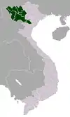 | |
| Hòa Bình Province | ||
| Lai Châu Province | ||
| Lào Cai Province | ||
| Sơn La Province | ||
| Yên Bái Province | ||
※ denotes provincial seat. | ||
This article is issued from Wikipedia. The text is licensed under Creative Commons - Attribution - Sharealike. Additional terms may apply for the media files.