Yên Bái
Yên Bái (![]() listen) is a city in Vietnam. It is the capital of Yên Bái Province, in the north-east region of Vietnam. As of 2018 the district had a population of 125,000.[1] It is one of the important trading hubs between the highlands and the lowlands of Northern Vietnam.
listen) is a city in Vietnam. It is the capital of Yên Bái Province, in the north-east region of Vietnam. As of 2018 the district had a population of 125,000.[1] It is one of the important trading hubs between the highlands and the lowlands of Northern Vietnam.
Yên Bái
Thành phố Yên Bái | |
|---|---|
| Yên Bái City | |
 | |
| |
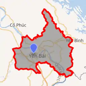
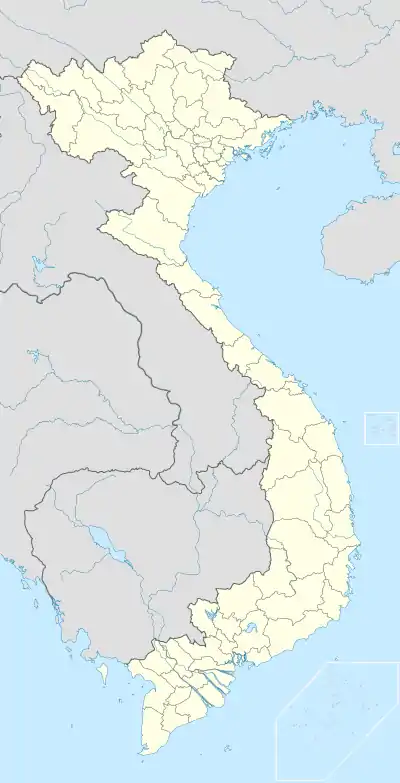 Yên Bái Location of in Vietnam | |
| Coordinates: 21°42′N 104°52′E | |
| Country | |
| Province | Yên Bái |
| Area | |
| • Total | 106.15 km2 (40.98 sq mi) |
| Population (208) | |
| • Total | 125,000 |
| • Density | 1,156/km2 (2,990/sq mi) |
| Website | thanhphoyenbai |
At the end of the sixteenth century Yên Bái was a small village in Bach Lam district, Quy Hoa district, Hung Hoa province. On 11 April 1900 Yen Bai province was established by the French colonialist government. The city grew in size with the opening of the Hanoi–Lào Cai railway, which attracted many migrants.
On 9 February 1930, part of the 4th Regiment of Tonkinese Rifles stationed at Yen Bai mutinied against their French officers in the Yên Bái mutiny. They were suppressed by loyal troops from the same unit. This incident led to widespread disturbances against French rule across northeastern Vietnam during 1930–31.
Administrative divisions
Yên Bái administers 9 wards and 6 rural communes:
- Đồng Tâm
- Hồng Hà
- Hợp Minh
- Minh Tân
- Nam Cường
- Nguyễn Phúc
- Nguyễn Thái Học
- Yên Ninh
- Yên Thịnh
Rural communes:
- Âu Lâu
- Giới Phiên
- Minh Bảo
- Tân Thịnh
- Tuy Lộc
- Văn Phú
Climate
| Climate data for Yên Bái | |||||||||||||
|---|---|---|---|---|---|---|---|---|---|---|---|---|---|
| Month | Jan | Feb | Mar | Apr | May | Jun | Jul | Aug | Sep | Oct | Nov | Dec | Year |
| Record high °C (°F) | 29.6 (85.3) |
34.8 (94.6) |
35.5 (95.9) |
36.9 (98.4) |
40.0 (104.0) |
39.3 (102.7) |
39.8 (103.6) |
39.6 (103.3) |
37.3 (99.1) |
37.2 (99.0) |
33.1 (91.6) |
30.8 (87.4) |
40.0 (104.0) |
| Average high °C (°F) | 19.2 (66.6) |
19.9 (67.8) |
23.0 (73.4) |
27.0 (80.6) |
31.2 (88.2) |
32.5 (90.5) |
32.6 (90.7) |
32.5 (90.5) |
31.5 (88.7) |
28.6 (83.5) |
25.2 (77.4) |
21.7 (71.1) |
27.1 (80.8) |
| Daily mean °C (°F) | 15.7 (60.3) |
16.8 (62.2) |
19.7 (67.5) |
23.5 (74.3) |
26.7 (80.1) |
28.0 (82.4) |
28.1 (82.6) |
27.8 (82.0) |
26.6 (79.9) |
24.1 (75.4) |
20.6 (69.1) |
17.3 (63.1) |
22.9 (73.2) |
| Average low °C (°F) | 13.6 (56.5) |
14.8 (58.6) |
17.8 (64.0) |
21.1 (70.0) |
23.7 (74.7) |
25.0 (77.0) |
25.2 (77.4) |
24.8 (76.6) |
23.6 (74.5) |
21.3 (70.3) |
17.8 (64.0) |
14.5 (58.1) |
20.3 (68.5) |
| Record low °C (°F) | 3.3 (37.9) |
5.1 (41.2) |
6.8 (44.2) |
11.0 (51.8) |
16.8 (62.2) |
18.6 (65.5) |
19.5 (67.1) |
18.3 (64.9) |
16.9 (62.4) |
11.3 (52.3) |
6.8 (44.2) |
2.9 (37.2) |
2.9 (37.2) |
| Average precipitation mm (inches) | 33 (1.3) |
45 (1.8) |
75 (3.0) |
131 (5.2) |
219 (8.6) |
291 (11.5) |
310 (12.2) |
364 (14.3) |
283 (11.1) |
180 (7.1) |
66 (2.6) |
27 (1.1) |
2,024 (79.7) |
| Average precipitation days | 14.9 | 17.2 | 21.2 | 21.2 | 16.9 | 16.8 | 18.8 | 18.4 | 14.3 | 12.4 | 9.4 | 9.1 | 190.6 |
| Average relative humidity (%) | 87.5 | 88.3 | 89.1 | 88.2 | 84.4 | 84.7 | 85.6 | 86.2 | 85.3 | 85.4 | 84.8 | 85.0 | 86.2 |
| Mean monthly sunshine hours | 52 | 39 | 44 | 70 | 149 | 149 | 168 | 178 | 174 | 148 | 121 | 104 | 1,397 |
| Source: Vietnam Institute for Building Science and Technology[2] | |||||||||||||
References
- "Official Website of Yên Bái Province". Vietnam Government. Retrieved December 31, 2015.
- "Vietnam Building Code Natural Physical & Climatic Data for Construction" (PDF). Vietnam Institute for Building Science and Technology. Archived from the original (PDF) on 22 July 2018. Retrieved 3 August 2018.
External links
Districts of Northwest Vietnam | ||
|---|---|---|
| Điện Biên Province | 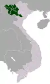 | |
| Hòa Bình Province | ||
| Lai Châu Province | ||
| Lào Cai Province | ||
| Sơn La Province | ||
| Yên Bái Province | ||
※ denotes provincial seat. | ||
