Milperra Bridge
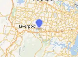
Milperra Bridge is a road bridge that carries Newbridge Road across the Georges River, located between Bankstown and Liverpool, in south-western Sydney, New South Wales, Australia. The bridge is located adjacent to Henry Lawson Drive and the Bankstown Airport; and Newbridge Road serves as a continuation of Canterbury and Milperra Roads.
Milpera Bridge | |
|---|---|
| Coordinates | 33°55′45″S 150°58′44″E |
| Carries | Newbridge Road |
| Crosses | Georges River |
| Locale | Between Bankstown and Liverpool, in south-western Sydney, New South Wales, Australia |
| Named for | Milperra |
| Owner | Roads & Maritime Services |
| Preceded by | Governor Macquarie Drive bridge |
| Followed by | M5 Motorway bridge |
| Characteristics | |
| Design | Pre-stressed concrete |
| Material | Concrete |
| No. of spans | 3 |
| Piers in water | 2 |
| No. of lanes | 7 |
| History | |
| Construction end | 1965 |
| Replaces | Composite truss version (1930) |
| Location | |

| |
History
Prior to the bridge being built, there was no crossing of the Georges River between Moorebank and Milperra, though the road to Canterbury was built up to the east bank. The road over the Liverpool Weir and its later 1894 truss bridge went south east toward Wollongong and Engadine.
There was call for access between the two military settler camps, Moorebank and Milperra, to have access and a punt was proposed in the early 1920s.[1]
The early design by the Main Roads Dept showed a height above water of only 4 metres (12 ft)[2] which was much decried by the locals, advising to the Dept that it be higher for the commercial and sporting interests of the area. The Dept replied with a proposal of 5 metres (17 ft).[3]
After long use, the old narrow bridge was not able to cope with the increase in traffic and was slated for replacement.[4]
The current concrete structure supersedes the earlier truss bridge built circa 1930[5] as a wider and higher crossing of the river.
Milperra Bridge | |
|---|---|
| Coordinates | 33°55′46″S 150°58′44″E |
| Carries | Newbridge Road |
| Crosses | Georges River |
| Other name(s) | Moorebank Bridge[6] |
| Owner | Department of Main Roads |
| Characteristics | |
| Design | Composite truss |
| Material | Timber |
| Total length | 72 metres (237 ft) |
| Width | 6 metres (20 ft)[7] |
| Longest span | 27 metres (90 ft) |
| No. of spans | 6 |
| Piers in water | 5 |
| Clearance below | 5 metres (17 ft) |
| History | |
| Opened | 18 April 1931[8] |
| Collapsed | 1965 |
| Replaced by | Current bridge |
| Location | |

| |
References
- "MEETING AT CHIPPING NORTON". The Cumberland Argus and Fruitgrowers' Advocate. XXXVI (2890). New South Wales, Australia. 2 December 1922. p. 5 – via National Library of Australia.
- "TOO LOW". The Cumberland Argus and Fruitgrowers' Advocate. XL (3576). New South Wales, Australia. 2 September 1929. p. 1 – via National Library of Australia.
- "Will Block Launches". The Biz. New South Wales, Australia. 30 August 1929. p. 7 – via National Library of Australia.
- ""Bottleneck" bridge to go". The Biz (2943). New South Wales, Australia. 14 November 1962. p. 2 – via National Library of Australia.
- "Advertising". The Sydney Morning Herald (28, 753). New South Wales, Australia. 1 March 1930. p. 22 – via National Library of Australia.
"MILPERRA BRIDGE". The Biz. New South Wales, Australia. 28 March 1930. p. 1 – via National Library of Australia. - "NEW GEORGES RIVER BRIDGE". The Biz. New South Wales, Australia. 21 November 1930. p. 6 – via National Library of Australia.
- "Advertising". The Biz. New South Wales, Australia. 1 November 1929. p. 5 – via National Library of Australia.
- "NEW BRIDGE". The Sydney Morning Herald (29, 105). 17 April 1931. p. 12 – via National Library of Australia.