Minden, Iowa
Minden is a city in Pottawattamie County, Iowa, United States. The population was 599 at the 2010 census. It has possessed a post office since 1875.[4]
Minden, Iowa | |
|---|---|
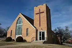 Minden United Church of Christ | |
 Location of Minden, Iowa | |
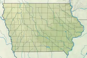 Minden Location within Iowa  Minden Location within the United States | |
| Coordinates: 41°28′1″N 95°32′32″W | |
| Country | |
| State | |
| County | Pottawattamie |
| Township | Minden |
| Area | |
| • Total | 0.45 sq mi (1.17 km2) |
| • Land | 0.45 sq mi (1.15 km2) |
| • Water | 0.01 sq mi (0.01 km2) |
| Elevation | 1,211 ft (369 m) |
| Population | |
| • Total | 599 |
| • Estimate (2019)[3] | 598 |
| • Density | 1,343.82/sq mi (518.75/km2) |
| Time zone | UTC-6 (Central (CST)) |
| • Summer (DST) | UTC-5 (CDT) |
| ZIP code | 51553 |
| Area code(s) | 712 |
| FIPS code | 19-52590 |
| GNIS feature ID | 0459122 |
Geography
Minden is located at 41°28′1″N 95°32′32″W (41.467002, -95.542231).[5]
According to the United States Census Bureau, the city has a total area of 0.43 square miles (1.11 km2), of which 0.42 square miles (1.09 km2) is land and 0.01 square miles (0.03 km2) is water.[6]
Demographics
| Year | Pop. | ±% |
|---|---|---|
| 1890 | 287 | — |
| 1900 | 328 | +14.3% |
| 1910 | 423 | +29.0% |
| 1920 | 381 | −9.9% |
| 1930 | 377 | −1.0% |
| 1940 | 310 | −17.8% |
| 1950 | 328 | +5.8% |
| 1960 | 355 | +8.2% |
| 1970 | 433 | +22.0% |
| 1980 | 483 | +11.5% |
| 1990 | 539 | +11.6% |
| 2000 | 564 | +4.6% |
| 2010 | 599 | +6.2% |
| 2019 | 598 | −0.2% |
| Source:"U.S. Census website". United States Census Bureau. Retrieved 2020-03-29. and Iowa Data Center Source: | ||
2010 census
At the 2010 census there were 599 people, 232 households, and 165 families living in the city. The population density was 1,426.2 inhabitants per square mile (550.7/km2). There were 246 housing units at an average density of 585.7 per square mile (226.1/km2). The racial makeup of the city was 98.7% White, 0.2% African American, 0.2% Native American, 0.5% Asian, and 0.5% from two or more races. Hispanic or Latino of any race were 0.5%.[2]
Of the 232 households 36.2% had children under the age of 18 living with them, 58.2% were married couples living together, 8.2% had a female householder with no husband/wife present, 4.7% had a male householder with no husband/wife present, and 28.9% were non-families. 25.0% of households were one person and 10.8% were one person aged 65 or older. The average household size was 2.58 and the average family size was 3.11.
The median age was 37.3 years. 27.4% of residents were under the age of 18; 6.6% were between the ages of 18 and 24; 27.3% were from 25 to 44; 24% were from 45 to 64; and 14.5% were 65 or older. The gender makeup of the city was 52.8% male and 47.2% female.
2000 census
At the 2000 census there were 564 people, 222 households, and 160 families living in the city. The population density was 1,603.3 people per square mile (622.2/km2). There were 236 housing units at an average density of 670.9 per square mile (260.3/km2). The racial makeup of the city was 99.82% White, 0.18% from other races. Hispanic or Latino of any race were 0.53%.[8]
Of the 222 households 34.7% had children under the age of 18 living with them, 62.2% were married couples living together, 5.9% had a female householder with no husband present, and 27.9% were non-families. 23.0% of households were one person and 13.1% were one person aged 65 or older. The average household size was 2.54 and the average family size was 2.99.
The age distribution was 27.8% under the age of 18, 6.7% from 18 to 24, 27.8% from 25 to 44, 22.7% from 45 to 64, and 14.9% 65 or older. The median age was 36 years. For every 100 females, there were 95.2 males. For every 100 females age 18 and over, there were 95.7 males.
The median household income was $42,054 and the median family income was $49,583. Males had a median income of $30,809 versus $22,813 for females. The per capita income for the city was $19,048. About 2.6% of families and 5.9% of the population were below the poverty line, including 6.4% of those under age 18 and 7.4% of those age 65 or over.
References
- "2019 U.S. Gazetteer Files". United States Census Bureau. Retrieved July 17, 2020.
- "U.S. Census website". United States Census Bureau. Retrieved 2012-05-11.
- "Population and Housing Unit Estimates". United States Census Bureau. May 24, 2020. Retrieved May 27, 2020.
- Post Offices in Pottawattamie County, Iowa
- "US Gazetteer files: 2010, 2000, and 1990". United States Census Bureau. 2011-02-12. Retrieved 2011-04-23.
- "US Gazetteer files 2010". United States Census Bureau. Archived from the original on 2012-01-25. Retrieved 2012-05-11.
- "Census of Population and Housing". Census.gov. Retrieved June 4, 2015.
- "U.S. Census website". United States Census Bureau. Retrieved 2008-01-31.
Metropolitan area of Omaha–Council Bluffs | ||||||
|---|---|---|---|---|---|---|
| Primary cities |
|  | ||||
| Cities over 10,000 (per 2010 Census) |
| |||||
| Cities of 5,000 to 10,000 (per 2010 Census) |
| |||||
| Cities of 1,000 to 5,000 (per 2010 Census) |
| |||||
| Census-designated places |
| |||||
| Cities and villages of fewer than 1,000 (per 2010 Census) |
| |||||
| Counties |
| |||||
Municipalities and communities of Pottawattamie County, Iowa, United States | ||
|---|---|---|
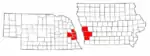
| Cities | Map of Iowa highlighting Pottawattamie County | |
| Townships | ||
| CDPs | ||
| Other community | ||
| Footnotes | ‡This populated place also has portions in an adjacent county or counties | |
| ||