Sarpy County, Nebraska
Sarpy County is a county located in the U.S. state of Nebraska. As of the 2010 United States Census, the population was 158,840,[1] making it the third-most populous county in Nebraska.[2] Its county seat is Papillion.[3]
Sarpy County | |
|---|---|
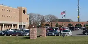 Sarpy County Courthouse in Papillion | |
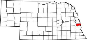 Location within the U.S. state of Nebraska | |
 Nebraska's location within the U.S. | |
| Coordinates: 41°07′N 96°07′W | |
| Country | |
| State | |
| Founded | 1 February 1857 |
| Named for | Peter A. Sarpy |
| Seat | Papillion |
| Largest city | Bellevue |
| Area | |
| • Total | 248 sq mi (640 km2) |
| • Land | 239 sq mi (620 km2) |
| • Water | 8.5 sq mi (22 km2) 3.4%% |
| Population | |
| • Estimate (2019) | 187,196 |
| • Density | 772/sq mi (298/km2) |
| Time zone | UTC−6 (Central) |
| • Summer (DST) | UTC−5 (CDT) |
| Congressional districts | 1st, 2nd |
| Website | www |
Sarpy County is part of the Omaha-Council Bluffs, NE-IA Metropolitan Statistical Area.[4]
History
This was part of the territory of the Omaha people. Explored in 1805 by the Lewis and Clark expedition following the Louisiana Purchase of 1803 by the United States, this area was settled by European-American fur traders, adventurers, farmers, and finally entrepreneurs. All initially depended on the Missouri River as a main transportation corridor and source of water. Sarpy County has served as the springboard for Nebraska's settlement and expansion. The county is named for Colonel Peter Sarpy,[5] an early fur trader at Fontenelle's Post in the Bellevue area in the 1840s. He also had Sarpy's post in what became Decatur; Sarpy died in Plattsmouth in 1865.
The area of present Sarpy County was a part of Douglas County until 1 February 1857, when the Territorial Legislature partitioned off that county's southern half and proclaimed it a separate organization.[6]
The Omaha people were forced onto a reservation in the 19th century, losing most of their land to the United States who then opened it for settlement by non-Native Americans who were U.S. citizens or immigrants from certain (mostly European) countries.
Fort Crook, the U.S. Army post south of Bellevue, was established in the 1890s and added Offutt Field in the 1920s. Its Glenn L. Martin Bomber Plant produced over two thousand aircraft during World War II, including the notable B-29's Enola Gay and Bockscar. Offutt Air Force Base was the headquarters of the Strategic Air Command (SAC) during the Cold War and continues as the home of U.S. Strategic Command.
In the Nebraska license plate system, Sarpy County was represented by the prefix "59" (it had the 59th largest number of vehicles registered in the county when the license plate system was established in 1922). Many license plates issued in Sarpy County featured the stacked format of the 59 code. The county, just south of Omaha, had grown significantly in population in the decades following 1922 and therefore required five characters rather than the four allowed by a standard double-digit county code. In 2002, the state discontinued the 1922 system in Sarpy as well as Douglas and Lancaster counties.
Geography
Sarpy County is bounded on the east by the Missouri River; on the south and west by the Platte River. The county's terrain consists of low rolling hills, cut by several small gullies and drainages that move groundwater to one of these rivers.[7] The county has a total area of 248 square miles (640 km2), of which 239 square miles (620 km2) is land and 8.5 square miles (22 km2) (3.4%) is water.[8] Sarpy is the smallest of Nebraska's 93 counties.
Major highways
Adjacent counties
- Douglas County - north
- Pottawattamie County, Iowa - northeast
- Mills County, Iowa - southeast
- Cass County - south
- Saunders County - west
Demographics
| Historical population | |||
|---|---|---|---|
| Census | Pop. | %± | |
| 1860 | 1,201 | — | |
| 1870 | 2,913 | 142.5% | |
| 1880 | 4,481 | 53.8% | |
| 1890 | 6,875 | 53.4% | |
| 1900 | 9,080 | 32.1% | |
| 1910 | 9,274 | 2.1% | |
| 1920 | 9,370 | 1.0% | |
| 1930 | 10,402 | 11.0% | |
| 1940 | 10,835 | 4.2% | |
| 1950 | 15,693 | 44.8% | |
| 1960 | 31,281 | 99.3% | |
| 1970 | 63,696 | 103.6% | |
| 1980 | 86,015 | 35.0% | |
| 1990 | 102,583 | 19.3% | |
| 2000 | 122,595 | 19.5% | |
| 2010 | 158,840 | 29.6% | |
| 2019 (est.) | 187,196 | [13] | 17.9% |
| US Decennial Census[14] 1790-1960[15] 1900-1990[16] 1990-2000[17] 2010-2019[1] | |||
As of the 2010 United States Census, there were 158,835 people and 69,851 households. The population density was 664 people per square mile (197/km2). There were 69,023 housing units at an average density of 289 per square mile (111/km2). The racial makeup of the county was 89.0% White, 4.4% Black or Black or African American, 0.7% Native American, 2.60% Asian, 0.1% Native Hawaiian and Pacific Islander, and 3.20% from two or more races . 9.4% of the population were Hispanic or Latino of any race.
As of the 2000 United States Census, there were 122,595 people, 43,426 households, and 33,220 families in the county. The population density was 510 people per square mile (197/km2). There were 44,981 housing units at an average density of 187 per square mile (72/km2). The racial makeup of the county was 89.18% White, 4.36% Black or African American, 0.42% Native American, 1.90% Asian, 0.09% Pacific Islander, 1.86% from other races, and 2.20% from two or more races. 4.37% of the population were Hispanic or Latino of any race.
There were 43,426 households, out of which 43.00% had children under the age of 18 living with them, 63.80% were married couples living together, 9.60% had a female householder with no husband present, and 23.50% were non-families. 18.40% of all households were made up of individuals, and 4.70% had someone living alone who was 65 years of age or older. The average household size was 2.79 and the average family size was 3.21.
The county population contained 30.50% under the age of 18, 9.40% from 18 to 24, 33.80% from 25 to 44, 19.70% from 45 to 64, and 6.60% who were 65 years of age or older. The median age was 32 years. For every 100 females there were 98.80 males. For every 100 females age 18 and over, there were 96.20 males.
The median income for a household in the county was $53,804, and the median income for a family was $59,723. Males had a median income of $37,230 versus $26,816 for females. The per capita income for the county was $21,985. About 3.10% of families and 4.20% of the population were below the poverty line, including 5.30% of those under age 18 and 3.30% of those age 65 or over.
Government and infrastructure
The Sarpy County Sheriff's Department is responsible for enforcing the law within the unincorporated areas of the county. By contract, the department is also responsible for enforcing the law within the city limits of Gretna and Springfield. The cities of Bellevue, La Vista, and Papillion have their own City Police Departments which are primarily responsible for law enforcement within their respective city limits. The Sheriff's Department has secondary responsibility for law enforcement within these three cities, providing essentials such as backup support.
The Sarpy County Law Enforcement Center, built in 1989, is located within the campus of the Sarpy County Courthouse in Papillion. It houses the county's jail facility and the Sarpy County Public Defender's Office. The Bellevue and LaVista City Police Departments also have their own holding cells. The county jail was designed to hold 148 people, but the facility frequently holds more than that number.[18] Fire protection and emergency medical services are provided by a mix of seven full-career, part-time paid, military, and all-volunteer fire departments, representing various municipalities within the county, plus Offutt Air Force Base.
Politics
Sarpy County voters have generally voted Republican in national politics. In only one national election since 1948 has the county selected the Democratic Party candidate (as of 2020). Since 1964, only two Democrats - Barack Obama in 2008 and Joe Biden in 2020 have received at least 40 percent of the county's vote. From 1968 to 2016, Republicans always carried Sarpy County by at least 21 points with the exception of a slight drop to 16 points in 2008. However, in 2020, Republican candidate Donald Trump beat Biden only by 11 points, a 60-year low for a winning Republican candidate.
As of December 2020, Republicans hold a plurality in the county voter registation.[19]
| Democratic | Republican | Libertarian | Non-Partisan | Total |
|---|---|---|---|---|
| 33,172 (27.14%) | 54,133 (44.3%) | 2,217 (1.81%) | 32,687 (26.75%) | 122,209 (100%) |
| Year | Republican | Democratic | Third Parties |
|---|---|---|---|
| 2020 | 54.0% 51,979 | 42.8% 41,206 | 3.1% 3,008 |
| 2016 | 56.0% 45,143 | 34.8% 28,033 | 9.2% 7,404 |
| 2012 | 60.5% 43,213 | 37.3% 26,671 | 2.3% 1,606 |
| 2008 | 57.1% 38,816 | 41.2% 28,010 | 1.8% 1,196 |
| 2004 | 68.9% 40,163 | 29.9% 17,455 | 1.2% 716 |
| 2000 | 64.0% 28,979 | 32.3% 14,637 | 3.7% 1,662 |
| 1996 | 57.7% 23,023 | 32.1% 12,806 | 10.2% 4,048 |
| 1992 | 50.4% 20,516 | 26.4% 10,741 | 23.2% 9,416 |
| 1988 | 64.5% 20,192 | 35.0% 10,947 | 0.5% 146 |
| 1984 | 74.3% 20,192 | 25.2% 6,838 | 0.5% 130 |
| 1980 | 67.0% 15,552 | 24.5% 5,689 | 8.5% 1,961 |
| 1976 | 60.4% 11,917 | 37.5% 7,385 | 2.1% 414 |
| 1972 | 74.7% 11,514 | 25.3% 3,904 | |
| 1968 | 52.5% 6,019 | 30.6% 3,506 | 17.0% 1,945 |
| 1964 | 44.2% 4,418 | 55.8% 5,581 | |
| 1960 | 55.3% 4,672 | 44.7% 3,777 | |
| 1956 | 60.5% 3,826 | 39.5% 2,501 | |
| 1952 | 59.1% 3,649 | 40.9% 2,529 | |
| 1948 | 47.3% 2,367 | 52.7% 2,635 | |
| 1944 | 49.9% 2,641 | 50.1% 2,654 | |
| 1940 | 46.0% 2,165 | 54.0% 2,537 | |
| 1936 | 33.8% 1,569 | 65.2% 3,030 | 1.1% 50 |
| 1932 | 26.5% 1,148 | 71.9% 3,112 | 1.6% 69 |
| 1928 | 51.0% 2,011 | 48.2% 1,900 | 0.7% 29 |
| 1924 | 38.9% 1,411 | 34.3% 1,247 | 26.8% 973 |
| 1920 | 59.8% 1,662 | 36.9% 1,027 | 3.3% 91 |
| 1916 | 39.2% 885 | 58.5% 1,320 | 2.4% 53 |
| 1912 | 22.5% 404 | 47.8% 857 | 29.7% 532 |
| 1908 | 44.1% 912 | 52.7% 1,090 | 3.2% 67 |
| 1904 | 53.7% 998 | 36.3% 675 | 10.0% 186 |
| 1900 | 41.1% 792 | 56.5% 1,090 | 2.4% 46 |
| 1896 | 35.2% 674 | 61.7% 1,183 | 3.1% 59 |
| 1892 | 39.2% 582 | 23.6% 351 | 37.2% 553 |
| 1888 | 41.0% 658 | 54.5% 875 | 4.5% 72 |
| 1884 | 49.3% 616 | 48.8% 610 | 1.8% 23 |
| 1880 | 47.9% 491 | 50.3% 516 | 1.9% 19 |
Communities
Cities
- Bellevue
- Gretna
- La Vista
- Papillion (county seat)
- Springfield
Census-designated places
Census divisions
Sarpy County is divided into the following divisions, called precincts, except for the City of Bellevue.
- City of Bellevue
- Bellevue Second I
- Bellevue Second II
- Bellevue Second III
- Bellevue Second IV
- Fairview
- Forest City No. 1
- Forest City No. 2
- Gilmore I
- Gilmore II
- Highland I
- Highland II
- LaPlatte I
- LaPlatte II
- La Vista
- Melia-Forest City
- Papillion
- Papillion Second I
- Papillion Second II
- Platford-Springfield I
- Platford-Springfield II
- Richland I
- Richland II
- Richland III
- Richland IV
- Richland V
- Richland VI
- Richland VII
- Richland VIII
- Springfield
References
- "State & County QuickFacts". United States Census Bureau. Retrieved October 28, 2014.
- According to 2019 estimates issued by US Census Bureau Sarpy County remains in third place. Douglas, Lancaster, and Sarpy are the only Nebraska counties in that estimate to have populations that exceed 100,000 persons.
- "Find a County". National Association of Counties. Retrieved 7 June 2011.
- United States Office of Management and Budget. "Update of Statistical Area Definitions and Guidance on Their Uses" (PDF). pp. 5, 36. Archived from the original (PDF) on May 14, 2006. Retrieved 21 July 2006.
- Burr, George L. (1921). History of Hamilton and Clay Counties, Nebraska, Vol. 1. S.J. Clarke Pub. Co. p. 136.
- Sarpy County - Part I (accessed 27 January 2019)
- Sarpy County NE Google Maps (accessed 27 January 2019)
- "2010 Census Gazetteer Files". US Census Bureau. August 22, 2012. Archived from the original on November 13, 2013. Retrieved December 11, 2014.
- Chalco Hills Recreation Area Google Maps (accessed 27 January 2019)
- Fontenelle Forest Nature Center Google Maps (accessed 27 January 2019)
- Gifford Point WMA Google Maps (accessed 27 January 2019)
- Walnut Creek NE Google Maps (accessed 27 January 2019
- "Population and Housing Unit Estimates". Retrieved May 21, 2020.
- "US Decennial Census". US Census Bureau. Retrieved December 11, 2014.
- "Historical Census Browser". University of Virginia Library. Retrieved December 11, 2014.
- "Population of Counties by Decennial Census: 1900 to 1990". US Census Bureau. Retrieved December 11, 2014.
- "Census 2000 PHC-T-4. Ranking Tables for Counties: 1990 and 2000" (PDF). US Census Bureau. Retrieved December 11, 2014.
- County Jail is short on space
- "2020 Eligible Voter Statistics" (PDF). Nebraska Secretary of State. December 1, 2020.
- Election Results
External links
| Wikimedia Commons has media related to Sarpy County, Nebraska. |
- Sarpy County Nebraska Website
- Sarpy County Chamber of Commerce
- Sarpy County Museum
- Sarpy County Tourism
Places adjacent to Sarpy County, Nebraska | ||||||||||
|---|---|---|---|---|---|---|---|---|---|---|
| ||||||||||
Municipalities and communities of Sarpy County, Nebraska, United States | ||
|---|---|---|
| Cities | Map of Nebraska highlighting Sarpy County | |
| CDPs | ||
| Other unincorporated communities | ||
| ||
Metropolitan area of Omaha–Council Bluffs | ||||||
|---|---|---|---|---|---|---|
| Primary cities |
|  | ||||
| Cities over 10,000 (per 2010 Census) |
| |||||
| Cities of 5,000 to 10,000 (per 2010 Census) |
| |||||
| Cities of 1,000 to 5,000 (per 2010 Census) |
| |||||
| Census-designated places |
| |||||
| Cities and villages of fewer than 1,000 (per 2010 Census) |
| |||||
| Counties |
| |||||

| Authority control |
|---|