Mirpur District
The Mirpur District (Urdu: ضلع میرپور) is one of the 10 districts of Pakistan's dependent territory of Azad Kashmir.[1]The Mirpur District is bounded on the north by the Kotli District, on th east by the Bhimber District, on the south by the Gujrat District of Pakistan's Punjab Province, on the south-west by the Jhelum District of Pakistan's Punjab Province, and on the west by Rawalpindi District of Pakistan's Punjab Province.The district is named after its main city, Mirpur. The Mirpur District has a population of 456,200[2] and covers an area of 1,010 km2 (390 sq mi). The district is mainly mountainous with some plains. Its hot, dry climate and other geographical conditions closely resemble those of the Gujrat District and the Jhelum District, the adjoining districts of Pakistan's Punjab Province.
Mirpur District
ضلع میرپور | |
|---|---|
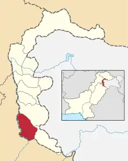 Map of Azad Kashmir with the Mirpur District highlighted in red | |
| Sovereign state | |
| Dependent territory | |
| Division | Mirpur Division |
| Headquarters | Mirpur |
| Area | |
| • Total | 1,010 km2 (390 sq mi) |
| Population (2017) | |
| • Total | 456,200 |
| • Density | 452/km2 (1,170/sq mi) |
| Number of tehsils | 2 |
History
.svg.png.webp)
(The Mirpur Division is roughly coterminus with the pre-1947 Mirpur District.)
During the British Raj, the Mirpur District was one of the five districts of the Jammu Province in the princely state of Jammu and Kashmir.[3][4] According to the 1941 census, the it had a population of 386,655, roughly 80% of whom were Muslim and 16% of whom were Hindu.[5] It consisted of three tehsils: the Bhimber Tehsil, the Kotli Tehsil, and the Mirpur Tehsil.[6] The Bhimber Tehsil and the Kotli Tehsil were subsequently elevated to district status. The three districts presently constitute the Mirpur Division of Azad Kashmir. Small portions of the former Mirpur District were included in the Rajouri District of Indian-administered Jammu and Kashmir.
The original Mirpur District, along with the Poonch District and the Rajouri District, had close geographic, ethnic, and cultural ties with the West Punjab area, more so than with the city of Jammu and the rest of the Jammu Province. Due to those reasons, scholar Christopher Snedden stated that the people of Mirpur area had a strong desire to join Pakistan during the partition.[7]
In November 1947, the Mirpur District was the site of the Mirpur Massacre, where many Hindus, Sikhs, and refugees from the partition, were killed by armed Pakistani tribesmen and soldiers.[8]
Language and ethnicity
There is considerable ambiguity surrounding the name of the local language:[9] its speakers call it variously Pahari, Mirpur Pahari, Mirpuri, and Pothwari,[10] while some label it as Punjabi.[11] Sociolinguists have regarded it as one of the three major dialects of the Pahari-Pothwari language complex,[12] which is intermediate between Lahnda and Punjabi.[13] Mirpur Pahari is mutually intelligible with the other two major dialects – Pothwari of the Potohar Plateau in the Punjab Province and the Pahari spoken to the north in Azad Kashmir and around Murree – and shares with them between 77% and 84% of its basic vocabulary,[14] although the difference with the northernmost varieties (in Muzaffarabad) is sufficient to impede understanding.[15] Mirpuri speakers have a strong sense of Kashmiri identity that takes precedence over linguistic identification with closely related groups outside of Azad Kashmir.[16] Another language spoken in the Mirpur District is Gujari. The local dialect is closely related to the Gujari varieties spoken in the rest of Azad Kashmir and in the Hazara region.[17] Other languages spoken include Urdu and English.
Villages
Dadyal Tehsil
- Amb
- Ankar Raajgan
- Chak Ghayan
- Chalayar
- Chattroh
- Haveli Baghal
- Kathar Dilawar
- Mandi
- Mohra Malkan
- Mohra Sher Shah
- Rajoa
- Ratta
- Sahalia
- Siakh Pahaith
- Thalarajwali Khan
- Thub Jagir
Mirpur Tehsil
- Abdulahpur
- Afzalpur
- Andrah Kalan
- Arah Jagir
- Bajjar
- Ballah
- Banni
- Bongdawara
- Burjan
- Chabrian Dattan
- Chak Haryam
- Chak Sagar
- Chakswari
- Chandral
- Chatan
- Chechian
- Chitterpari
- Dalyala
- Dheri Thothal
- Ghaseetpur Awan
- Ghaseetpur Sohalian
- Gorsian
- Islamgarh
- Jangian Kotla
- Jatlan
- Kakra
- Kalyal Bhainsi
- Kas Kalyal
- Khaliqabad
- Khari Sharif
- Khokhar
- Kot Qandu khan
- Mankarah
- Mehmunpur
- Mirpur New City
- Mora Loharan
- Mora Rakhyal
- Mora Rathyan
- Mori
- Nagial
- Nawan Garan
- Pakhral
- Palyala
- Pindi Subherwal
- Potha Bainsi
- Raipur
- Rathoa
- Sahang
- Saleemabad
- Sukhchainpur
- Tariqabaxd
References
- - Government Website
- "Census 2017: AJK population rises to over 4m". The Nation. Retrieved 2017-09-01.
- Karim, Kashmir The Troubled Frontiers 2013, pp. 29-32.
- Behera, Demystifying Kashmir 2007, p. 15.
- Snedden 2001, p. 118.
- Snedden 2001, p. 112.
- Snedden 2001, p. 120.
- https://www.jammukashmirnow.com/Encyc/2019/11/25/25-November-1947-Mirpur-massacre-An-ill-fated-day-that-reminds-us-of-injustice-and-infringement-brutality-and-bloodshed.html
- Lothers & Lothers 2010, p. 100.
- Lothers & Lothers 2010, pp. 2–3, 5, 19, 100.
- Lothers & Lothers 2010, p. 44.
- Lothers & Lothers 2010, p. 2.
- Shackle 1979, p. 201.
- Lothers & Lothers 2010, pp. 2, 24.
- Lothers & Lothers 2010, p. 86.
- Shackle 2007, p. 114.
- Hallberg & O'Leary 1992, pp. 111–12. The variety surveyed is from Kotli, to the north of Mirpur District
- "Tehsils of Mirpur District on AJK map". ajk.gov.pk. AJK Official Portal. Retrieved 18 November 2019.
Bibliography
- Behera, Navnita Chadha (2007), Demystifying Kashmir, Pearson Education India, ISBN 8131708462
- Hallberg, Calinda E.; O'Leary, Clare F. (1992). "Dialect Variation and Multilingualism among Gujars of Pakistan". In O'Leary, Clare F.; Rensch, Calvin R.; Hallberg, Calinda E. (eds.). Hindko and Gujari. Sociolinguistic Survey of Northern Pakistan. Islamabad: National Institute of Pakistan Studies, Quaid-i-Azam University and Summer Institute of Linguistics. pp. 91–196. ISBN 969-8023-13-5.
- Karim, Maj Gen Afsir (2013), Kashmir The Troubled Frontiers, Lancer Publishers LLC, pp. 29–32, ISBN 978-1-935501-76-3
- Lothers, Michael; Lothers, Laura (2010). Pahari and Pothwari: a sociolinguistic survey (Report). SIL Electronic Survey Reports. 2010–012.
- Shackle, Christopher (1979). "Problems of classification in Pakistan Panjab". Transactions of the Philological Society. 77 (1): 191–210. doi:10.1111/j.1467-968X.1979.tb00857.x. ISSN 0079-1636.
- Shackle, Christopher (2007). "Pakistan". In Simpson, Andrew (ed.). Language and national identity in Asia. Oxford linguistics Y. Oxford University Press. ISBN 978-0-19-922648-1.
- Snedden, Christopher (2001), "What happened to Muslims in Jammu? Local identity, '"the massacre" of 1947' and the roots of the 'Kashmir problem'", South Asia: Journal of South Asian Studies, 24 (2): 111–134, doi:10.1080/00856400108723454
- Snedden, Christopher (2013) [first published as The Untold Story of the People of Azad Kashmir, 2012], Kashmir: The Unwritten History, HarperCollins India, ISBN 9350298988
Provincial capital: Muzaffarabad | ||
| Muzaffarabad | 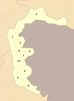 | |
| Poonch | ||
| Mirpur | ||