NP postcode area
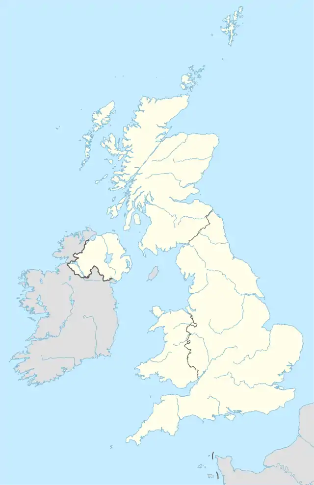
The NP postcode area, also known as the Newport postcode area,[2] is a group of eighteen postcode districts, which are subdivisions of fourteen post towns. These cover south-east Wales, including Newport, Pontypool, Abergavenny, Monmouth, Chepstow, Abertillery, Usk, Tredegar, New Tredegar, Ebbw Vale, Crickhowell, Blackwood, Caldicot and Cwmbran, plus a small part of the English counties of Gloucestershire and Herefordshire.
Newport | |
|---|---|
 NP | |
| Coordinates: 51.685°N 3.019°W | |
| Country | United Kingdom |
| Postcode area | NP |
| Postcode area name | Newport |
| Post towns | 14 |
| Postcode districts | 25 |
| Postcode sectors | 142 |
| Postcodes (live) | 13,698 |
| Postcodes (total) | 30,399 |
| Statistics as at May 2020[1] | |
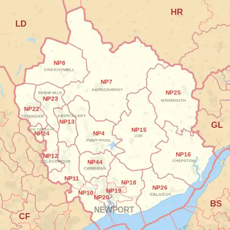
Coverage
The approximate coverage of the postcode districts:
| Postcode district | Post town | Coverage | Local authority area(s) |
|---|---|---|---|
| NP4 | PONTYPOOL | Pontypool, Blaenavon, Little Mill, Griffithstown, parts of Glascoed | Torfaen, Monmouthshire |
| NP7 | ABERGAVENNY | Abergavenny | Monmouthshire, Herefordshire |
| NP8 | CRICKHOWELL | Crickhowell , Ffawyddog | Powys |
| NP10 | NEWPORT | Western Newport, including Bassaleg, Duffryn, Rogerstone | Newport |
| NP11 | NEWPORT | North-western Newport, including: Abercarn, Crumlin, Cwmfelinfach, Risca, Ynysddu | Caerphilly |
| NP12 | BLACKWOOD | Blackwood, Pontllanfraith, Wyllie | Caerphilly |
| NP13 | ABERTILLERY | Abertillery | Blaenau Gwent |
| NP15 | USK | Usk, Raglan | Monmouthshire |
| NP16 | CHEPSTOW | Chepstow, Sedbury, Beachley | Monmouthshire, Forest of Dean |
| NP18 | NEWPORT | Eastern Newport, including Caerleon, Langstone, Llanwern, Nash, Llandegveth Underwood | Newport, Monmouthshire, Torfaen |
| NP19 | NEWPORT | Eastern and East Central Newport, including: Beechwood, Maindee, St. Julians, Ringland | Newport |
| NP20 | NEWPORT | Western and West Central Newport, including: City centre, Pill, Maesglas, Crindau, Malpas, Bettws | Newport |
| NP22 | TREDEGAR | Tredegar, Rhymney | Blaenau Gwent, Caerphilly |
| NP23 | EBBW VALE | Ebbw Vale, Brynmawr, Cwm | Blaenau Gwent |
| NP24 | NEW TREDEGAR | New Tredegar | Caerphilly |
| NP25 | MONMOUTH | Monmouth, Wyesham, Redbrook, Welsh Newton | Monmouthshire, Forest of Dean, Herefordshire |
| NP26 | CALDICOT | Caldicot, Magor, Newport | Monmouthshire, Newport |
| NP44 | CWMBRAN | Cwmbran | Torfaen |
Map
References
- "ONS Postcode Directory Version Notes" (ZIP). National Statistics Postcode Products. Office for National Statistics. May 2020. Table 2. Retrieved 19 June 2020. Coordinates from mean of unit postcode points, "Code-Point Open". OS OpenData. Ordnance Survey. February 2012. Retrieved 21 April 2012.
- Royal Mail, Address Management Guide, (2004)
External links
This article is issued from Wikipedia. The text is licensed under Creative Commons - Attribution - Sharealike. Additional terms may apply for the media files.