BD postcode area
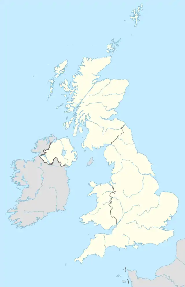
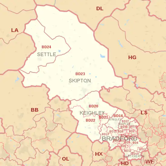
The BD postcode area, also known as the Bradford postcode area,[2] is a group of 24 postcode districts in England, within seven post towns. These cover northwestern West Yorkshire (including Bradford, Bingley, Shipley, Cleckheaton and Keighley) and southwestern North Yorkshire (including Skipton and Settle), plus very small parts of Lancashire.
Bradford | |
|---|---|
 BD | |
| Coordinates: 53.832°N 1.836°W | |
| Country | United Kingdom |
| Postcode area | BD |
| Postcode area name | Bradford |
| Post towns | 7 |
| Postcode districts | 27 |
| Postcode sectors | 112 |
| Postcodes (live) | 16,979 |
| Postcodes (total) | 23,359 |
| Statistics as at May 2020[1] | |
Coverage
The approximate coverage of the postcode districts:
| Postcode district | Post town | Coverage | Local authority area(s) |
|---|---|---|---|
| BD1 | BRADFORD | Bradford City Centre, Little Germany, Goitside, Independent Quarter, West End, City Park | Bradford |
| BD2 | BRADFORD | Eccleshill, Five Lane Ends, parts of Undercliffe, Fagley, Bolton Woods, Poplars Farm, Swain House, Ashbourne, High House, Grove House | Bradford |
| BD3 | BRADFORD | Barkerend, Bradford Moor, Thornbury, Eastbrook, Pollard Park, parts of, Laisterdyke, Undercliffe, Wapping | Bradford, Leeds |
| BD4 | BRADFORD | Bierley, East Bowling, East Bierley, Laisterdyke, Tong, Tong Street, Holme Wood, Dudley Hill, Tyersal, Swaine Green, Cutler Heights, Tong Village | Bradford, Leeds |
| BD5 | BRADFORD | Bankfoot, Little Horton, West Bowling, Canterbury, Marshfields, Ripleyville, | Bradford |
| BD6 | BRADFORD | Buttershaw, Wibsey, Woodside, Westwood Park, Odsal, Staithgate, parts of Horton Bank Top (Cooperville) | Bradford |
| BD7 | BRADFORD | Great Horton, Lidget Green, Scholemoor, Horton Bank Top, Horton Grange | Bradford |
| BD8 | BRADFORD | Manningham, Girlington, White Abbey, Lower Grange, Four Lane Ends, Whetley, Longlands, West Park, Rhodesway, Crossley Hall, Belle Vue | Bradford |
| BD9 | BRADFORD | Frizinghall, Emman Lane,Heaton, Daisy Hill, Haworth Road Estate, Chellow Heights, Chellow Grange | Bradford |
| BD10 | BRADFORD | Apperley Bridge, parts of Eccleshill, Greengates, Idle, Ravenscliffe, Thackley, Thorpe Edge. | Bradford, Leeds |
| BD11 | BRADFORD | Birkenshaw, Drighlington | Kirklees, Leeds |
| BD12 | BRADFORD | Low Moor, Oakenshaw, Wyke, Lower Wyke, Delph Hill | Bradford, Kirklees |
| BD13 | BRADFORD | Cullingworth, Clayton Heights Denholme, Queensbury, Thornton, School Green | Bradford |
| BD14 | BRADFORD | Clayton | Bradford |
| BD15 | BRADFORD | Allerton, Norr, Wilsden, Sandy Lane | Bradford |
| BD16 | BINGLEY | Bingley, Cottingley, Eldwick, Harden | Bradford |
| BD17 | SHIPLEY | Baildon, Shipley | Bradford |
| BD18 | SHIPLEY | Saltaire, Shipley, Windhill, Wrose | Bradford |
| BD19 | CLECKHEATON | Cleckheaton, Gomersal, Scholes | Kirklees |
| BD20 | KEIGHLEY | Cononley, Cross Hills, Glusburn, Kildwick, Silsden, Steeton, Sutton-in-Craven | Bradford, Craven |
| BD21 | KEIGHLEY | Hainworth, Keighley | Bradford |
| BD22 | KEIGHLEY | Cowling, Haworth, Oakworth, Oxenhope, Cross Roads | Bradford |
| BD23 | SKIPTON | Carleton-in-Craven, Embsay, Gargrave, Grassington, Hebden, Hellifield, Horton, Kettlewell, Kirkby Malham, Skipton, Threshfield, Tosside | Craven, Harrogate, Ribble Valley |
| BD24 | SETTLE | Giggleswick, Horton in Ribblesdale, Settle | Craven |
| BD97 | BINGLEY | non-geographic | |
| BD98 | BRADFORD, SHIPLEY | non-geographic | |
| BD99 | BRADFORD | Euroway Trading Estate M606 | non-geographic |
Map
References
- "ONS Postcode Directory Version Notes" (ZIP). National Statistics Postcode Products. Office for National Statistics. May 2020. Table 2. Retrieved 19 June 2020. Coordinates from mean of unit postcode points, "Code-Point Open". OS OpenData. Ordnance Survey. February 2012. Retrieved 21 April 2012.
- Royal Mail, Address Management Guide, (2004)
External links
This article is issued from Wikipedia. The text is licensed under Creative Commons - Attribution - Sharealike. Additional terms may apply for the media files.
