National Register of Historic Places listings in Adams County, Mississippi
This is a list of the National Register of Historic Places listings in Adams County, Mississippi.
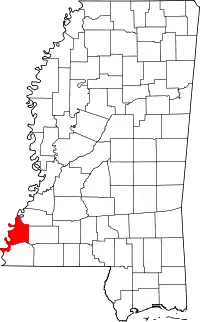
Location of Adams County in Mississippi
This is intended to be a complete list of the properties and districts on the National Register of Historic Places in Adams County, Mississippi, United States. Latitude and longitude coordinates are provided for many National Register properties and districts; these locations may be seen together in a map.[1]
There are 120 properties and districts listed on the National Register in the county, including 13 National Historic Landmarks. Another 2 properties were once listed but have been removed.
- This National Park Service list is complete through NPS recent listings posted January 29, 2021.[2]
Current listings
| [3] | Name on the Register[4] | Image | Date listed[5] | Location | City or town | Description |
|---|---|---|---|---|---|---|
| 1 | William Ailes House | March 12, 1980 (#80002190) |
657 S. Canal St. 31°33′08″N 91°24′40″W |
Natchez | ||
| 2 | Airlie |  Airlie |
October 29, 1982 (#82000566) |
9 Elm St. 31°34′09″N 91°23′40″W |
Natchez | |
| 3 | Anna Site |  Anna Site |
September 14, 1993 (#93001606) |
10 miles (16 km) north of Natchez 31°41′43″N 91°20′59″W |
Natchez | A Plaquemine culture archeological site that is a U.S. National Historic Landmark |
| 4 | Arlington |  Arlington |
December 12, 1973 (#73000999) |
Main St. 31°33′10″N 91°23′33″W |
Natchez | |
| 5 | Assembly Hall |  Assembly Hall |
April 19, 1978 (#78001587) |
Assembly and Main Sts. 31°34′44″N 91°17′54″W |
Washington | |
| 6 | Auburn |  Auburn |
May 30, 1974 (#74001047) |
Duncan Park 31°32′42″N 91°23′33″W |
Natchez | |
| 7 | John Baynton House |  John Baynton House |
October 16, 1974 (#74001048) |
821 Main St. 31°33′24″N 91°23′53″W |
Natchez | |
| 8 | Bedford Plantation | November 16, 1978 (#78001576) |
Northeast of Natchez off U.S. Route 61 31°37′00″N 91°11′52″W |
Natchez | ||
| 9 | Beechland | November 4, 1982 (#82000567) |
South of Natchez off U.S. Route 61 31°23′41″N 91°19′11″W |
Natchez | ||
| 10 | Belvidere | April 8, 1980 (#80002191) |
70 Homochitto St. 31°33′03″N 91°24′01″W |
Natchez | ||
| 11 | Brandon Hall |  Brandon Hall |
June 12, 1980 (#80002198) |
Northeast of Washington on U.S. Route 61 31°36′53″N 91°15′10″W |
Washington | |
| 12 | Gerard Brandon IV House | .jpg.webp) Gerard Brandon IV House |
March 19, 1982 (#82003094) |
708 N Union St. 31°33′53″N 91°23′48″W |
Natchez | |
| 13 | Briars |  Briars |
August 24, 1977 (#77000778) |
Southwest of Natchez 31°33′06″N 91°25′10″W |
Natchez | |
| 14 | Brumfield High School | .jpg.webp) Brumfield High School |
October 21, 1993 (#93001139) |
100 St. Catherine St. 31°33′26″N 91°23′33″W |
Natchez | |
| 15 | Buie House | July 13, 1983 (#83000948) |
Northeast of Natchez 31°38′06″N 91°16′13″W |
Natchez | ||
| 16 | The Burn | .jpg.webp) The Burn |
July 3, 1979 (#79001280) |
307 Oak St. 31°33′55″N 91°23′46″W |
Natchez | |
| 17 | Carmel Presbyterian Church | October 31, 1985 (#85003441) |
Carmel Church Rd. 31°25′53″N 91°19′34″W |
Natchez | ||
| 18 | Cedar Grove | March 19, 1982 (#82003088) |
Southeast of Natchez 31°25′44″N 91°17′42″W |
Natchez | ||
| 19 | Cemetery Bluff District | .jpg.webp) Cemetery Bluff District |
October 24, 1980 (#80002192) |
Cemetery Rd. 31°34′37″N 91°23′39″W |
Natchez | |
| 20 | Cherry Grove Plantation | 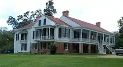 Cherry Grove Plantation |
March 31, 1983 (#83000949) |
South of Natchez off Kingston Rd. 31°27′55″N 91°21′03″W |
Natchez | |
| 21 | China Grove Plantation | April 7, 1982 (#82003089) |
South of Natchez 31°24′54″N 91°22′49″W |
Natchez | ||
| 22 | Cliffs Plantation | September 18, 1980 (#80002193) |
South of Natchez 31°27′39″N 91°24′56″W |
Natchez | ||
| 23 | Clifton Heights Historic District | 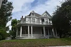 Clifton Heights Historic District |
November 12, 1982 (#82000568) |
Roughly bounded by Ridge and Mulberry Alley, Natchez Bluff, Park Ave., and Maple St. 31°34′07″N 91°24′00″W |
Natchez | |
| 24 | Commercial Bank and Banker's House | 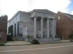 Commercial Bank and Banker's House |
May 30, 1974 (#74002252) |
206 Main St. and 107 Canal St. 31°33′39″N 91°24′18″W |
Natchez | |
| 25 | Concord Quarters | January 24, 2019 (#100003342) |
301 Gayosa St. 31°33′52″N 91°22′56″W |
Natchez | ||
| 26 | Cottage Gardens | 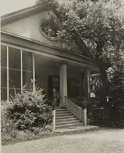 Cottage Gardens |
July 5, 1979 (#79001281) |
816 Myrtle Ave. 31°34′08″N 91°23′43″W |
Natchez | |
| 27 | D'Evereux | 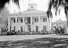 D'Evereux |
January 13, 1972 (#72000683) |
D'Evereaux Dr. 31°33′20″N 91°22′40″W |
Natchez | |
| 28 | John Dicks House | .jpg.webp) John Dicks House |
March 25, 1982 (#82003090) |
802 N. Union St. 31°33′57″N 91°23′41″W |
Natchez | |
| 29 | Dixon Building |  Dixon Building |
May 30, 1979 (#79001282) |
514 Main St. 31°33′33″N 91°24′08″W |
Natchez | |
| 30 | Downriver Residential Historic District |  Downriver Residential Historic District |
March 25, 1999 (#99000385) |
Roughly bounded by S. Canal St., Orleans St., the Illinois Central railroad tracks, and the bayou between Union and Rankin Sts. 31°33′18″N 91°24′25″W |
Natchez | |
| 31 | Dr. Charles H. Dubs Townhouse | 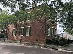 Dr. Charles H. Dubs Townhouse |
May 5, 1978 (#78001577) |
311 N. Pearl St. 31°33′44″N 91°24′02″W |
Natchez | |
| 32 | Dunleith | 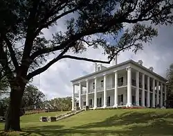 Dunleith |
September 14, 1972 (#72000684) |
84 Homochitto St. 31°32′52″N 91°24′03″W |
Natchez | |
| 33 | Edgewood | 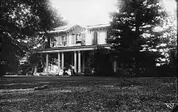 Edgewood |
March 30, 1979 (#79001283) |
North of Natchez on Mississippi Highway 554 31°38′01″N 91°20′18″W |
Natchez | |
| 34 | Elgin | January 19, 1979 (#79001284) |
South of Natchez off U.S. Route 61 31°29′01″N 91°22′56″W |
Natchez | ||
| 35 | Elizabeth Female Academy Site (No. 101-3X) | 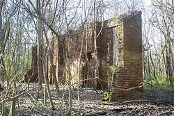 Elizabeth Female Academy Site (No. 101-3X) |
May 6, 1977 (#77000109) |
East of Natchez on U.S. Routes 84/98 31°34′30″N 91°17′36″W |
Natchez | Ruins of the defunct Elizabeth Female Academy. |
| 36 | Elms Court | 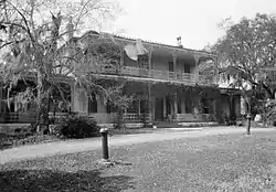 Elms Court |
December 2, 1977 (#77000780) |
42 John R. Junkin Dr. 31°31′52″N 91°23′42″W |
Natchez | |
| 37 | The Elms | .JPG.webp) The Elms |
November 7, 1976 (#76001083) |
215 S. Pine St. 31°33′20″N 91°23′48″W |
Natchez | |
| 38 | Emerald Mound Site (22AD504) | 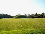 Emerald Mound Site (22AD504) |
November 18, 1988 (#88002618) |
10 miles northeast of Natchez, off the Natchez Trace Parkway[6] 31°38′10″N 91°14′50″W |
Stanton | |
| 39 | Eola Hotel | 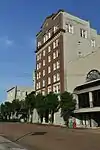 Eola Hotel |
January 11, 1979 (#79001285) |
Main and Pearl Sts. 31°33′38″N 91°24′11″W |
Natchez | |
| 40 | Fair Oaks | November 13, 1976 (#76001084) |
South of Natchez on U.S. Route 61 31°27′00″N 91°23′03″W |
Natchez | ||
| 41 | Fairchild's Creek Bridge | June 8, 2005 (#05000562) |
County Road 555 31°43′31″N 91°18′49″W |
Natchez | ||
| 42 | First Presbyterian Church of Natchez | 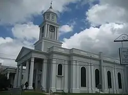 First Presbyterian Church of Natchez |
December 22, 1978 (#78001578) |
117 S. Pearl St. 31°33′32″N 91°24′13″W |
Natchez | |
| 43 | Fort Dearborn Site | September 17, 1974 (#74001054) |
North of Washington off U.S. Route 61 31°35′14″N 91°17′40″W |
Washington | ||
| 44 | Foster's Mound | September 2, 1982 (#82003091) |
Northeast of Natchez off U.S. Route 61 31°35′58″N 91°19′39″W |
Natchez | ||
| 45 | Glen Aubin | August 29, 1985 (#85001930) |
Off U.S. Route 61 31°23′04″N 91°26′12″W |
Natchez | ||
| 46 | Glen Mary Plantation and Tenant House | July 6, 1979 (#79003380) |
Foster Mound Rd. 31°35′41″N 91°19′38″W |
Natchez | ||
| 47 | Glenburnie | December 19, 1978 (#78001579) |
551 John R. Junkin Dr. 31°32′08″N 91°23′33″W |
Natchez | ||
| 48 | Glencannon | .jpg.webp) Glencannon |
February 8, 1990 (#89002322) |
Junction of Providence Rd. and Gov. Fleet Rd. 31°32′30″N 91°25′00″W |
Natchez | Also known as Glencannon |
| 49 | Gloucester | 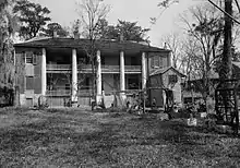 Gloucester |
November 7, 1976 (#76001085) |
South of Natchez on Lower Woodville Rd. 31°31′54″N 91°24′07″W |
Natchez | |
| 50 | Grand Village of the Natchez Indians | 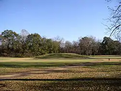 Grand Village of the Natchez Indians |
October 15, 1966 (#66000408) |
3 miles southeast of Natchez 31°31′25″N 91°22′46″W |
Natchez | |
| 51 | Hawthorne Place | July 3, 1979 (#79001286) |
Lower Woodville Rd. 31°32′18″N 91°24′04″W |
Natchez | ||
| 52 | Wharlest and Exerlena Jackson House | June 5, 2017 (#100001027) |
13 Matthews St. 31°34′05″N 91°23′22″W |
Natchez | ||
| 53 | Henderson-Britton House | 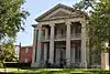 Henderson-Britton House |
June 9, 1978 (#78001580) |
215 S. Pearl St. 31°33′30″N 91°24′15″W |
Natchez | |
| 54 | Hillside | September 15, 1987 (#87000617) |
Hutchins Landing Rd. 31°29′47″N 91°16′54″W |
Natchez | ||
| 55 | Holy Family Catholic Church Historic District | 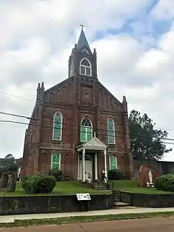 Holy Family Catholic Church Historic District |
July 14, 1995 (#95000855) |
Roughly along Aldrich, Old D'Evereux, St. Catherine, Abbott, and Byrne Sts. 31°33′34″N 91°23′46″W |
Natchez | |
| 56 | Hope Farm | 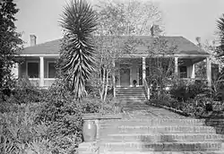 Hope Farm |
August 22, 1975 (#75001037) |
147 Homochitto St. 31°32′42″N 91°23′48″W |
Natchez | |
| 57 | House on Ellicott's Hill |  House on Ellicott's Hill |
May 30, 1974 (#74001050) |
N. Canal and Jefferson Sts. 31°33′45″N 91°24′13″W |
Natchez | |
| 58 | Institute Hall | .JPG.webp) Institute Hall |
June 20, 1979 (#79001287) |
111 S. Pearl St. 31°33′34″N 91°24′12″W |
Natchez | |
| 59 | Jefferson College |  Jefferson College |
August 25, 1970 (#70000316) |
North St. 31°34′52″N 91°18′01″W |
Washington | |
| 60 | William Johnson House |  William Johnson House |
June 16, 1976 (#76001086) |
210 State St. 31°33′34″N 91°23′29″W |
Natchez | |
| 61 | Keyhole House | March 25, 1982 (#82003092) |
1016 Main St. 31°33′43″N 91°23′46″W |
Natchez | ||
| 62 | King's Tavern |  King's Tavern |
May 6, 1971 (#71000444) |
611 Jefferson St. 31°33′38″N 91°23′57″W |
Natchez | |
| 63 | Kingston Methodist Church | 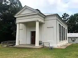 Kingston Methodist Church |
May 13, 1982 (#82003093) |
Southeast of Natchez 31°23′21″N 91°16′43″W |
Natchez | |
| 64 | Koontz House |  Koontz House |
March 29, 1979 (#79001288) |
303 S. Rankin St. 31°33′21″N 91°24′07″W |
Natchez | |
| 65 | Lansdowne | 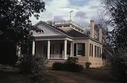 Lansdowne |
July 24, 1978 (#78001581) |
North of Natchez on Pine Ridge Rd. 31°35′04″N 91°21′47″W |
Natchez | |
| 66 | Laurel Hill Plantation | October 26, 1982 (#82000569) |
South of Natchez off U.S. Route 61 31°25′20″N 91°24′35″W |
Natchez | ||
| 67 | Linden |  Linden |
September 1, 1978 (#78001582) |
1 Linden Pl. 31°33′04″N 91°23′01″W |
Natchez | |
| 68 | Lisle-Shields Town House | March 29, 1979 (#79001289) |
701 N. Union St. 31°33′50″N 91°23′47″W |
Natchez | ||
| 69 | Longwood | 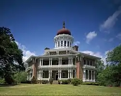 Longwood |
December 16, 1969 (#69000079) |
1.5 miles southeast of Natchez 31°32′12″N 91°24′17″W |
Natchez | Octagonal, unfinished antebellum mansion, known also as Nutt's Folly |
| 70 | Magnolia Hill | March 30, 1979 (#79001290) |
Southeast of Natchez 31°26′40″N 91°16′40″W |
Natchez | ||
| 71 | The Manse |  The Manse |
March 7, 1979 (#79001291) |
307 S. Rankin St. 31°33′20″N 91°24′09″W |
Natchez | |
| 72 | Mazique Archeological Site |  Mazique Archeological Site |
October 23, 1991 (#91001529) |
Address Restricted |
Natchez | |
| 73 | Meadvilla | November 17, 1982 (#82000570) |
Address Restricted |
Washington | ||
| 74 | Melrose | 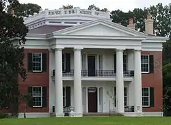 Melrose |
May 30, 1974 (#74002253) |
Melrose Ave. 31°32′32″N 91°22′56″W |
Natchez | |
| 75 | Mercer House | August 9, 1979 (#79001292) |
118 S. Wall St. 31°33′37″N 91°24′18″W |
Natchez | ||
| 76 | Mistletoe | October 10, 1973 (#73001000) |
Northeast of Natchez on Mississippi Highway 554 31°37′31″N 91°19′00″W |
Natchez | ||
| 77 | Monmouth | .jpg.webp) Monmouth |
April 26, 1973 (#73001001) |
E. Franklin St. and Melrose Ave. 31°33′38″N 91°23′10″W |
Natchez | |
| 78 | Montaigne | 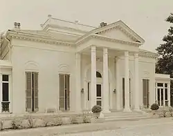 Montaigne |
December 11, 1974 (#74001052) |
Liberty Rd. 31°33′01″N 91°22′46″W |
Natchez | |
| 79 | Montpellier |  Montpellier |
December 18, 1979 (#79001293) |
Southeast of Natchez on Mississippi Highway 551 31°32′08″N 91°21′03″W |
Natchez | |
| 80 | Mount Olive | November 28, 1980 (#80002194) |
Northeast of Natchez 31°37′14″N 91°20′27″W |
Natchez | ||
| 81 | Mount Repose |  Mount Repose |
June 19, 1979 (#79001294) |
North of Natchez on Mississippi Highway 555 31°38′12″N 91°20′40″W |
Natchez | |
| 82 | Myrtle Bank |  Myrtle Bank |
December 22, 1978 (#78001583) |
408 N. Pearl St. 31°33′48″N 91°24′02″W |
Natchez | |
| 83 | Natchez On-Top-of-the-Hill Historic District |  Natchez On-Top-of-the-Hill Historic District |
September 17, 1979 (#79003381) |
U.S. Routes 61, 84, and 98 31°33′34″N 91°24′09″W |
Natchez | |
| 84 | Natchez Bluffs and Under-the-Hill Historic District | 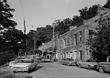 Natchez Bluffs and Under-the-Hill Historic District |
April 11, 1972 (#72000685) |
Bounded by S. Canal St., Broadway, and Mississippi River 31°33′32″N 91°25′36″W |
Natchez | |
| 85 | Natchez National Cemetery | 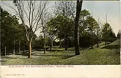 Natchez National Cemetery |
November 22, 1999 (#99001387) |
41 Cemetery Rd. 31°34′51″N 91°23′42″W |
Natchez | |
| 86 | Natchez National Historical Park |  Natchez National Historical Park |
October 7, 1988 (#01000276) |
PO Box 1208 31°32′36″N 91°22′59″W |
Natchez | |
| 87 | Neibert-Fisk House | 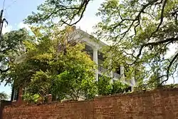 Neibert-Fisk House |
January 22, 1979 (#79001295) |
310 N. Wall St. 31°33′48″N 91°24′07″W |
Natchez | |
| 88 | Oakland | 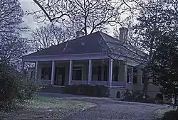 Oakland |
October 21, 1976 (#76001087) |
9 Oakhurst Dr. 31°33′00″N 91°22′30″W |
Natchez | |
| 89 | Oakland | June 29, 1989 (#89000781) |
Lower Woodville Rd. 31°24′42″N 91°24′21″W |
Natchez | ||
| 90 | Oakwood | May 9, 1985 (#85000968) |
Off Kingston Rd. 31°25′01″N 91°16′28″W |
Natchez | ||
| 91 | Charles Patterson House | June 24, 1994 (#94000645) |
506 S. Union St. 31°33′17″N 91°24′20″W |
Natchez | ||
| 92 | Pine Ridge Church | 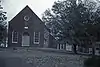 Pine Ridge Church |
December 13, 1979 (#79001296) |
Northeast of Natchez at Pine Ridge Rd. and Mississippi Highway 554 31°37′51″N 91°20′57″W |
Natchez | |
| 93 | Pleasant Hill | 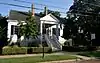 Pleasant Hill |
March 28, 1979 (#79001297) |
310 Pearl St. 31°33′28″N 91°24′20″W |
Natchez | |
| 94 | Prentiss Club | 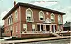 Prentiss Club |
April 17, 1979 (#79001298) |
Pearl and Jefferson Sts. 31°33′42″N 91°24′06″W |
Natchez | |
| 95 | Ratcliffe Mound Site | Ratcliffe Mound Site |
December 30, 2004 (#04001406) |
Address Restricted |
Washington | |
| 96 | Ravenna | November 4, 1982 (#82004975) |
601 S. Union St. 31°33′12″N 91°24′19″W |
Natchez | ||
| 97 | Ravennaside | 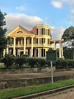 Ravennaside |
July 5, 1979 (#79001299) |
601 S. Union St. 31°32′47″N 91°24′33″W |
Natchez | |
| 98 | Richmond | 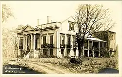 Richmond |
November 16, 1978 (#78001584) |
Government Fleet Rd. 31°32′47″N 91°24′33″W |
Natchez | |
| 99 | Roos House | November 8, 1979 (#79001300) |
208 Linton Ave. 31°34′08″N 91°23′57″W |
Natchez | ||
| 100 | Rosalie | .JPG.webp) Rosalie |
August 16, 1977 (#77000781) |
100 Orleans St. 31°33′32″N 91°24′30″W |
Natchez | |
| 101 | Routhland | August 22, 1977 (#77000782) |
92 Winchester Rd. 31°33′04″N 91°23′42″W |
Natchez | ||
| 102 | Saragossa |  Saragossa |
November 24, 1980 (#80002196) |
South of Natchez on Saragossa Rd. 31°29′30″N 91°24′06″W |
Natchez | |
| 103 | Selma Plantation House |  Selma Plantation House |
June 15, 1989 (#89000207) |
467 Selma Rd. 31°36′01″N 91°16′12″W |
Natchez | |
| 104 | Shadyside | March 29, 1979 (#79001301) |
107 Shadyside St. 31°33′49″N 91°23′27″W |
Natchez | ||
| 105 | Smart-Griffin House | May 18, 1979 (#79001302) |
180 St. Catherine St. 31°33′22″N 91°23′15″W |
Natchez | ||
| 106 | Smith-Bontura-Evans House | 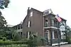 Smith-Bontura-Evans House |
March 29, 1978 (#78001585) |
107 Broadway St. 31°33′40″N 91°24′22″W |
Natchez | |
| 107 | Smithland | April 2, 1987 (#87000575) |
1 mile south of Kingston-Hutchins Rd. 31°23′03″N 91°21′13″W |
Natchez | ||
| 108 | Stanton Hall |  Stanton Hall |
May 30, 1974 (#74002254) |
High St. between Pearl and Commerce Sts. 31°33′45″N 91°24′01″W |
Natchez | |
| 109 | Texada Tavern | 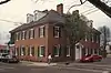 Texada Tavern |
April 17, 1979 (#79001303) |
222 S. Wall St. 31°33′23″N 91°24′06″W |
Natchez | |
| 110 | Tillman House | 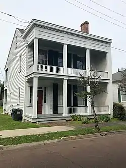 Tillman House |
April 17, 1979 (#79001304) |
506 High St. 31°33′42″N 91°24′00″W |
Natchez | |
| 111 | Traveller's Rest | 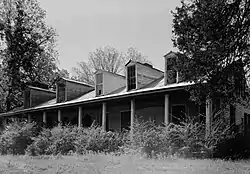 Traveller's Rest |
May 3, 1984 (#84002110) |
Address Restricted |
Natchez | |
| 112 | Upriver Residential District | December 1, 1983 (#83004371) |
Roughly bounded by Pine, Monroe, Elm-Bishop, and Ridge-Maple Sts. 31°34′00″N 91°23′49″W |
Natchez | ||
| 113 | Van Court Town House |  Van Court Town House |
July 9, 1980 (#80004474) |
510 Washington St. 31°33′25″N 91°24′28″W |
Natchez | |
| 114 | Warren-Erwin House | March 19, 1982 (#82003095) |
Palestine Rd. 31°33′26″N 91°17′53″W |
Washington | ||
| 115 | Washington Methodist Church | .jpg.webp) Washington Methodist Church |
September 4, 1986 (#86002168) |
Main and Church Sts. 31°34′41″N 91°18′08″W |
Washington | |
| 116 | Weymouth Hall |  Weymouth Hall |
March 12, 1980 (#80002197) |
1 Cemetery Rd. 31°34′30″N 91°23′38″W |
Natchez | |
| 117 | White Cottage | October 13, 1983 (#83003937) |
71 Homochitto St. 31°33′02″N 91°23′19″W |
Natchez | ||
| 118 | Winchester House | January 31, 1979 (#79001305) |
816 Main St. 31°33′25″N 91°23′55″W |
Natchez | ||
| 119 | Woodlawn Historic District | November 7, 1995 (#95001250) |
Roughly bounded by Martin Luther King St., E. Stiers and Old College Lns., and Elm and Bishop Sts. 31°34′03″N 91°23′24″W |
Natchez | ||
| 120 | Woodstock | June 29, 1989 (#89000782) |
Carmel Church Rd., 12 miles southeast of Natchez 31°25′33″N 91°19′30″W |
Natchez |
Former listings
| [3] | Name on the Register | Image | Date listed | Date removed | Location | City or town | Summary |
|---|---|---|---|---|---|---|---|
| 1 | Patrick Murphy House | April 9, 1980 (#80002195) | July 25, 1997 | 21 Irvine Lane |
Natchez | Destroyed by fire in 1993[7] | |
| 2 | U.S. Marine Hospital |  U.S. Marine Hospital |
November 29, 1978 (#78001586) | May 15, 1987 | 801 Maple St. |
Natchez | Destroyed by fire in 1984[8] |
See also
| Wikimedia Commons has media related to National Register of Historic Places in Adams County, Mississippi. |
References
- The latitude and longitude information provided in this table was derived originally from the National Register Information System, which has been found to be fairly accurate for about 99% of listings. Some locations in this table may have been corrected to current GPS standards.
- "National Register of Historic Places: Weekly List Actions". National Park Service, United States Department of the Interior. Retrieved on January 29, 2021.
- Numbers represent an alphabetical ordering by significant words. Various colorings, defined here, differentiate National Historic Landmarks and historic districts from other NRHP buildings, structures, sites or objects.
- "National Register Information System". National Register of Historic Places. National Park Service. March 13, 2009.
- The eight-digit number below each date is the number assigned to each location in the National Register Information System database, which can be viewed by clicking the number.
- Location derived from this National Park Service webpage; the NRIS lists the site as "Address Restricted"
- MDAH
- MDAH
| Topics | |
|---|---|
| Lists by state |
|
| Lists by insular areas | |
| Lists by associated state | |
| Other areas | |
| Related | |
| |
Municipalities and communities of Adams County, Mississippi, United States | ||
|---|---|---|
| Cities | Map of Mississippi highlighting Adams County | |
| CDPs | ||
| Other unincorporated communities | ||
| Ghost towns | ||
| ||
This article is issued from Wikipedia. The text is licensed under Creative Commons - Attribution - Sharealike. Additional terms may apply for the media files.