National Register of Historic Places listings in Brown County, South Dakota
This is a list of the National Register of Historic Places listings in Brown County, South Dakota.
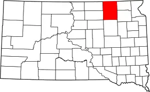
Location of Brown County in South Dakota
This is intended to be a complete list of the properties and districts on the National Register of Historic Places in Brown County, South Dakota, United States. The locations of National Register properties and districts for which the latitude and longitude coordinates are included below, may be seen in a map.[1]
There are 45 properties and districts listed on the National Register in the county. Another property was once listed but has since been removed
- This National Park Service list is complete through NPS recent listings posted January 29, 2021.[2]
Current listings
| [3] | Name on the Register[4] | Image | Date listed[5] | Location | City or town | Description |
|---|---|---|---|---|---|---|
| 1 | Aberdeen Commercial Historic District | 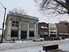 Aberdeen Commercial Historic District |
May 23, 1988 (#88000586) |
1-523 South Main Street 45°27′44″N 98°29′16″W |
Aberdeen | |
| 2 | Aberdeen Highlands Historic District | 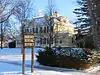 Aberdeen Highlands Historic District |
June 5, 1975 (#75001710) |
Both sides of North Main from 12th to 15th Avenue, N.E. 45°28′46″N 98°29′15″W |
Aberdeen | |
| 3 | Aberdeen Historic District | 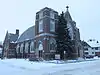 Aberdeen Historic District |
June 5, 1975 (#75001711) |
Both sides of 3rd-6th Avenues and Jay, Kline, and Arch Streets 45°27′38″N 98°28′55″W |
Aberdeen | |
| 4 | Augustana Swedish Lutheran Church | 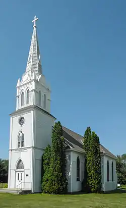 Augustana Swedish Lutheran Church |
December 20, 1988 (#88002842) |
4.5 miles south of Claremont 45°36′04″N 98°00′02″W |
Claremont | |
| 5 | Aurland United Norwegian Lutheran Church | 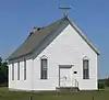 Aurland United Norwegian Lutheran Church |
April 16, 1982 (#82003916) |
Southeast of Frederick 45°46′14″N 98°24′55″W |
Frederick | |
| 6 | William G. Bickelhaupt House | 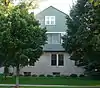 William G. Bickelhaupt House |
October 19, 1989 (#89001727) |
1003 South Jay 45°27′16″N 98°29′00″W |
Aberdeen | |
| 7 | Brown County Courthouse | 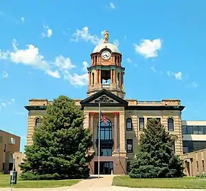 Brown County Courthouse |
June 3, 1976 (#76001718) |
First Avenue 45°27′52″N 98°29′10″W |
Aberdeen | |
| 8 | Brown Hall | 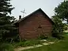 Brown Hall |
February 7, 1990 (#89002336) |
Main Street 45°43′55″N 98°29′50″W |
Barnard | |
| 9 | Brown's Post | May 27, 1988 (#88000583) |
Address Restricted |
Sisseton | ||
| 10 | Colin Campbell Post | May 27, 1988 (#88000584) |
Address Restricted |
Frederick | ||
| 11 | Chicago, Milwaukee, St. Paul and Pacific Railroad Depot | 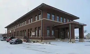 Chicago, Milwaukee, St. Paul and Pacific Railroad Depot |
September 20, 1977 (#77001238) |
Main Street and Railroad Avenue 45°27′56″N 98°29′20″W |
Aberdeen | |
| 12 | Dakota Farmer Building | 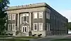 Dakota Farmer Building |
August 1, 1984 (#84003221) |
1216 South Main Street 45°27′07″N 98°29′19″W |
Aberdeen | |
| 13 | Easton's Castle |  Easton's Castle |
March 1, 1973 (#73001736) |
1210 Second Avenue, N.W. 45°28′07″N 98°30′15″W |
Aberdeen | |
| 14 | Finnish Apostolic Lutheran Church |  Finnish Apostolic Lutheran Church |
May 31, 1984 (#84003223) |
101 Street and 392 Avenue[6] 45°55′24″N 98°23′38″W |
Frederick | |
| 15 | John H. Firey House | 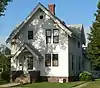 John H. Firey House |
March 23, 1995 (#95000277) |
418 South Arch Street 45°27′38″N 98°28′52″W |
Aberdeen | |
| 16 | First Presbyterian Church of Groton | March 14, 2019 (#100003447) |
300 N. Main St. 45°26′56″N 98°05′55″W |
Groton | ||
| 17 | First United Methodist Church | 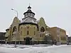 First United Methodist Church |
May 28, 1976 (#76001719) |
S. Lincoln St. and SE. 5th Ave. 45°27′36″N 98°29′12″W |
Aberdeen | |
| 18 | Foght-Murdy House | 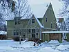 Foght-Murdy House |
March 23, 1995 (#95000276) |
1403 S. Main St. 45°27′18″N 98°29′17″W |
Aberdeen | |
| 19 | Paul and Fredriika Geranen Farm | November 13, 1985 (#85003498) |
East of Frederick 45°51′00″N 98°24′48″W |
Frederick | ||
| 20 | Great Northern Railway Passenger and Freight Depot | 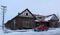 Great Northern Railway Passenger and Freight Depot |
January 27, 1983 (#83003002) |
1 Court St. 45°27′54″N 98°29′07″W |
Aberdeen | |
| 21 | Anna Herron Farm | June 30, 1995 (#95000778) |
1.5 miles east of Highway 18 on County Highway 21 near Groton 45°23′11″N 98°11′47″W |
West Hanson Township | ||
| 22 | Art Karl Farm | July 7, 1995 (#95000777) |
Southeastern corner of the junction of Highways 14 and 21 near Aberdeen 45°23′10″N 98°24′41″W |
West Gem Township | ||
| 23 | Margaret and Maurice Lamont House |  Margaret and Maurice Lamont House |
March 23, 1995 (#95000281) |
515 S. Arch St. 45°27′34″N 98°28′50″W |
Aberdeen | |
| 24 | Martilla-Pettingel and Gorder General Merchandise Store |  Martilla-Pettingel and Gorder General Merchandise Store |
November 13, 1985 (#85003490) |
312 Main St.[7] 45°49′57″N 98°30′21″W |
Frederick | |
| 25 | Masonic Temple | 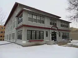 Masonic Temple |
May 29, 1980 (#80003719) |
503 S. Main St. 45°27′35″N 98°29′15″W |
Aberdeen | |
| 26 | McGregor House | _from_WNW_1.jpg.webp) McGregor House |
June 8, 2005 (#05000591) |
621 S. Kline St. 45°27′30″N 98°28′55″W |
Aberdeen | |
| 27 | McKenzie-Cassels House | February 13, 1986 (#86000242) |
508 N. 3rd St. 45°27′04″N 98°05′49″W |
Groton | ||
| 28 | Minneapolis and St. Louis Railroad Depot | 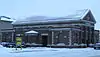 Minneapolis and St. Louis Railroad Depot |
September 28, 1976 (#76001720) |
1100 S. Main St. 45°27′14″N 98°29′17″W |
Aberdeen | |
| 29 | Modern Woodmen of America Hall | July 7, 1995 (#95000775) |
Northwestern corner of the junction of Main and 2nd Sts. 45°14′35″N 98°33′46″W |
Mansfield | ||
| 30 | George Pfutzenreuter House | June 21, 1990 (#90000955) |
411 3rd St. 45°52′54″N 98°09′09″W |
Hecla | ||
| 31 | Plana School | July 7, 1995 (#95000773) |
7 miles north of Highway 12 and 1 mile east of County Highway 16 45°31′04″N 98°18′34″W |
Plana | ||
| 32 | Melchior Ryman Farm | June 30, 1995 (#95000771) |
2 miles west of Highway 281, 3 miles north of Mansfield 45°17′13″N 98°33′30″W |
Mansfield | ||
| 33 | Savo Hall-Finnish National Society Hall | 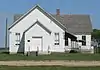 Savo Hall-Finnish National Society Hall |
November 13, 1985 (#85003494) |
104 St and 391 Ave[8] 45°52′47″N 98°24′51″W |
Savo Township | |
| 34 | Simmons House | 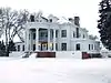 Simmons House |
August 1, 1984 (#84003224) |
1408 S. Main St. 45°27′01″N 98°29′19″W |
Aberdeen | |
| 35 | South Dakota Dept. of Transportation Bridge No. 07-009-060 | March 9, 2000 (#00000185) |
Local road over Elm Dam Spillway 45°51′07″N 98°42′22″W |
Frederick | ||
| 36 | South Dakota Dept. of Transportation Bridge No. 07-220-454 | March 9, 2000 (#00000184) |
Local road over Mud Creek 45°16′13″N 98°17′16″W |
Stratford | ||
| 37 | South Dakota Dept. of Transportation Bridge No. 07-268-030 | March 9, 2000 (#00000186) |
Local road over the James River 45°53′35″N 98°10′33″W |
Hecla | ||
| 38 | South Dakota Dept. of Transportation Bridge No. 07-304-414 | March 9, 2000 (#00000187) |
Local road over Ferney Ravine 45°20′19″N 98°05′43″W |
Ferney | ||
| 39 | Trinity Episcopal Church | January 27, 1983 (#83003003) |
Third Avenue East and Third Street North 45°26′55″N 98°05′54″W |
Groton | ||
| 40 | US Post Office and Courthouse-Aberdeen | 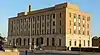 US Post Office and Courthouse-Aberdeen |
October 4, 2006 (#06000931) |
102 Forth Avenue, S.E. 45°27′39″N 98°29′09″W |
Aberdeen | |
| 41 | Alonzo Ward Hotel | 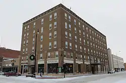 Alonzo Ward Hotel |
June 17, 1982 (#82003915) |
104 South Main Street 45°27′50″N 98°29′17″W |
Aberdeen | |
| 42 | Welsh Presbyterian Church | July 6, 1995 (#95000776) |
7 miles north of Highway 12 and 1 mile east of Highway 16 45°31′08″N 98°18′39″W |
Plana | ||
| 43 | Gustav and Mary Werth House | _from_SW_1.jpg.webp) Gustav and Mary Werth House |
June 28, 1991 (#91000846) |
1502 North Dakota Street 45°28′52″N 98°28′27″W |
Aberdeen | |
| 44 | Western Union Building | 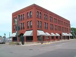 Western Union Building |
December 12, 1976 (#76001721) |
21-23 South Main Street 45°27′52″N 98°29′15″W |
Aberdeen | |
| 45 | Wylie Park Pavilion | Wylie Park Pavilion |
January 26, 1978 (#78002540) |
North of Aberdeen off U.S. Route 281 45°29′22″N 98°31′00″W |
Aberdeen |
Former listing
| [3] | Name on the Register | Image | Date listed | Date removed | Location | City or town | Summary |
|---|---|---|---|---|---|---|---|
| 1 | South Dakota Dept. of Transportation Bridge No. 07-091-330 | March 9, 2000 (#00000183) | March 26, 2008 | US 12 over State of South Dakota RR tracks |
Aberdeen vicinity | Replaced in 2005 |
See also
| Wikimedia Commons has media related to National Register of Historic Places in Brown County, South Dakota. |
References
- The latitude and longitude information provided in this table was derived originally from the National Register Information System, which has been found to be fairly accurate for about 99% of listings. Some locations in this table may have been corrected to current GPS standards.
- "National Register of Historic Places: Weekly List Actions". National Park Service, United States Department of the Interior. Retrieved on January 29, 2021.
- Numbers represent an alphabetical ordering by significant words. Various colorings, defined here, differentiate National Historic Landmarks and historic districts from other NRHP buildings, structures, sites or objects.
- "National Register Information System". National Register of Historic Places. National Park Service. April 24, 2008.
- The eight-digit number below each date is the number assigned to each location in the National Register Information System database, which can be viewed by clicking the number.
- See 2017 photo
- The NRHP nominating form gives the address as 515–516 Main Street. However, the Frederick Area Business Directory gives its address as 312 Main St. (see "Community Store" under the heading "Groceries"). A 2017 photo shows the store on Main just east of 3rd Avenue.
- See photo
| Topics | |
|---|---|
| Lists by state |
|
| Lists by insular areas | |
| Lists by associated state | |
| Other areas | |
| Related | |
| |
Municipalities and communities of Brown County, South Dakota, United States | ||
|---|---|---|
| Cities | | |
| Towns | ||
| CDPs | ||
| Other unincorporated communities | ||
| Townships |
| |
| Footnotes | ‡This populated place also has portions in an adjacent county or counties | |
| ||
This article is issued from Wikipedia. The text is licensed under Creative Commons - Attribution - Sharealike. Additional terms may apply for the media files.